Property Record
1 Jacks Hill Rd, Oxford, CT 06478


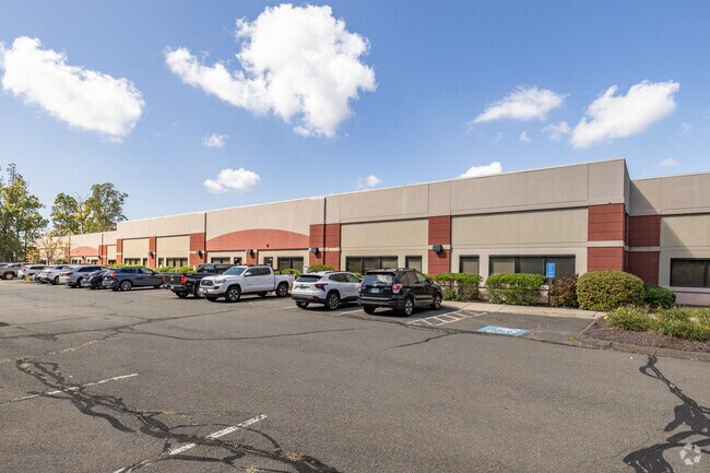
Property Detail
1 Jacks Hill Rd
OXFO-000018-000025-000001-AA000002
Naugatuck Vly
Warehouse
Connecticut
IND
1-2aa
B and X Area of moderate flood hazard, usually the area between the limits of the 100-year and 500-year floods.
12 AC
2025
Naugatuck
2025
Westchester/So Connecticut
346102
New Haven, CT
35,820 SF
NEARBY LISTINGS FOR SALE OR LEASE
DEMOGRAPHICS near 1 Jacks Hill Rd
1 mile
3 mile
5 mile
2025 Total Population
975
11,214
49,126
2030 Population
1,046
11,718
50,674
Pop Growth 2025-2030
+ 7.28%
+ 4.49%
+ 3.15%
Average Age
43
44
43
2025 Total Households
350
4,111
19,063
HH Growth 2025-2030
+ 7.14%
+ 4.38%
+ 3.05%
Median Household Inc
$94,813
$117,595
$107,617
Avg Household Size
2.70
2.70
2.50
2025 Avg HH Vehicles
2.00
2.00
2.00
Median Home Value
$416,463
$463,522
$415,882
Median Year Built
1982
1987
1975
Nearby Places
Map Layers
Map Styles
 Street
 Aerial
Layers
 Traffic
 Biking
Places
Listings with unknown addresses are not visible on the map
- Restaurants
- Banks
- Shops
- Fitness
- Groceries
PUBLIC TRANSPORTATION
COMMUTER RAIL
Beacon Falls Station (New Haven Line - Metro-North Commuter Railroad Company (Metro-North))
Drive
Walk
Distance
Beacon Falls Station (New Haven Line - Metro-North Commuter Railroad Company (Metro-North))
15 min
7.5 mi
AIRPORT
Tweed/New Haven
Drive
Walk
Distance
Tweed/New Haven
42 min
22.9 mi
Freight Ports
Port of New Haven
Drive
Walk
Distance
Port of New Haven
37 min
20.1 mi
SALE & LEASE HISTORY
LISTING DATE
SALE/LEASE

Sep 02, 2020
For Lease
Nearby Properties
Address
Land Use
TOTAL SIZE
Lot Size
Zoning
Address
Land Use
TOTAL SIZE
Lot Size
Zoning
404.50 AC
IND
Address
Land Use
TOTAL SIZE
Lot Size
Zoning
62,992 SF
RESA
Address
Land Use
TOTAL SIZE
Lot Size
Zoning
67,200 SF
139.13 AC
RESA
Address
Land Use
TOTAL SIZE
Lot Size
Zoning
107,774 SF
4.21 AC
VCMUD
Address
Land Use
TOTAL SIZE
Lot Size
Zoning
103,488 SF
2.97 AC
VCMUD
Address
Land Use
TOTAL SIZE
Lot Size
Zoning
17.80 AC
IND
Address
Land Use
TOTAL SIZE
Lot Size
Zoning
20.30 AC
IND
Address
Land Use
TOTAL SIZE
Lot Size
Zoning
64,356 SF
RESA
Address
Land Use
TOTAL SIZE
Lot Size
Zoning
40.53 AC
L200
Address
Land Use
TOTAL SIZE
Lot Size
Zoning
52,228 SF
1.41 AC
VCMUD
Address
Land Use
TOTAL SIZE
Lot Size
Zoning
26.10 AC
RESA
Address
Land Use
TOTAL SIZE
Lot Size
Zoning
29,951 SF
5.01 AC
VCMUD
Address
Land Use
TOTAL SIZE
Lot Size
Zoning
137,519 SF
10.11 AC
IND
Address
Land Use
TOTAL SIZE
Lot Size
Zoning
20 AC
IND
Address
Land Use
TOTAL SIZE
Lot Size
Zoning
62.31 AC
IND
Address
Land Use
TOTAL SIZE
Lot Size
Zoning
110,160 SF
24.13 AC
IND
Address
Land Use
TOTAL SIZE
Lot Size
Zoning
142,146 SF
6.63 AC
B-2
Address
Land Use
TOTAL SIZE
Lot Size
Zoning
60,528 SF
10 AC
IND
Address
Land Use
TOTAL SIZE
Lot Size
Zoning
9.66 AC
IND
Address
Land Use
TOTAL SIZE
Lot Size
Zoning
9,268 SF
139.13 AC
RESA
Address
Land Use
TOTAL SIZE
Lot Size
Zoning
15,205 SF
2.33 AC
VCMUD
Address
Land Use
TOTAL SIZE
Lot Size
Zoning
60,000 SF
12 AC
IND
Address
Land Use
TOTAL SIZE
Lot Size
Zoning
43,250 SF
6.20 AC
IND
Address
Land Use
TOTAL SIZE
Lot Size
Zoning
45,000 SF
5.36 AC
IND
Address
Land Use
TOTAL SIZE
Lot Size
Zoning
51,345 SF
6.75 AC
IND
Address
Land Use
TOTAL SIZE
Lot Size
Zoning
67,910 SF
5.60 AC
IND
Address
Land Use
TOTAL SIZE
Lot Size
Zoning
35.94 AC
RESA
Address
Land Use
TOTAL SIZE
Lot Size
Zoning
13,120 SF
5.68 AC
RESA
Address
Land Use
TOTAL SIZE
Lot Size
Zoning
50,937 SF
7.25 AC
GI40
The World's #1 Commercial Real Estate Marketplace
Connect with us
© 2026 CoStar Group
The information above has been obtained from sources believed reliable. While we do not doubt its accuracy we have not verified it and make no guarantee, warranty or representation about it. It is your responsibility to independently confirm its accuracy and completeness. Any projections, opinions, assumptions, or estimates used are for example only and do not represent the current or future performance of the property. The value of this transaction to you depends on tax and other factors which should be evaluated by your tax, financial, and legal advisors. You and your advisors should conduct a careful, independent investigation of the property to determine to your satisfaction the suitability of the property for your needs.