Property Record
1 Jan Sebastian Dr, Sandwich, MA 02563
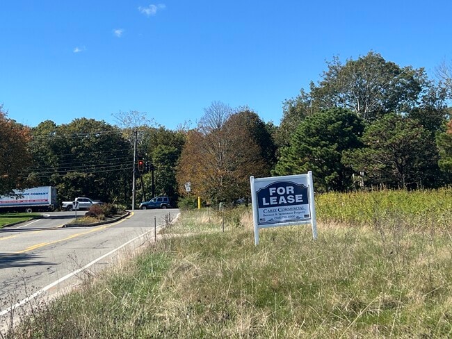
Current Lease Availabilities
NEARBY LISTINGS FOR SALE OR LEASE
-
-
View all Sandwich listings for lease on LoopNet.com
Property Detail
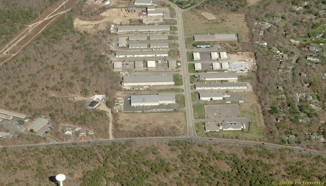
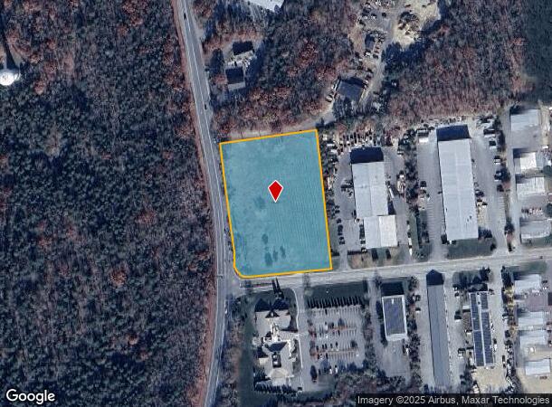
1 Jan Sebastian Dr
SAND-000027-000027
Barnstable
Industrialacreage
Massachusetts
X
3.32 AC
25001C0528J
Cape Cod
2025
Other Market Areas
2025
Barnstable Town, MA
013600
DEMOGRAPHICS near 1 Jan Sebastian Dr
1 Mile
3 Mile
5 Mile
2024 Total Population
1,150
9,509
24,694
2029 Population
1,127
9,408
24,431
Pop Growth 2024-2029
(2.00%)
(1.06%)
(1.07%)
Average Age
43
45
46
2024 Total Households
434
3,683
9,716
HH Growth 2024-2029
(2.30%)
(1.33%)
(1.36%)
Median Household Inc
$94,827
$113,217
$108,665
Avg Household Size
2.60
2.50
2.50
2024 Avg HH Vehicles
2.00
2.00
2.00
Median Home Value
$399,212
$455,506
$468,986
Median Year Built
1989
1984
1983
Nearby Places
- Restaurants
- Banks
- Shops
- Fitness
- Groceries
PUBLIC TRANSPORTATION
COMMUTER RAIL
Bourne (CapeFLYER - Cape Cod Regional Transit Authority)
DRIVE
WALK
Distance
Bourne (CapeFLYER - Cape Cod Regional Transit Authority)
16 min
9.1 mi
AIRPORT
Martha's Vineyard
DRIVE
WALK
Distance
Martha's Vineyard
99 min
34.9 mi
Freight Ports
Port of New Bedford Harbor
DRIVE
WALK
Distance
Port of New Bedford Harbor
52 min
36.9 mi
Nearby Properties
Address
Land Use
TOTAL SIZE
Lot Size
Zoning
Address
Land Use
TOTAL SIZE
Lot Size
Zoning
270,790 SF
62.90 AC
R-2
Address
Land Use
TOTAL SIZE
Lot Size
Zoning
125,550 SF
45.57 AC
RIDGE
Address
Land Use
TOTAL SIZE
Lot Size
Zoning
2,295.68 AC
BUSINE
Address
Land Use
TOTAL SIZE
Lot Size
Zoning
128,833 SF
77.46 AC
RIDGE
Address
Land Use
TOTAL SIZE
Lot Size
Zoning
73.40 AC
R-2
Address
Land Use
TOTAL SIZE
Lot Size
Zoning
8,000 SF
256.70 AC
RIDGE
Address
Land Use
TOTAL SIZE
Lot Size
Zoning
47.35 AC
R-2
Address
Land Use
TOTAL SIZE
Lot Size
Zoning
325 AC
R-1
Address
Land Use
TOTAL SIZE
Lot Size
Zoning
12.60 AC
BUSINE
Address
Land Use
TOTAL SIZE
Lot Size
Zoning
46.68 AC
R-1
Address
Land Use
TOTAL SIZE
Lot Size
Zoning
38.35 AC
RIDGE
Address
Land Use
TOTAL SIZE
Lot Size
Zoning
7,241 SF
209.72 AC
GD
Address
Land Use
TOTAL SIZE
Lot Size
Zoning
5,466 SF
131.61 AC
R-2
Address
Land Use
TOTAL SIZE
Lot Size
Zoning
40,968 SF
9 AC
RIDGE
Address
Land Use
TOTAL SIZE
Lot Size
Zoning
14,704 SF
Address
Land Use
TOTAL SIZE
Lot Size
Zoning
8.13 AC
BUSINE
Address
Land Use
TOTAL SIZE
Lot Size
Zoning
7,513 SF
168.71 AC
R-2
Address
Land Use
TOTAL SIZE
Lot Size
Zoning
54,044 SF
8.61 AC
BUSINE
Address
Land Use
TOTAL SIZE
Lot Size
Zoning
4.94 AC
VILLAG
Address
Land Use
TOTAL SIZE
Lot Size
Zoning
31.50 AC
MARINE
Address
Land Use
TOTAL SIZE
Lot Size
Zoning
83.01 AC
R-2
Address
Land Use
TOTAL SIZE
Lot Size
Zoning
10 AC
BUSINE
Address
Land Use
TOTAL SIZE
Lot Size
Zoning
17,110 SF
1.68 AC
R-1
Address
Land Use
TOTAL SIZE
Lot Size
Zoning
60,820 SF
9.11 AC
FLEX
Address
Land Use
TOTAL SIZE
Lot Size
Zoning
610 SF
24.11 AC
R-1
Address
Land Use
TOTAL SIZE
Lot Size
Zoning
23,621 SF
R-2
Address
Land Use
TOTAL SIZE
Lot Size
Zoning
21.30 AC
IND
Address
Land Use
TOTAL SIZE
Lot Size
Zoning
4.25 AC
BUSINE
Address
Land Use
TOTAL SIZE
Lot Size
Zoning
136.85 AC
R-2
Address
Land Use
TOTAL SIZE
Lot Size
Zoning
95.35 AC
RIDGE
The World's #1 Commercial Real Estate Marketplace
Connect with us
© 2025 CoStar Group
The information above has been obtained from sources believed reliable. While we do not doubt its accuracy we have not verified it and make no guarantee, warranty or representation about it. It is your responsibility to independently confirm its accuracy and completeness. Any projections, opinions, assumptions, or estimates used are for example only and do not represent the current or future performance of the property. The value of this transaction to you depends on tax and other factors which should be evaluated by your tax, financial, and legal advisors. You and your advisors should conduct a careful, independent investigation of the property to determine to your satisfaction the suitability of the property for your needs.