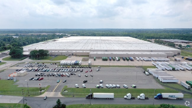
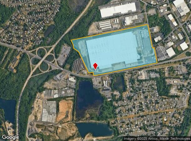
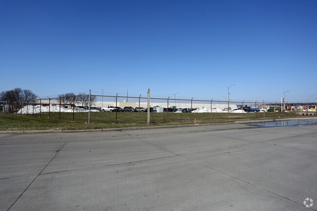
Property Record
1 Kresge Rd, Fairless Hills, PA 19030
NEARBY LISTINGS FOR SALE OR LEASE
Property Detail
1 Kresge Rd
13-028-062-001
@13-28-58-1 LOT 96.2A N S LR09136 1293 FT W OF NEWHOLD RD
Warehouse
Bucks
AE
Pennsylvania
42017C0466K
96
2024
95.90 AC
2025
Bucks
105805
Philadelphia
2,108,894 SF
Philadelphia-Camden-Wilmington, PA-NJ-DE-MD
DEMOGRAPHICS near 1 Kresge Rd
1 Mile
3 Mile
5 Mile
2024 Total Population
3,471
67,019
248,050
2029 Population
3,517
66,613
245,888
Pop Growth 2024-2029
+ 1.33%
(0.61%)
(0.87%)
Average Age
43
40
39
2024 Total Households
1,371
24,479
89,982
HH Growth 2024-2029
+ 1.31%
(0.65%)
(0.85%)
Median Household Inc
$92,974
$87,069
$75,828
Avg Household Size
2.40
2.60
2.60
2024 Avg HH Vehicles
2.00
2.00
2.00
Median Home Value
$76,518
$282,026
$259,026
Median Year Built
1975
1957
1955
Nearby Places
Map Layers
Map Styles
 Street
 Aerial
- Restaurants
- Banks
- Shops
- Fitness
- Groceries
PUBLIC TRANSPORTATION
COMMUTER RAIL
Trenton Transit Center (Trenton Line - SEPTA)
DRIVE
WALK
Distance
Trenton Transit Center (Trenton Line - SEPTA)
11 min
5.2 mi
Levittown (R7 - Southeastern Pennsylvania Transportation Authority Regional Rail (SEPTA Regional Rail))
DRIVE
WALK
Distance
Levittown (R7 - Southeastern Pennsylvania Transportation Authority Regional Rail (SEPTA Regional Rail))
10 min
5.3 mi
AIRPORT
Trenton Mercer
DRIVE
WALK
Distance
Trenton Mercer
20 min
9.9 mi
Freight Ports
Port of Philadelphia
DRIVE
WALK
Distance
Port of Philadelphia
42 min
25.0 mi
Nearby Properties
Address
Land Use
TOTAL SIZE
Lot Size
Zoning
Address
Land Use
TOTAL SIZE
Lot Size
Zoning
43,715 SF
49.95 AC
Address
Land Use
TOTAL SIZE
Lot Size
Zoning
13.85 AC
MU
Address
Land Use
TOTAL SIZE
Lot Size
Zoning
4.63 AC
MU
Address
Land Use
TOTAL SIZE
Lot Size
Zoning
96,530 SF
3.19 AC
0000
Address
Land Use
TOTAL SIZE
Lot Size
Zoning
96,530 SF
3.49 AC
0000
Address
Land Use
TOTAL SIZE
Lot Size
Zoning
96,530 SF
3.05 AC
0000
Address
Land Use
TOTAL SIZE
Lot Size
Zoning
88,353 SF
1.63 AC
RB
Address
Land Use
TOTAL SIZE
Lot Size
Zoning
1.89 AC
RB
Address
Land Use
TOTAL SIZE
Lot Size
Zoning
2.42 AC
RB
Address
Land Use
TOTAL SIZE
Lot Size
Zoning
1.99 AC
MU
Address
Land Use
TOTAL SIZE
Lot Size
Zoning
150,000 SF
64 AC
HR
Address
Land Use
TOTAL SIZE
Lot Size
Zoning
35,542 SF
27.89 AC
NC
Address
Land Use
TOTAL SIZE
Lot Size
Zoning
16,800 SF
3.14 AC
BB
Address
Land Use
TOTAL SIZE
Lot Size
Zoning
4.38 AC
MFG
Address
Land Use
TOTAL SIZE
Lot Size
Zoning
396,000 SF
36.71 AC
PIP
Address
Land Use
TOTAL SIZE
Lot Size
Zoning
22,552 SF
0.77 AC
BB
Address
Land Use
TOTAL SIZE
Lot Size
Zoning
44,362 SF
14.37 AC
IA
Address
Land Use
TOTAL SIZE
Lot Size
Zoning
3.45 AC
IA
Address
Land Use
TOTAL SIZE
Lot Size
Zoning
2,108,894 SF
95.90 AC
LI
Address
Land Use
TOTAL SIZE
Lot Size
Zoning
26,191 SF
1.64 AC
Address
Land Use
TOTAL SIZE
Lot Size
Zoning
163,209 SF
23.23 AC
HC
Address
Land Use
TOTAL SIZE
Lot Size
Zoning
2.64 AC
0000
Address
Land Use
TOTAL SIZE
Lot Size
Zoning
469,130 SF
50.51 AC
H1
Address
Land Use
TOTAL SIZE
Lot Size
Zoning
0.57 AC
BB
Address
Land Use
TOTAL SIZE
Lot Size
Zoning
43.54 AC
LI
Address
Land Use
TOTAL SIZE
Lot Size
Zoning
132,780 SF
11.09 AC
R3
Address
Land Use
TOTAL SIZE
Lot Size
Zoning
230,775 SF
28.29 AC
HI
Address
Land Use
TOTAL SIZE
Lot Size
Zoning
3,760 SF
1.59 AC
BA
Address
Land Use
TOTAL SIZE
Lot Size
Zoning
55,512 SF
0.70 AC
0000
Address
Land Use
TOTAL SIZE
Lot Size
Zoning
148,444 SF
24.06 AC
HR
The World's #1 Commercial Real Estate Marketplace
Connect with us
© 2026 CoStar Group
The information above has been obtained from sources believed reliable. While we do not doubt its accuracy we have not verified it and make no guarantee, warranty or representation about it. It is your responsibility to independently confirm its accuracy and completeness. Any projections, opinions, assumptions, or estimates used are for example only and do not represent the current or future performance of the property. The value of this transaction to you depends on tax and other factors which should be evaluated by your tax, financial, and legal advisors. You and your advisors should conduct a careful, independent investigation of the property to determine to your satisfaction the suitability of the property for your needs.