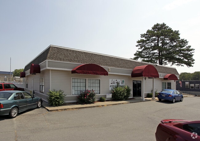
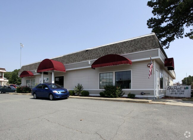
Property Record
1 Lake Pointe Dr, Maumelle, AR 72113
NEARBY LISTINGS FOR SALE OR LEASE
Property Detail
1 Lake Pointe Dr
42M-008-00-009-07
Cook Mtn Vil Ctr Unrec
Daycare
PT SW COM AT CNT OF SEC S269 41 W1696 02 TO POB & N R/W LN LAKE POINT DR TH AL N R/W LN N65*4037 W113 26 N18*4817E97 28 N76*28 49E149.12 S22*5047W188.38 TO POB AKA TR 13-A COOK MTN VIL CTR UNREC 28-3N-13W
X
Pulaski
05119C0310G
Arkansas
2025
0.39 AC
2025
Outlying Pulaski County
004306
Little Rock/N Little Rock
4,125 SF
Little Rock-North Little Rock-Conway, AR
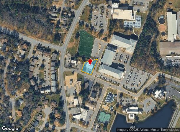
DEMOGRAPHICS near 1 Lake Pointe Dr
1 Mile
3 Mile
5 Mile
2024 Total Population
6,869
24,384
35,543
2029 Population
6,781
24,125
35,237
Pop Growth 2024-2029
(1.28%)
(1.06%)
(0.86%)
Average Age
38
39
39
2024 Total Households
2,943
10,550
15,511
HH Growth 2024-2029
(1.33%)
(1.02%)
(0.87%)
Median Household Inc
$64,770
$71,833
$66,456
Avg Household Size
2.30
2.30
2.30
2024 Avg HH Vehicles
2.00
2.00
2.00
Median Home Value
$185,721
$234,239
$237,863
Median Year Built
1988
2000
1998
Nearby Places
Map Layers
Map Styles
 Street
 Aerial
- Restaurants
- Banks
- Shops
- Fitness
- Groceries
PUBLIC TRANSPORTATION
AIRPORT
Bill and Hillary Clinton Ntl/Adams Field
DRIVE
WALK
Distance
Bill and Hillary Clinton Ntl/Adams Field
27 min
20.2 mi
Freight Ports
Port of Shreveport
DRIVE
WALK
Distance
Port of Shreveport
260 min
239.6 mi
Nearby Properties
Address
Land Use
TOTAL SIZE
Lot Size
Zoning
Address
Land Use
TOTAL SIZE
Lot Size
Zoning
1,160,360 SF
119.55 AC
Address
Land Use
TOTAL SIZE
Lot Size
Zoning
28,414 SF
80.25 AC
Address
Land Use
TOTAL SIZE
Lot Size
Zoning
320,000 SF
91.54 AC
Address
Land Use
TOTAL SIZE
Lot Size
Zoning
89,847 SF
12.77 AC
Address
Land Use
TOTAL SIZE
Lot Size
Zoning
35,712 SF
19.92 AC
Address
Land Use
TOTAL SIZE
Lot Size
Zoning
1,974 SF
14.30 AC
Address
Land Use
TOTAL SIZE
Lot Size
Zoning
55,997 SF
11.51 AC
Address
Land Use
TOTAL SIZE
Lot Size
Zoning
83,352 SF
6.90 AC
Address
Land Use
TOTAL SIZE
Lot Size
Zoning
77,478 SF
38.22 AC
Address
Land Use
TOTAL SIZE
Lot Size
Zoning
18,904 SF
12.73 AC
Address
Land Use
TOTAL SIZE
Lot Size
Zoning
12,077 SF
27.97 AC
Address
Land Use
TOTAL SIZE
Lot Size
Zoning
484,932 SF
32.85 AC
Address
Land Use
TOTAL SIZE
Lot Size
Zoning
157,500 SF
54.99 AC
Address
Land Use
TOTAL SIZE
Lot Size
Zoning
2,340 SF
37.56 AC
Address
Land Use
TOTAL SIZE
Lot Size
Zoning
192,104 SF
34.51 AC
Address
Land Use
TOTAL SIZE
Lot Size
Zoning
139,444 SF
7.63 AC
Address
Land Use
TOTAL SIZE
Lot Size
Zoning
8,624 SF
10.37 AC
Address
Land Use
TOTAL SIZE
Lot Size
Zoning
188,528 SF
24.29 AC
Address
Land Use
TOTAL SIZE
Lot Size
Zoning
66,619 SF
5.89 AC
Address
Land Use
TOTAL SIZE
Lot Size
Zoning
56,423 SF
Address
Land Use
TOTAL SIZE
Lot Size
Zoning
8,417 SF
101 AC
Address
Land Use
TOTAL SIZE
Lot Size
Zoning
12,346 SF
14.41 AC
Address
Land Use
TOTAL SIZE
Lot Size
Zoning
38,369 SF
10.04 AC
Address
Land Use
TOTAL SIZE
Lot Size
Zoning
60,966 SF
21.82 AC
Address
Land Use
TOTAL SIZE
Lot Size
Zoning
6,357 SF
10.80 AC
Address
Land Use
TOTAL SIZE
Lot Size
Zoning
37,955 SF
2.45 AC
Address
Land Use
TOTAL SIZE
Lot Size
Zoning
840 SF
20.01 AC
Address
Land Use
TOTAL SIZE
Lot Size
Zoning
83,647 SF
11.60 AC
Address
Land Use
TOTAL SIZE
Lot Size
Zoning
71,132 SF
5.89 AC
Address
Land Use
TOTAL SIZE
Lot Size
Zoning
162,010 SF
10.45 AC
The World's #1 Commercial Real Estate Marketplace
Connect with us
© 2025 CoStar Group
The information above has been obtained from sources believed reliable. While we do not doubt its accuracy we have not verified it and make no guarantee, warranty or representation about it. It is your responsibility to independently confirm its accuracy and completeness. Any projections, opinions, assumptions, or estimates used are for example only and do not represent the current or future performance of the property. The value of this transaction to you depends on tax and other factors which should be evaluated by your tax, financial, and legal advisors. You and your advisors should conduct a careful, independent investigation of the property to determine to your satisfaction the suitability of the property for your needs.