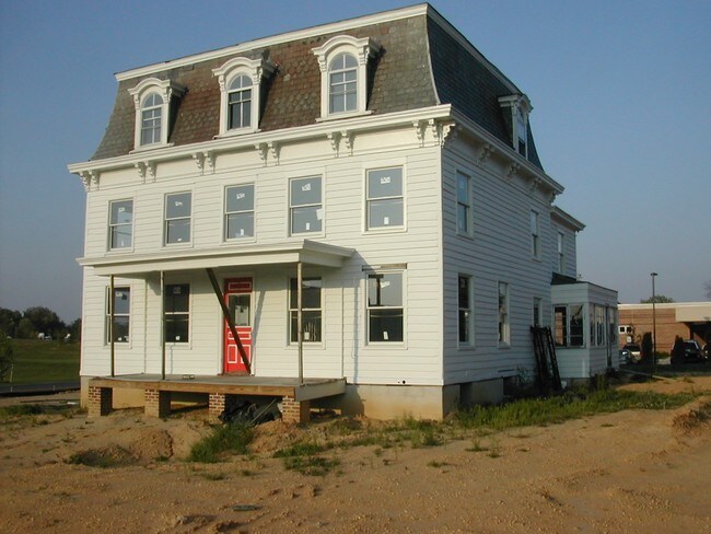
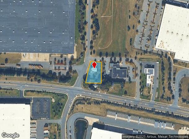
Property Record
1 Liberty Way, Cranbury, NJ 08512
NEARBY LISTINGS FOR SALE OR LEASE
Property Detail
1 Liberty Way
New York-Jersey City-White Plains, NY-NJ
Cabot Distribution Center Majo
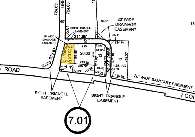
02-00007-01-00020-02
0.510 ACRE
Vacantlandnec
Middlesex
X
New Jersey
34021C0167F
20.2
2024
0.51 AC
2025
Brunswick West
008700
Northern New Jersey
2,758 SF
DEMOGRAPHICS near 1 Liberty Way
1 Mile
3 Mile
5 Mile
2024 Total Population
3,788
38,770
99,488
2029 Population
3,892
38,419
98,495
Pop Growth 2024-2029
+ 2.75%
(0.91%)
(1.00%)
Average Age
42
48
44
2024 Total Households
1,236
16,651
39,793
HH Growth 2024-2029
+ 2.75%
(1.50%)
(1.35%)
Median Household Inc
$178,880
$90,730
$106,421
Avg Household Size
2.90
2.30
2.40
2024 Avg HH Vehicles
2.00
2.00
2.00
Median Home Value
$699,594
$330,308
$395,989
Median Year Built
1996
1982
1984
Nearby Places
Map Layers
Map Styles
 Street
 Aerial
- Restaurants
- Banks
- Shops
- Fitness
- Groceries
PUBLIC TRANSPORTATION
COMMUTER RAIL
Princeton Junction (Northeast Corridor Line - NJ Transit Commuter Rail (NJ Transit), Princeton Branch - NJ Transit Commuter Rail (NJ Transit))
DRIVE
WALK
Distance
Princeton Junction (Northeast Corridor Line - NJ Transit Commuter Rail (NJ Transit), Princeton Branch - NJ Transit Commuter Rail (NJ Transit))
16 min
9.0 mi
AIRPORT
Trenton Mercer
DRIVE
WALK
Distance
Trenton Mercer
36 min
22.4 mi
Newark Liberty International
DRIVE
WALK
Distance
Newark Liberty International
53 min
39.0 mi
Freight Ports
New York Container Terminal
DRIVE
WALK
Distance
New York Container Terminal
46 min
34.1 mi
Nearby Properties
Address
Land Use
TOTAL SIZE
Lot Size
Zoning
Address
Land Use
TOTAL SIZE
Lot Size
Zoning
203.85 AC
I/LI
Address
Land Use
TOTAL SIZE
Lot Size
Zoning
115.37 AC
I/LI
Address
Land Use
TOTAL SIZE
Lot Size
Zoning
63.54 AC
LI
Address
Land Use
TOTAL SIZE
Lot Size
Zoning
51.01 AC
RO
Address
Land Use
TOTAL SIZE
Lot Size
Zoning
69.34 AC
LI
Address
Land Use
TOTAL SIZE
Lot Size
Zoning
47.51 AC
I/LI
Address
Land Use
TOTAL SIZE
Lot Size
Zoning
53.31 AC
LI
Address
Land Use
TOTAL SIZE
Lot Size
Zoning
58.21 AC
LI
Address
Land Use
TOTAL SIZE
Lot Size
Zoning
74.64 AC
LI
Address
Land Use
TOTAL SIZE
Lot Size
Zoning
83.35 AC
I/LA
Address
Land Use
TOTAL SIZE
Lot Size
Zoning
2,338 SF
58.26 AC
I/LI
Address
Land Use
TOTAL SIZE
Lot Size
Zoning
53.31 AC
LI
Address
Land Use
TOTAL SIZE
Lot Size
Zoning
51.28 AC
LI
Address
Land Use
TOTAL SIZE
Lot Size
Zoning
69.94 AC
ILIS
Address
Land Use
TOTAL SIZE
Lot Size
Zoning
528,314 SF
31.98 AC
LI
Address
Land Use
TOTAL SIZE
Lot Size
Zoning
53.98 AC
LI
Address
Land Use
TOTAL SIZE
Lot Size
Zoning
46.04 AC
I/LI
Address
Land Use
TOTAL SIZE
Lot Size
Zoning
186,785 SF
29.83 AC
HC
Address
Land Use
TOTAL SIZE
Lot Size
Zoning
243,700 SF
34.78 AC
HC
Address
Land Use
TOTAL SIZE
Lot Size
Zoning
38.20 AC
LI
Address
Land Use
TOTAL SIZE
Lot Size
Zoning
53.56 AC
I/LI
Address
Land Use
TOTAL SIZE
Lot Size
Zoning
38.99 AC
LI
Address
Land Use
TOTAL SIZE
Lot Size
Zoning
414,975 SF
37.45 AC
LI
Address
Land Use
TOTAL SIZE
Lot Size
Zoning
31.12 AC
LI
Address
Land Use
TOTAL SIZE
Lot Size
Zoning
29.89 AC
LI
Address
Land Use
TOTAL SIZE
Lot Size
Zoning
251,698 SF
0.01 AC
LI
Address
Land Use
TOTAL SIZE
Lot Size
Zoning
18.24 AC
ROLI
Address
Land Use
TOTAL SIZE
Lot Size
Zoning
35.33 AC
LI
Address
Land Use
TOTAL SIZE
Lot Size
Zoning
31.52 AC
LI
Address
Land Use
TOTAL SIZE
Lot Size
Zoning
22.13 AC
PUD
The World's #1 Commercial Real Estate Marketplace
Connect with us
© 2025 CoStar Group
The information above has been obtained from sources believed reliable. While we do not doubt its accuracy we have not verified it and make no guarantee, warranty or representation about it. It is your responsibility to independently confirm its accuracy and completeness. Any projections, opinions, assumptions, or estimates used are for example only and do not represent the current or future performance of the property. The value of this transaction to you depends on tax and other factors which should be evaluated by your tax, financial, and legal advisors. You and your advisors should conduct a careful, independent investigation of the property to determine to your satisfaction the suitability of the property for your needs.