Property Record
1 Live Oak Ave, Morgan Hill, CA 95037


NEARBY LISTINGS FOR SALE OR LEASE
Property Detail
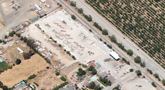
1 Live Oak Ave
712-07-055
Dougherty Randol
Lumberyard
Santa Clara
D
California
06085C0437H
8
2024
5.94 AC
2025
Morgan Hill
512100
South Bay/San Jose
3,000 SF
San Jose-Sunnyvale-Santa Clara, CA
DEMOGRAPHICS near 1 Live Oak Ave
1 Mile
3 Mile
5 Mile
2024 Total Population
634
13,817
40,223
2029 Population
573
13,132
38,529
Pop Growth 2024-2029
(9.62%)
(4.96%)
(4.21%)
Average Age
41
40
40
2024 Total Households
174
4,291
12,962
HH Growth 2024-2029
(9.77%)
(5.17%)
(4.44%)
Median Household Inc
$99,305
$143,749
$141,381
Avg Household Size
3.20
3.10
3.00
2024 Avg HH Vehicles
3.00
2.00
2.00
Median Home Value
$1,125,000
$1,048,339
$1,036,989
Median Year Built
1977
1991
1987
Nearby Places
Map Layers
Map Styles
 Street
 Aerial
- Restaurants
- Banks
- Shops
- Fitness
- Groceries
PUBLIC TRANSPORTATION
COMMUTER RAIL
Morgan Hill Caltrain Station Southbound (South Santa Clara County Connector - Caltrain (Caltrain))
DRIVE
WALK
Distance
Morgan Hill Caltrain Station Southbound (South Santa Clara County Connector - Caltrain (Caltrain))
8 min
4.0 mi
Morgan Hill (Caltrain - Caltrain (Caltrain))
DRIVE
WALK
Distance
Morgan Hill (Caltrain - Caltrain (Caltrain))
8 min
4.1 mi
AIRPORT
Norman Y Mineta San Jose International
DRIVE
WALK
Distance
Norman Y Mineta San Jose International
30 min
22.0 mi
Freight Ports
Port of Redwood City
DRIVE
WALK
Distance
Port of Redwood City
51 min
40.1 mi
Nearby Properties
Address
Land Use
TOTAL SIZE
Lot Size
Zoning
Address
Land Use
TOTAL SIZE
Lot Size
Zoning
23.35 AC
PUD
Address
Land Use
TOTAL SIZE
Lot Size
Zoning
7.53 AC
CT
Address
Land Use
TOTAL SIZE
Lot Size
Zoning
19.50 AC
RAM
Address
Land Use
TOTAL SIZE
Lot Size
Zoning
257,296 SF
14.71 AC
M
Address
Land Use
TOTAL SIZE
Lot Size
Zoning
9.18 AC
IL
Address
Land Use
TOTAL SIZE
Lot Size
Zoning
6.84 AC
IL
Address
Land Use
TOTAL SIZE
Lot Size
Zoning
8.65 AC
IL
Address
Land Use
TOTAL SIZE
Lot Size
Zoning
285,877 SF
16.30 AC
MPUD
Address
Land Use
TOTAL SIZE
Lot Size
Zoning
91,853 SF
5.30 AC
M
Address
Land Use
TOTAL SIZE
Lot Size
Zoning
79,059 SF
5.87 AC
M1
Address
Land Use
TOTAL SIZE
Lot Size
Zoning
85,456 SF
4.98 AC
M
Address
Land Use
TOTAL SIZE
Lot Size
Zoning
76,845 SF
2.43 AC
A140
Address
Land Use
TOTAL SIZE
Lot Size
Zoning
400 SF
756.21 AC
A(PD)
Address
Land Use
TOTAL SIZE
Lot Size
Zoning
151,242 SF
10.44 AC
ML
Address
Land Use
TOTAL SIZE
Lot Size
Zoning
4.95 AC
M
Address
Land Use
TOTAL SIZE
Lot Size
Zoning
82,446 SF
5.32 AC
M
Address
Land Use
TOTAL SIZE
Lot Size
Zoning
65,809 SF
2.93 AC
R3
Address
Land Use
TOTAL SIZE
Lot Size
Zoning
4.53 AC
IL
Address
Land Use
TOTAL SIZE
Lot Size
Zoning
73,600 SF
5 AC
M
Address
Land Use
TOTAL SIZE
Lot Size
Zoning
4.30 AC
M
Address
Land Use
TOTAL SIZE
Lot Size
Zoning
120,000 SF
6.86 AC
ML
Address
Land Use
TOTAL SIZE
Lot Size
Zoning
47,928 SF
8.84 AC
M
Address
Land Use
TOTAL SIZE
Lot Size
Zoning
155,353 SF
9.21 AC
IPUD
Address
Land Use
TOTAL SIZE
Lot Size
Zoning
4.93 AC
ML
Address
Land Use
TOTAL SIZE
Lot Size
Zoning
127,732 SF
4.74 AC
HC
Address
Land Use
TOTAL SIZE
Lot Size
Zoning
127,732 SF
6.26 AC
CT
Address
Land Use
TOTAL SIZE
Lot Size
Zoning
22,385 SF
2.45 AC
CT
Address
Land Use
TOTAL SIZE
Lot Size
Zoning
4,734 SF
20.32 AC
PVD
Address
Land Use
TOTAL SIZE
Lot Size
Zoning
61,198 SF
4.14 AC
M
Address
Land Use
TOTAL SIZE
Lot Size
Zoning
108,631 SF
13.90 AC
A-20A
The World's #1 Commercial Real Estate Marketplace
Connect with us
© 2025 CoStar Group
The information above has been obtained from sources believed reliable. While we do not doubt its accuracy we have not verified it and make no guarantee, warranty or representation about it. It is your responsibility to independently confirm its accuracy and completeness. Any projections, opinions, assumptions, or estimates used are for example only and do not represent the current or future performance of the property. The value of this transaction to you depends on tax and other factors which should be evaluated by your tax, financial, and legal advisors. You and your advisors should conduct a careful, independent investigation of the property to determine to your satisfaction the suitability of the property for your needs.