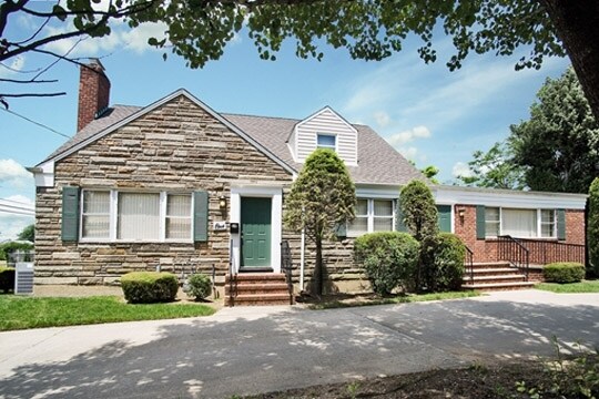
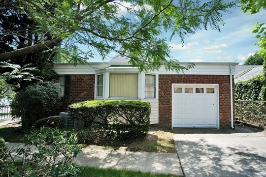
Property Record
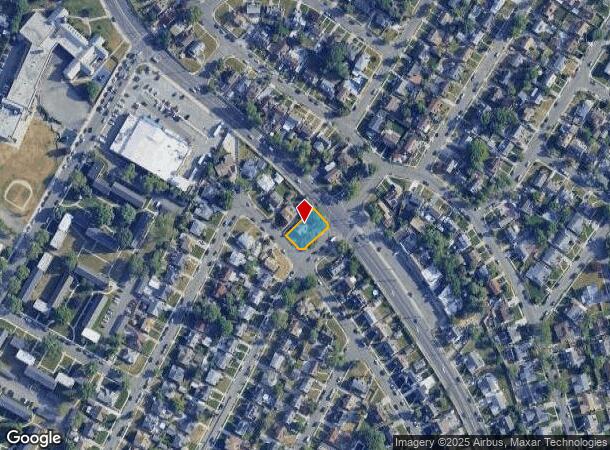
1 Margaret Dr, Valley Stream, NY 11580

NEARBY LISTINGS FOR SALE OR LEASE
Property Detail
1 Margaret Dr
2089-37-584-00-0019-0
TOWN #1 SCH DIST 016
Religious
Nassau
X
New York
36059C0212G
19
2025
0.19 AC
2025
Southern Nassau
409900
Long Island (New York)
3,447 SF
Nassau County-Suffolk County, NY
DEMOGRAPHICS near 1 Margaret Dr
1 Mile
3 Mile
5 Mile
2024 Total Population
32,926
318,600
806,262
2029 Population
31,851
301,223
764,360
Pop Growth 2024-2029
(3.26%)
(5.45%)
(5.20%)
Average Age
42
42
41
2024 Total Households
9,510
98,047
255,103
HH Growth 2024-2029
(3.41%)
(5.75%)
(5.44%)
Median Household Inc
$122,935
$110,279
$97,990
Avg Household Size
3.30
3.10
3.00
2024 Avg HH Vehicles
2.00
2.00
2.00
Median Home Value
$569,296
$629,359
$658,927
Median Year Built
1951
1950
1952
Nearby Places
- Restaurants
- Banks
- Shops
- Fitness
- Groceries
PUBLIC TRANSPORTATION
COMMUTER RAIL
Valley Stream Station (Far Rockaway Branch - Long Island Rail Road, Long Beach Branch - Long Island Rail Road, West Hempstead Branch - Long Island Rail Road)
DRIVE
WALK
Distance
Valley Stream Station (Far Rockaway Branch - Long Island Rail Road, Long Beach Branch - Long Island Rail Road, West Hempstead Branch - Long Island Rail Road)
4 min
1.7 mi
Rosedale Station (Far Rockaway Branch - Long Island Rail Road)
DRIVE
WALK
Distance
Rosedale Station (Far Rockaway Branch - Long Island Rail Road)
5 min
3.0 mi
AIRPORT
John F Kennedy International
DRIVE
WALK
Distance
John F Kennedy International
14 min
8.0 mi
LaGuardia
DRIVE
WALK
Distance
LaGuardia
24 min
15.0 mi
Newark Liberty International
DRIVE
WALK
Distance
Newark Liberty International
50 min
32.9 mi
Freight Ports
NY - Red Hook Container Terminal
DRIVE
WALK
Distance
NY - Red Hook Container Terminal
35 min
19.4 mi
Nearby Properties
Address
Land Use
TOTAL SIZE
Lot Size
Zoning
Address
Land Use
TOTAL SIZE
Lot Size
Zoning
294.47 AC
PARK
Address
Land Use
TOTAL SIZE
Lot Size
Zoning
285,170 SF
12.63 AC
R3-1
Address
Land Use
TOTAL SIZE
Lot Size
Zoning
27.23 AC
PARK
Address
Land Use
TOTAL SIZE
Lot Size
Zoning
50,000 SF
52.45 AC
PARK
Address
Land Use
TOTAL SIZE
Lot Size
Zoning
129,378 SF
4.86 AC
R2A
Address
Land Use
TOTAL SIZE
Lot Size
Zoning
160,000 SF
4.02 AC
R3-2
Address
Land Use
TOTAL SIZE
Lot Size
Zoning
64,618 SF
8.04 AC
Address
Land Use
TOTAL SIZE
Lot Size
Zoning
99,814 SF
1.31 AC
R3-2
Address
Land Use
TOTAL SIZE
Lot Size
Zoning
93.35 AC
PARK
Address
Land Use
TOTAL SIZE
Lot Size
Zoning
122,080 SF
2.81 AC
R2
Address
Land Use
TOTAL SIZE
Lot Size
Zoning
5,296 SF
37.42 AC
PARK
Address
Land Use
TOTAL SIZE
Lot Size
Zoning
213,338 SF
2.91 AC
R3X
Address
Land Use
TOTAL SIZE
Lot Size
Zoning
252,665 SF
7.50 AC
R3-2
Address
Land Use
TOTAL SIZE
Lot Size
Zoning
97,190 SF
1.75 AC
R3X
Address
Land Use
TOTAL SIZE
Lot Size
Zoning
170,000 SF
4.02 AC
R3-2
Address
Land Use
TOTAL SIZE
Lot Size
Zoning
56,385 SF
7.81 AC
R6
Address
Land Use
TOTAL SIZE
Lot Size
Zoning
78,380 SF
0.85 AC
R3-2
Address
Land Use
TOTAL SIZE
Lot Size
Zoning
806 SF
84.15 AC
R2A
Address
Land Use
TOTAL SIZE
Lot Size
Zoning
260,000 SF
4.14 AC
R2
Address
Land Use
TOTAL SIZE
Lot Size
Zoning
96,071 SF
5.58 AC
M1-1
Address
Land Use
TOTAL SIZE
Lot Size
Zoning
149,804 SF
9.07 AC
M1-1
Address
Land Use
TOTAL SIZE
Lot Size
Zoning
122,740 SF
2.77 AC
R2
Address
Land Use
TOTAL SIZE
Lot Size
Zoning
85,330 SF
2.91 AC
R3-2
Address
Land Use
TOTAL SIZE
Lot Size
Zoning
4,000 SF
23.88 AC
PARK
Address
Land Use
TOTAL SIZE
Lot Size
Zoning
32,000 SF
8.70 AC
M1-1
Address
Land Use
TOTAL SIZE
Lot Size
Zoning
131,000 SF
2.43 AC
M1-1
Address
Land Use
TOTAL SIZE
Lot Size
Zoning
78,944 SF
11.31 AC
M1-1
Address
Land Use
TOTAL SIZE
Lot Size
Zoning
100 SF
15.61 AC
PARK
Address
Land Use
TOTAL SIZE
Lot Size
Zoning
49,410 SF
3.19 AC
R3A
Address
Land Use
TOTAL SIZE
Lot Size
Zoning
99,000 SF
1.65 AC
R3A
The World's #1 Commercial Real Estate Marketplace
Connect with us
© 2025 CoStar Group
The information above has been obtained from sources believed reliable. While we do not doubt its accuracy we have not verified it and make no guarantee, warranty or representation about it. It is your responsibility to independently confirm its accuracy and completeness. Any projections, opinions, assumptions, or estimates used are for example only and do not represent the current or future performance of the property. The value of this transaction to you depends on tax and other factors which should be evaluated by your tax, financial, and legal advisors. You and your advisors should conduct a careful, independent investigation of the property to determine to your satisfaction the suitability of the property for your needs.