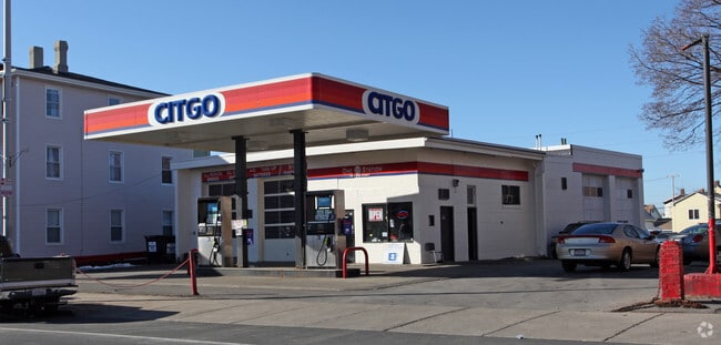
Property Record
146 Main St, Maynard, MA 01754
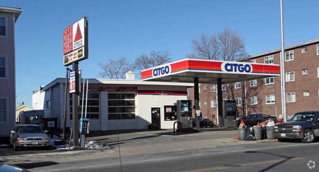
NEARBY LISTINGS FOR SALE OR LEASE
Property Detail
146 Main St
MAYN-000014-000000-000201-T000000
Middlesex
Telephonefacility
Massachusetts
AE
35.89 AC
25017C0362F
Somerville/Everett
2025
Boston
2025
Boston-Cambridge-Newton, MA-NH
364102
DEMOGRAPHICS near 146 Main St
1 Mile
3 Mile
5 Mile
2024 Total Population
37,172
355,967
788,995
2029 Population
35,839
342,652
765,134
Pop Growth 2024-2029
(3.59%)
(3.74%)
(3.02%)
Average Age
37
38
38
2024 Total Households
13,936
144,342
328,127
HH Growth 2024-2029
(3.42%)
(3.77%)
(3.11%)
Median Household Inc
$77,214
$90,538
$97,358
Avg Household Size
2.60
2.40
2.20
2024 Avg HH Vehicles
1.00
1.00
1.00
Median Home Value
$623,432
$682,755
$755,373
Median Year Built
1948
1949
1949
Nearby Places
Map Layers
Map Styles
 Street
 Aerial
- Restaurants
- Banks
- Shops
- Fitness
- Groceries
PUBLIC TRANSPORTATION
COMMUTER RAIL
South Acton (Fitchburg/South Acton Line - Massachusetts Bay Transportation Authority Commuter Rail (Purple Line))
DRIVE
WALK
Distance
South Acton (Fitchburg/South Acton Line - Massachusetts Bay Transportation Authority Commuter Rail (Purple Line))
6 min
2.7 mi
West Concord (Fitchburg/South Acton Line - Massachusetts Bay Transportation Authority Commuter Rail (Purple Line))
DRIVE
WALK
Distance
West Concord (Fitchburg/South Acton Line - Massachusetts Bay Transportation Authority Commuter Rail (Purple Line))
9 min
4.1 mi
AIRPORT
General Edward Lawrence Logan International
DRIVE
WALK
Distance
General Edward Lawrence Logan International
45 min
27.5 mi
Worcester Regional
DRIVE
WALK
Distance
Worcester Regional
48 min
29.5 mi
Freight Ports
Port of Boston
DRIVE
WALK
Distance
Port of Boston
45 min
27.6 mi
Nearby Properties
Address
Land Use
TOTAL SIZE
Lot Size
Zoning
Address
Land Use
TOTAL SIZE
Lot Size
Zoning
30.39 AC
I
Address
Land Use
TOTAL SIZE
Lot Size
Zoning
160 SF
R1
Address
Land Use
TOTAL SIZE
Lot Size
Zoning
326,464 SF
19.52 AC
I
Address
Land Use
TOTAL SIZE
Lot Size
Zoning
51,504 SF
18.87 AC
C
Address
Land Use
TOTAL SIZE
Lot Size
Zoning
46.82 AC
RC
Address
Land Use
TOTAL SIZE
Lot Size
Zoning
155,339 SF
24 AC
R1
Address
Land Use
TOTAL SIZE
Lot Size
Zoning
35.99 AC
HI
Address
Land Use
TOTAL SIZE
Lot Size
Zoning
104,150 SF
14.98 AC
R
Address
Land Use
TOTAL SIZE
Lot Size
Zoning
9.56 AC
PM
Address
Land Use
TOTAL SIZE
Lot Size
Zoning
815 AC
OS
Address
Land Use
TOTAL SIZE
Lot Size
Zoning
13.19 AC
B
Address
Land Use
TOTAL SIZE
Lot Size
Zoning
54,892 SF
7.99 AC
AA
Address
Land Use
TOTAL SIZE
Lot Size
Zoning
990.40 AC
RC
Address
Land Use
TOTAL SIZE
Lot Size
Zoning
40 AC
R2
Address
Land Use
TOTAL SIZE
Lot Size
Zoning
33.05 AC
I
Address
Land Use
TOTAL SIZE
Lot Size
Zoning
72,821 SF
16.56 AC
R
Address
Land Use
TOTAL SIZE
Lot Size
Zoning
26.16 AC
R2
Address
Land Use
TOTAL SIZE
Lot Size
Zoning
105,163 SF
10.65 AC
OP2
Address
Land Use
TOTAL SIZE
Lot Size
Zoning
85,000 SF
18.77 AC
R1
Address
Land Use
TOTAL SIZE
Lot Size
Zoning
98,750 SF
15.48 AC
OP2
Address
Land Use
TOTAL SIZE
Lot Size
Zoning
124,668 SF
9.89 AC
I
Address
Land Use
TOTAL SIZE
Lot Size
Zoning
5,002 SF
34.80 AC
PM
Address
Land Use
TOTAL SIZE
Lot Size
Zoning
6.73 AC
R2
Address
Land Use
TOTAL SIZE
Lot Size
Zoning
3.89 AC
C
Address
Land Use
TOTAL SIZE
Lot Size
Zoning
8.06 AC
R1
Address
Land Use
TOTAL SIZE
Lot Size
Zoning
18,564 SF
12 AC
R2
Address
Land Use
TOTAL SIZE
Lot Size
Zoning
107,034 SF
2.15 AC
LI
Address
Land Use
TOTAL SIZE
Lot Size
Zoning
58,460 SF
5.81 AC
PM
Address
Land Use
TOTAL SIZE
Lot Size
Zoning
32,488 SF
0.92 AC
CB
Address
Land Use
TOTAL SIZE
Lot Size
Zoning
9.99 AC
R1
The World's #1 Commercial Real Estate Marketplace
Connect with us
© 2026 CoStar Group
The information above has been obtained from sources believed reliable. While we do not doubt its accuracy we have not verified it and make no guarantee, warranty or representation about it. It is your responsibility to independently confirm its accuracy and completeness. Any projections, opinions, assumptions, or estimates used are for example only and do not represent the current or future performance of the property. The value of this transaction to you depends on tax and other factors which should be evaluated by your tax, financial, and legal advisors. You and your advisors should conduct a careful, independent investigation of the property to determine to your satisfaction the suitability of the property for your needs.