Property Record
1 Morningside Dr N, Westport, CT 06880


NEARBY LISTINGS FOR SALE OR LEASE
Property Detail
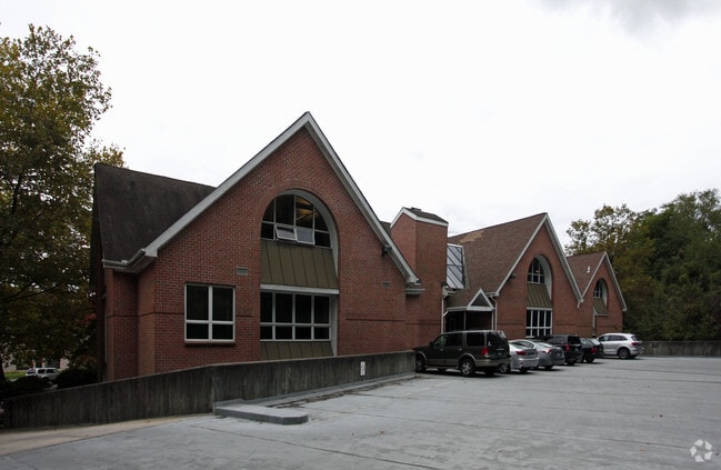
1 Morningside Dr N
WPOR-000009F-000000-000124
Fairfield
Commercialnec
Connecticut
X
124-0
09001C0414G
1.87 AC
2025
Westport
2025
Westchester/So Connecticut
050302
Bridgeport-Stamford-Norwalk, CT
DEMOGRAPHICS near 1 Morningside Dr N
1 Mile
3 Mile
5 Mile
2024 Total Population
5,415
32,479
105,651
2029 Population
5,486
32,819
106,210
Pop Growth 2024-2029
+ 1.31%
+ 1.05%
+ 0.53%
Average Age
41
42
41
2024 Total Households
1,913
11,712
38,148
HH Growth 2024-2029
+ 1.31%
+ 1.02%
+ 0.54%
Median Household Inc
$223,616
$211,081
$152,015
Avg Household Size
2.80
2.70
2.60
2024 Avg HH Vehicles
2.00
2.00
2.00
Median Home Value
$1,037,582
$1,038,835
$789,704
Median Year Built
1971
1967
1964
Nearby Places
Map Layers
Map Styles
 Street
 Aerial
- Restaurants
- Banks
- Shops
- Fitness
- Groceries
PUBLIC TRANSPORTATION
COMMUTER RAIL
Green's Farms Station (New Haven Line - Metro-North Commuter Railroad Company (Metro-North))
DRIVE
WALK
Distance
Green's Farms Station (New Haven Line - Metro-North Commuter Railroad Company (Metro-North))
6 min
1.8 mi
Southport Station (New Haven Line - Metro-North Commuter Railroad Company (Metro-North))
DRIVE
WALK
Distance
Southport Station (New Haven Line - Metro-North Commuter Railroad Company (Metro-North))
6 min
2.5 mi
AIRPORT
Westchester County
DRIVE
WALK
Distance
Westchester County
43 min
27.2 mi
Tweed/New Haven
DRIVE
WALK
Distance
Tweed/New Haven
49 min
30.9 mi
Freight Ports
Port of New Haven
DRIVE
WALK
Distance
Port of New Haven
43 min
28.0 mi
Nearby Properties
Address
Land Use
TOTAL SIZE
Lot Size
Zoning
Address
Land Use
TOTAL SIZE
Lot Size
Zoning
50.42 AC
DDD4
Address
Land Use
TOTAL SIZE
Lot Size
Zoning
6.80 AC
B2
Address
Land Use
TOTAL SIZE
Lot Size
Zoning
27.33 AC
AAA
Address
Land Use
TOTAL SIZE
Lot Size
Zoning
1.44 AC
BCD/H
Address
Land Use
TOTAL SIZE
Lot Size
Zoning
272.25 AC
AAA
Address
Land Use
TOTAL SIZE
Lot Size
Zoning
45.06 AC
AAA
Address
Land Use
TOTAL SIZE
Lot Size
Zoning
13.10 AC
RBD
Address
Land Use
TOTAL SIZE
Lot Size
Zoning
29.50 AC
DOSRD1
Address
Land Use
TOTAL SIZE
Lot Size
Zoning
23.15 AC
A
Address
Land Use
TOTAL SIZE
Lot Size
Zoning
168.95 AC
AAA_AA
Address
Land Use
TOTAL SIZE
Lot Size
Zoning
23.87 AC
A
Address
Land Use
TOTAL SIZE
Lot Size
Zoning
24.82 AC
AA_A
Address
Land Use
TOTAL SIZE
Lot Size
Zoning
90,056 SF
28.10 AC
AA_A
Address
Land Use
TOTAL SIZE
Lot Size
Zoning
85,050 SF
6.76 AC
GBD
Address
Land Use
TOTAL SIZE
Lot Size
Zoning
10.55 AC
AA
Address
Land Use
TOTAL SIZE
Lot Size
Zoning
7.13 AC
B
Address
Land Use
TOTAL SIZE
Lot Size
Zoning
94,449 SF
5.40 AC
BPD/A
Address
Land Use
TOTAL SIZE
Lot Size
Zoning
23.70 AC
AAA
Address
Land Use
TOTAL SIZE
Lot Size
Zoning
21.93 AC
DDD4
Address
Land Use
TOTAL SIZE
Lot Size
Zoning
3.43 AC
GBD_AA
Address
Land Use
TOTAL SIZE
Lot Size
Zoning
13.40 AC
A
Address
Land Use
TOTAL SIZE
Lot Size
Zoning
97,746 SF
8.68 AC
GBD/A
Address
Land Use
TOTAL SIZE
Lot Size
Zoning
92,057 SF
10.20 AC
B
Address
Land Use
TOTAL SIZE
Lot Size
Zoning
17.19 AC
AA
Address
Land Use
TOTAL SIZE
Lot Size
Zoning
98,755 SF
7.20 AC
DID
Address
Land Use
TOTAL SIZE
Lot Size
Zoning
32.37 AC
AAA
Address
Land Use
TOTAL SIZE
Lot Size
Zoning
44,438 SF
7.06 AC
DDD2
Address
Land Use
TOTAL SIZE
Lot Size
Zoning
4.41 AC
RBD_A
Address
Land Use
TOTAL SIZE
Lot Size
Zoning
29 AC
A
Address
Land Use
TOTAL SIZE
Lot Size
Zoning
8.61 AC
AAA
The World's #1 Commercial Real Estate Marketplace
Connect with us
© 2025 CoStar Group
The information above has been obtained from sources believed reliable. While we do not doubt its accuracy we have not verified it and make no guarantee, warranty or representation about it. It is your responsibility to independently confirm its accuracy and completeness. Any projections, opinions, assumptions, or estimates used are for example only and do not represent the current or future performance of the property. The value of this transaction to you depends on tax and other factors which should be evaluated by your tax, financial, and legal advisors. You and your advisors should conduct a careful, independent investigation of the property to determine to your satisfaction the suitability of the property for your needs.