Property Record
1 N Main St, Oshkosh, WI 54901

NEARBY LISTINGS FOR SALE OR LEASE
-
-
View all Oshkosh listings for sale on LoopNet.com
Property Detail
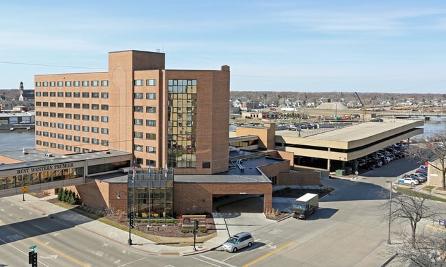
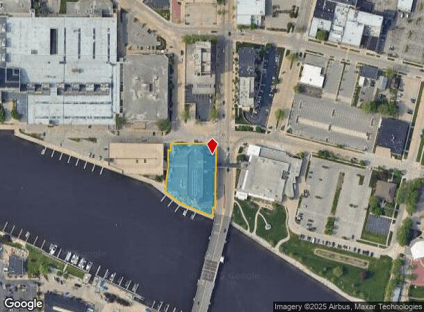
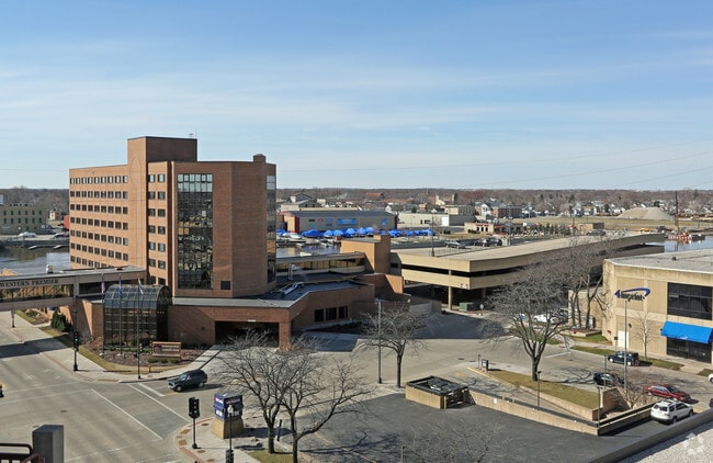
1 N Main St
Oshkosh-Neenah, WI
Moores Subdivision
01-0040-0000
LOT 3 CSM 1197 DOC #602518 R OF D EXC THAT PRT IN DOC#1612548 R OF D
Commercialnec
Winnebago
AE
Wisconsin
55087C0450D
3
2024
1.15 AC
2024
Appleton/Oshkosh
000501
Other Market Areas
128,951 SF
DEMOGRAPHICS near 1 N Main St
1 mile
3 mile
5 mile
2024 Total Population
16,183
55,889
74,874
2029 Population
16,262
56,194
75,174
Pop Growth 2024-2029
+ 0.49%
+ 0.55%
+ 0.40%
Average Age
35
39
39
2024 Total Households
6,980
24,411
31,149
HH Growth 2024-2029
+ 0.52%
+ 0.69%
+ 0.62%
Median Household Inc
$54,020
$53,933
$58,846
Avg Household Size
2.10
2.10
2.20
2024 Avg HH Vehicles
2.00
2.00
2.00
Median Home Value
$128,239
$153,375
$170,081
Median Year Built
1947
1965
1972
Nearby Places
Map Layers
Map Styles
 Street
 Aerial
Transit
 Traffic
 Biking
Places
Listings with unknown addresses are not visible on the map
- Restaurants
- Banks
- Shops
- Fitness
- Groceries
PUBLIC TRANSPORTATION
AIRPORT
Appleton International
Drive
Walk
Distance
Appleton International
30 min
20.9 mi
Freight Ports
Port Milwaukee
Drive
Walk
Distance
Port Milwaukee
106 min
88.9 mi
Nearby Properties
Address
Land Use
TOTAL SIZE
Lot Size
Zoning
Address
Land Use
TOTAL SIZE
Lot Size
Zoning
32.81 AC
CBPPD
Address
Land Use
TOTAL SIZE
Lot Size
Zoning
7.74 AC
Address
Land Use
TOTAL SIZE
Lot Size
Zoning
208,278 SF
22.77 AC
C2
Address
Land Use
TOTAL SIZE
Lot Size
Zoning
255,080 SF
21.29 AC
MR-12
Address
Land Use
TOTAL SIZE
Lot Size
Zoning
570,585 SF
81.26 AC
M2
Address
Land Use
TOTAL SIZE
Lot Size
Zoning
128,951 SF
4.95 AC
R1
Address
Land Use
TOTAL SIZE
Lot Size
Zoning
485,007 SF
41.76 AC
M3
Address
Land Use
TOTAL SIZE
Lot Size
Zoning
195,847 SF
4.66 AC
UMU-PD
Address
Land Use
TOTAL SIZE
Lot Size
Zoning
14.77 AC
SMU-PD
Address
Land Use
TOTAL SIZE
Lot Size
Zoning
2.29 AC
RMUPDRFO
Address
Land Use
TOTAL SIZE
Lot Size
Zoning
70,672 SF
4.97 AC
Address
Land Use
TOTAL SIZE
Lot Size
Zoning
161,640 SF
18.54 AC
C-2PD
Address
Land Use
TOTAL SIZE
Lot Size
Zoning
2.63 AC
RMU-PD-RFO
Address
Land Use
TOTAL SIZE
Lot Size
Zoning
2.40 AC
CBP-PD
Address
Land Use
TOTAL SIZE
Lot Size
Zoning
152,505 SF
6.54 AC
MR-20-RFO
Address
Land Use
TOTAL SIZE
Lot Size
Zoning
19,488 SF
16.43 AC
C-2
Address
Land Use
TOTAL SIZE
Lot Size
Zoning
136,368 SF
10.24 AC
C-2PD
Address
Land Use
TOTAL SIZE
Lot Size
Zoning
84,363 SF
10.97 AC
C-2PD
Address
Land Use
TOTAL SIZE
Lot Size
Zoning
53,998 SF
3.63 AC
C2
Address
Land Use
TOTAL SIZE
Lot Size
Zoning
175,906 SF
11.60 AC
MR-20
Address
Land Use
TOTAL SIZE
Lot Size
Zoning
1.78 AC
C3
Address
Land Use
TOTAL SIZE
Lot Size
Zoning
107,778 SF
8.57 AC
SMUPD
Address
Land Use
TOTAL SIZE
Lot Size
Zoning
117,892 SF
7.36 AC
MR-20
Address
Land Use
TOTAL SIZE
Lot Size
Zoning
25,456 SF
1.74 AC
R1;SINGLE
Address
Land Use
TOTAL SIZE
Lot Size
Zoning
9.86 AC
MR-12
Address
Land Use
TOTAL SIZE
Lot Size
Zoning
92,958 SF
1.02 AC
C2
Address
Land Use
TOTAL SIZE
Lot Size
Zoning
80,118 SF
7.88 AC
C2
Address
Land Use
TOTAL SIZE
Lot Size
Zoning
34,340 SF
8.56 AC
C2
Address
Land Use
TOTAL SIZE
Lot Size
Zoning
114,338 SF
10.20 AC
C2
The World's #1 Commercial Real Estate Marketplace
Connect with us
© 2026 CoStar Group
The information above has been obtained from sources believed reliable. While we do not doubt its accuracy we have not verified it and make no guarantee, warranty or representation about it. It is your responsibility to independently confirm its accuracy and completeness. Any projections, opinions, assumptions, or estimates used are for example only and do not represent the current or future performance of the property. The value of this transaction to you depends on tax and other factors which should be evaluated by your tax, financial, and legal advisors. You and your advisors should conduct a careful, independent investigation of the property to determine to your satisfaction the suitability of the property for your needs.