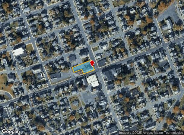
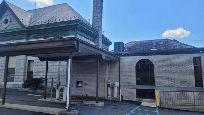
Property Record
1 N Robinson Ave, Pen Argyl, PA 18072
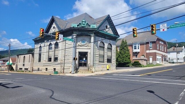
This Property Is For Sale
NEARBY LISTINGS FOR SALE OR LEASE
Property Detail
1 N Robinson Ave
Financialbuilding
Northampton
X
Pennsylvania
42095C0132E
0.37 AC
2025
Lehigh Valley
2025
Philadelphia
015600
Allentown-Bethlehem-Easton, PA-NJ
6,466 SF
E8NE2A-34-1-0625
DEMOGRAPHICS near 1 N Robinson Ave
1 Mile
3 Mile
5 Mile
2024 Total Population
4,524
18,739
29,123
2029 Population
4,569
18,925
29,314
Pop Growth 2024-2029
+ 0.99%
+ 0.99%
+ 0.66%
Average Age
41
42
43
2024 Total Households
1,792
7,644
11,628
HH Growth 2024-2029
+ 1.12%
+ 1.05%
+ 0.78%
Median Household Inc
$79,332
$65,679
$70,951
Avg Household Size
2.50
2.40
2.40
2024 Avg HH Vehicles
2.00
2.00
2.00
Median Home Value
$212,126
$214,105
$237,037
Median Year Built
1947
1952
1961
Nearby Places
- Restaurants
- Banks
- Shops
- Fitness
- Groceries
PUBLIC TRANSPORTATION
AIRPORT
Lehigh Valley International
DRIVE
WALK
Distance
Lehigh Valley International
38 min
24.5 mi
Nearby Properties
Address
Land Use
TOTAL SIZE
Lot Size
Zoning
Address
Land Use
TOTAL SIZE
Lot Size
Zoning
13,872 SF
23.48 AC
IE
Address
Land Use
TOTAL SIZE
Lot Size
Zoning
42,140 SF
33.11 AC
R10
Address
Land Use
TOTAL SIZE
Lot Size
Zoning
12,355 SF
2,230.15 AC
E
Address
Land Use
TOTAL SIZE
Lot Size
Zoning
104,971 SF
20.30 AC
A
Address
Land Use
TOTAL SIZE
Lot Size
Zoning
6,200 SF
345.07 AC
FF
Address
Land Use
TOTAL SIZE
Lot Size
Zoning
120,747 SF
22.45 AC
R12
Address
Land Use
TOTAL SIZE
Lot Size
Zoning
87,926 SF
20.76 AC
R2
Address
Land Use
TOTAL SIZE
Lot Size
Zoning
63,477 SF
16.68 AC
C
Address
Land Use
TOTAL SIZE
Lot Size
Zoning
73,531 SF
1.44 AC
GB
Address
Land Use
TOTAL SIZE
Lot Size
Zoning
7,704 SF
1.78 AC
R78
Address
Land Use
TOTAL SIZE
Lot Size
Zoning
34,781 SF
167.39 AC
FF
Address
Land Use
TOTAL SIZE
Lot Size
Zoning
3,440 SF
6.73 AC
IE
Address
Land Use
TOTAL SIZE
Lot Size
Zoning
43,744 SF
10.12 AC
C
Address
Land Use
TOTAL SIZE
Lot Size
Zoning
20,608 SF
4.77 AC
R10
Address
Land Use
TOTAL SIZE
Lot Size
Zoning
50,000 SF
5.17 AC
1C
Address
Land Use
TOTAL SIZE
Lot Size
Zoning
92,438 SF
19.14 AC
FF
Address
Land Use
TOTAL SIZE
Lot Size
Zoning
674.77 AC
E
Address
Land Use
TOTAL SIZE
Lot Size
Zoning
5,024 SF
5.31 AC
GC
Address
Land Use
TOTAL SIZE
Lot Size
Zoning
17,500 SF
2.90 AC
IL
Address
Land Use
TOTAL SIZE
Lot Size
Zoning
4,617 SF
34.94 AC
C-1
Address
Land Use
TOTAL SIZE
Lot Size
Zoning
28,688 SF
79.34 AC
GI
Address
Land Use
TOTAL SIZE
Lot Size
Zoning
18,424 SF
5.30 AC
IC
Address
Land Use
TOTAL SIZE
Lot Size
Zoning
72,160 SF
12 AC
R2
Address
Land Use
TOTAL SIZE
Lot Size
Zoning
72,160 SF
12 AC
R2
Address
Land Use
TOTAL SIZE
Lot Size
Zoning
20,339 SF
2.46 AC
R10
Address
Land Use
TOTAL SIZE
Lot Size
Zoning
280.40 AC
W
Address
Land Use
TOTAL SIZE
Lot Size
Zoning
15,777 SF
15.57 AC
IE
Address
Land Use
TOTAL SIZE
Lot Size
Zoning
118,318 SF
1.58 AC
IL
Address
Land Use
TOTAL SIZE
Lot Size
Zoning
24,000 SF
4.25 AC
C
Address
Land Use
TOTAL SIZE
Lot Size
Zoning
18,892 SF
3.23 AC
R1
The World's #1 Commercial Real Estate Marketplace
Connect with us
© 2025 CoStar Group
The information above has been obtained from sources believed reliable. While we do not doubt its accuracy we have not verified it and make no guarantee, warranty or representation about it. It is your responsibility to independently confirm its accuracy and completeness. Any projections, opinions, assumptions, or estimates used are for example only and do not represent the current or future performance of the property. The value of this transaction to you depends on tax and other factors which should be evaluated by your tax, financial, and legal advisors. You and your advisors should conduct a careful, independent investigation of the property to determine to your satisfaction the suitability of the property for your needs.