Property Record
1 Nablus Rd, Wakefield, MA 01880


Current Lease Availabilities
NEARBY LISTINGS FOR SALE OR LEASE
Property Detail
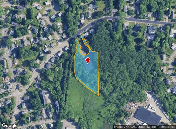
1 Nablus Rd
Warehouse
Middlesex
AE
Massachusetts
25009C0389G
2 AC
2025
Reading/Melrose
2025
Boston
335302
Boston-Cambridge-Newton, MA-NH
12,254 SF
WAKE-000029-000195-000001
DEMOGRAPHICS near 1 Nablus Rd
1 mile
3 mile
5 mile
2024 Total Population
11,397
77,322
200,845
2029 Population
11,168
76,495
199,271
Pop Growth 2024-2029
(2.01%)
(1.07%)
(0.78%)
Average Age
43
43
43
2024 Total Households
4,767
30,086
77,980
HH Growth 2024-2029
(2.18%)
(1.21%)
(0.87%)
Median Household Inc
$105,875
$124,011
$117,651
Avg Household Size
2.30
2.50
2.50
2024 Avg HH Vehicles
2.00
2.00
2.00
Median Home Value
$666,483
$713,770
$683,584
Median Year Built
1956
1959
1961
Nearby Places
Map Layers
Map Styles
 Street
 Aerial
Transit
 Traffic
 Biking
Places
Listings with unknown addresses are not visible on the map
- Restaurants
- Banks
- Shops
- Fitness
- Groceries
PUBLIC TRANSPORTATION
COMMUTER RAIL
Wakefield (Haverhill Line - Massachusetts Bay Transportation Authority Commuter Rail (Purple Line))
Drive
Walk
Distance
Wakefield (Haverhill Line - Massachusetts Bay Transportation Authority Commuter Rail (Purple Line))
3 min
1.2 mi
Greenwood (Haverhill Line - Massachusetts Bay Transportation Authority Commuter Rail (Purple Line))
Drive
Walk
Distance
Greenwood (Haverhill Line - Massachusetts Bay Transportation Authority Commuter Rail (Purple Line))
7 min
2.3 mi
AIRPORT
General Edward Lawrence Logan International
Drive
Walk
Distance
General Edward Lawrence Logan International
26 min
13.8 mi
Manchester Boston Regional
Drive
Walk
Distance
Manchester Boston Regional
62 min
43.1 mi
Freight Ports
Port of Boston
Drive
Walk
Distance
Port of Boston
28 min
15.3 mi
Nearby Properties
Address
Land Use
TOTAL SIZE
Lot Size
Zoning
Address
Land Use
TOTAL SIZE
Lot Size
Zoning
213,401 SF
15.16 AC
B
Address
Land Use
TOTAL SIZE
Lot Size
Zoning
720 SF
632 AC
SA8
Address
Land Use
TOTAL SIZE
Lot Size
Zoning
31.56 AC
HB
Address
Land Use
TOTAL SIZE
Lot Size
Zoning
267,277 SF
60 AC
MD
Address
Land Use
TOTAL SIZE
Lot Size
Zoning
215,057 SF
12 AC
RB
Address
Land Use
TOTAL SIZE
Lot Size
Zoning
217,937 SF
8.40 AC
I
Address
Land Use
TOTAL SIZE
Lot Size
Zoning
153,906 SF
4 AC
S15
Address
Land Use
TOTAL SIZE
Lot Size
Zoning
228,797 SF
10.61 AC
MD
Address
Land Use
TOTAL SIZE
Lot Size
Zoning
172,056 SF
I
Address
Land Use
TOTAL SIZE
Lot Size
Zoning
6.28 AC
RB
Address
Land Use
TOTAL SIZE
Lot Size
Zoning
9 AC
C/R
Address
Land Use
TOTAL SIZE
Lot Size
Zoning
14,760 SF
1 AC
SR
Address
Land Use
TOTAL SIZE
Lot Size
Zoning
155,686 SF
2.88 AC
I
Address
Land Use
TOTAL SIZE
Lot Size
Zoning
262,220 SF
11.79 AC
Address
Land Use
TOTAL SIZE
Lot Size
Zoning
254,374 SF
34.70 AC
I
Address
Land Use
TOTAL SIZE
Lot Size
Zoning
141,827 SF
8.10 AC
S15
Address
Land Use
TOTAL SIZE
Lot Size
Zoning
167,470 SF
8.50 AC
B
Address
Land Use
TOTAL SIZE
Lot Size
Zoning
156,846 SF
11.79 AC
Address
Land Use
TOTAL SIZE
Lot Size
Zoning
210,452 SF
16.20 AC
NA
Address
Land Use
TOTAL SIZE
Lot Size
Zoning
146,088 SF
8.93 AC
IND
Address
Land Use
TOTAL SIZE
Lot Size
Zoning
135,065 SF
1.58 AC
GR
Address
Land Use
TOTAL SIZE
Lot Size
Zoning
76,854 SF
0.97 AC
S15
Address
Land Use
TOTAL SIZE
Lot Size
Zoning
110,812 SF
32.87 AC
RA
Address
Land Use
TOTAL SIZE
Lot Size
Zoning
260,027 SF
20 AC
IND
Address
Land Use
TOTAL SIZE
Lot Size
Zoning
118,020 SF
3.18 AC
LI
Address
Land Use
TOTAL SIZE
Lot Size
Zoning
76,577 SF
8.56 AC
PUD
Address
Land Use
TOTAL SIZE
Lot Size
Zoning
160,000 SF
14.10 AC
I
Address
Land Use
TOTAL SIZE
Lot Size
Zoning
237,828 SF
12.53 AC
I
Address
Land Use
TOTAL SIZE
Lot Size
Zoning
162,138 SF
15.88 AC
NA
Address
Land Use
TOTAL SIZE
Lot Size
Zoning
219,065 SF
23.98 AC
B
The World's #1 Commercial Real Estate Marketplace
Connect with us
© 2026 CoStar Group
The information above has been obtained from sources believed reliable. While we do not doubt its accuracy we have not verified it and make no guarantee, warranty or representation about it. It is your responsibility to independently confirm its accuracy and completeness. Any projections, opinions, assumptions, or estimates used are for example only and do not represent the current or future performance of the property. The value of this transaction to you depends on tax and other factors which should be evaluated by your tax, financial, and legal advisors. You and your advisors should conduct a careful, independent investigation of the property to determine to your satisfaction the suitability of the property for your needs.