Property Record
1 Northrop Pl, Perry, GA 31069

Property Detail
1 Northrop Pl
Warner Robins, GA
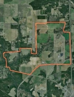
PART OF TRACT G-2 \ 157.99 AC +\- LL23 LD1
048-007-A
PEACH
Publicstorage
Georgia
R-AG
pg2+c
2025
157.99 AC
2025
Perry/Warner Robins
021300
Other Market Areas
7,686 SF
NEARBY LISTINGS FOR SALE OR LEASE
DEMOGRAPHICS near 1 Northrop Pl
1 mile
3 mile
5 mile
2025 Total Population
155
5,632
31,936
2030 Population
161
5,977
33,783
Pop Growth 2025-2030
+ 3.87%
+ 6.13%
+ 5.78%
Average Age
42
41
39
2025 Total Households
60
2,294
11,833
HH Growth 2025-2030
+ 3.33%
+ 6.28%
+ 5.95%
Median Household Inc
$94,444
$81,264
$90,937
Avg Household Size
2.50
2.40
2.60
2025 Avg HH Vehicles
2.00
2.00
2.00
Median Home Value
$265,384
$247,670
$267,888
Median Year Built
1996
2001
2001
Nearby Places
Map Layers
Map Styles
 Street
 Aerial
Layers
 Traffic
 Biking
Places
Listings with unknown addresses are not visible on the map
- Restaurants
- Banks
- Shops
- Fitness
- Groceries
Nearby Properties
Address
Land Use
TOTAL SIZE
Lot Size
Zoning
Address
Land Use
TOTAL SIZE
Lot Size
Zoning
106,055 SF
22.72 AC
GU
Address
Land Use
TOTAL SIZE
Lot Size
Zoning
Address
Land Use
TOTAL SIZE
Lot Size
Zoning
158,407 SF
218.84 AC
M2
Address
Land Use
TOTAL SIZE
Lot Size
Zoning
120,000 SF
20 AC
M1
Address
Land Use
TOTAL SIZE
Lot Size
Zoning
54,262 SF
38.29 AC
M1
Address
Land Use
TOTAL SIZE
Lot Size
Zoning
151,845 SF
17.55 AC
C2
Address
Land Use
TOTAL SIZE
Lot Size
Zoning
439.32 AC
M2
Address
Land Use
TOTAL SIZE
Lot Size
Zoning
2,568 SF
10.30 AC
RM-2
Address
Land Use
TOTAL SIZE
Lot Size
Zoning
439.32 AC
M2
Address
Land Use
TOTAL SIZE
Lot Size
Zoning
158,300 SF
30 AC
GU
Address
Land Use
TOTAL SIZE
Lot Size
Zoning
91,249 SF
15.85 AC
GU
Address
Land Use
TOTAL SIZE
Lot Size
Zoning
442.42 AC
M2
Address
Land Use
TOTAL SIZE
Lot Size
Zoning
52,336 SF
3.07 AC
C1
Address
Land Use
TOTAL SIZE
Lot Size
Zoning
78,800 SF
7.93 AC
C2
Address
Land Use
TOTAL SIZE
Lot Size
Zoning
41,985 SF
1.65 AC
C1/C2
Address
Land Use
TOTAL SIZE
Lot Size
Zoning
51,780 SF
2.50 AC
C1
Address
Land Use
TOTAL SIZE
Lot Size
Zoning
68,762 SF
2 AC
C2
Address
Land Use
TOTAL SIZE
Lot Size
Zoning
4,052 SF
15.17 AC
RM-2
Address
Land Use
TOTAL SIZE
Lot Size
Zoning
218.84 AC
M2
Address
Land Use
TOTAL SIZE
Lot Size
Zoning
13,888 SF
2.90 AC
C1
Address
Land Use
TOTAL SIZE
Lot Size
Zoning
38,475 SF
16.77 AC
C1
Address
Land Use
TOTAL SIZE
Lot Size
Zoning
533 SF
7.27 AC
RM-2
Address
Land Use
TOTAL SIZE
Lot Size
Zoning
124.57 AC
M2
Address
Land Use
TOTAL SIZE
Lot Size
Zoning
4,800 SF
101.24 AC
RAG
Address
Land Use
TOTAL SIZE
Lot Size
Zoning
120,000 SF
20 AC
M1
Address
Land Use
TOTAL SIZE
Lot Size
Zoning
56,400 SF
2.16 AC
C2
Address
Land Use
TOTAL SIZE
Lot Size
Zoning
2,676 SF
9.65 AC
C2 R1
Address
Land Use
TOTAL SIZE
Lot Size
Zoning
13,792 SF
10 AC
C1
Address
Land Use
TOTAL SIZE
Lot Size
Zoning
69,369 SF
3.82 AC
C2
Address
Land Use
TOTAL SIZE
Lot Size
Zoning
32,110 SF
4.27 AC
C2
The World's #1 Commercial Real Estate Marketplace
Connect with us
© 2026 CoStar Group
The information above has been obtained from sources believed reliable. While we do not doubt its accuracy we have not verified it and make no guarantee, warranty or representation about it. It is your responsibility to independently confirm its accuracy and completeness. Any projections, opinions, assumptions, or estimates used are for example only and do not represent the current or future performance of the property. The value of this transaction to you depends on tax and other factors which should be evaluated by your tax, financial, and legal advisors. You and your advisors should conduct a careful, independent investigation of the property to determine to your satisfaction the suitability of the property for your needs.