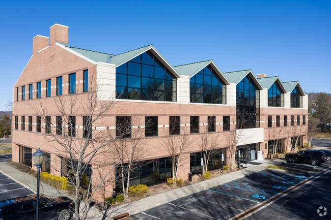
Property Record
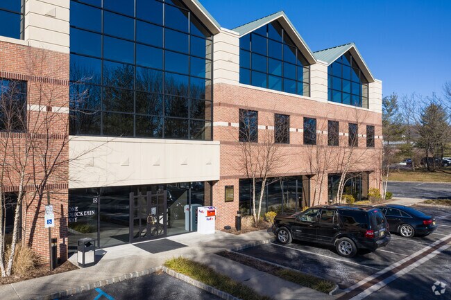
1 Pluckemin Way, Bedminster, NJ 07921

Current Lease Availabilities
NEARBY LISTINGS FOR SALE OR LEASE
Property Detail
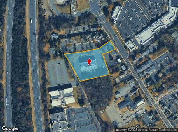
1 Pluckemin Way
Lakewood-New Brunswick, NJ
Prism Realty Investors
01-00057-0000-00007
ADDITIONAL LOTS: L5
Vacantlandnec
Somerset
X
New Jersey
34035C0044E
7
2024
2.47 AC
2025
Route 78 East
052906
Northern New Jersey
DEMOGRAPHICS near 1 Pluckemin Way
1 Mile
3 Mile
5 Mile
2024 Total Population
5,620
22,890
60,660
2029 Population
5,635
22,790
60,644
Pop Growth 2024-2029
+ 0.27%
(0.44%)
(0.03%)
Average Age
47
44
43
2024 Total Households
3,153
9,152
22,664
HH Growth 2024-2029
+ 0.22%
(0.44%)
(0.10%)
Median Household Inc
$121,627
$155,711
$155,387
Avg Household Size
1.80
2.50
2.60
2024 Avg HH Vehicles
2.00
2.00
2.00
Median Home Value
$370,025
$592,430
$610,525
Median Year Built
1985
1986
1985
Nearby Places
Map Layers
Map Styles
 Street
 Aerial
- Restaurants
- Banks
- Shops
- Fitness
- Groceries
PUBLIC TRANSPORTATION
COMMUTER RAIL
Far Hills (Morris & Essex Gladstone Branch - NJ Transit Commuter Rail (NJ Transit))
DRIVE
WALK
Distance
Far Hills (Morris & Essex Gladstone Branch - NJ Transit Commuter Rail (NJ Transit))
6 min
3.1 mi
Peapack (Morris & Essex Gladstone Branch - NJ Transit Commuter Rail (NJ Transit))
DRIVE
WALK
Distance
Peapack (Morris & Essex Gladstone Branch - NJ Transit Commuter Rail (NJ Transit))
9 min
4.6 mi
AIRPORT
Newark Liberty International
DRIVE
WALK
Distance
Newark Liberty International
39 min
32.0 mi
Trenton Mercer
DRIVE
WALK
Distance
Trenton Mercer
60 min
33.4 mi
Freight Ports
Maher Terminal
DRIVE
WALK
Distance
Maher Terminal
43 min
32.6 mi
Nearby Properties
Address
Land Use
TOTAL SIZE
Lot Size
Zoning
Address
Land Use
TOTAL SIZE
Lot Size
Zoning
Address
Land Use
TOTAL SIZE
Lot Size
Zoning
196.68 AC
OR
Address
Land Use
TOTAL SIZE
Lot Size
Zoning
2.82 AC
SED
Address
Land Use
TOTAL SIZE
Lot Size
Zoning
23.08 AC
OR
Address
Land Use
TOTAL SIZE
Lot Size
Zoning
12.74 AC
PUD
Address
Land Use
TOTAL SIZE
Lot Size
Zoning
13.94 AC
PUD
Address
Land Use
TOTAL SIZE
Lot Size
Zoning
146.60 AC
SED
Address
Land Use
TOTAL SIZE
Lot Size
Zoning
1.21 AC
SED
Address
Land Use
TOTAL SIZE
Lot Size
Zoning
243.82 AC
R10
Address
Land Use
TOTAL SIZE
Lot Size
Zoning
2,848 SF
22.47 AC
ORVM
Address
Land Use
TOTAL SIZE
Lot Size
Zoning
10.06 AC
R40
Address
Land Use
TOTAL SIZE
Lot Size
Zoning
17.63 AC
OR
Address
Land Use
TOTAL SIZE
Lot Size
Zoning
Address
Land Use
TOTAL SIZE
Lot Size
Zoning
30.52 AC
R50
Address
Land Use
TOTAL SIZE
Lot Size
Zoning
2,726 SF
10.01 AC
VN
Address
Land Use
TOTAL SIZE
Lot Size
Zoning
12.94 AC
SED
Address
Land Use
TOTAL SIZE
Lot Size
Zoning
49,786 SF
13.84 AC
VN2
Address
Land Use
TOTAL SIZE
Lot Size
Zoning
12 AC
P3
Address
Land Use
TOTAL SIZE
Lot Size
Zoning
22.33 AC
R40
Address
Land Use
TOTAL SIZE
Lot Size
Zoning
31.95 AC
R3
Address
Land Use
TOTAL SIZE
Lot Size
Zoning
28.41 AC
E2
Address
Land Use
TOTAL SIZE
Lot Size
Zoning
10,266 SF
3 AC
R10
Address
Land Use
TOTAL SIZE
Lot Size
Zoning
3.90 AC
PUD
Address
Land Use
TOTAL SIZE
Lot Size
Zoning
19.40 AC
R50
Address
Land Use
TOTAL SIZE
Lot Size
Zoning
5,398 SF
4.90 AC
VN
Address
Land Use
TOTAL SIZE
Lot Size
Zoning
60,506 SF
10.44 AC
PUD5
Address
Land Use
TOTAL SIZE
Lot Size
Zoning
13.77 AC
MH-1
Address
Land Use
TOTAL SIZE
Lot Size
Zoning
17.96 AC
R50
Address
Land Use
TOTAL SIZE
Lot Size
Zoning
3.88 AC
VN
Address
Land Use
TOTAL SIZE
Lot Size
Zoning
5,052 SF
266.92 AC
PUD5
The World's #1 Commercial Real Estate Marketplace
Connect with us
© 2026 CoStar Group
The information above has been obtained from sources believed reliable. While we do not doubt its accuracy we have not verified it and make no guarantee, warranty or representation about it. It is your responsibility to independently confirm its accuracy and completeness. Any projections, opinions, assumptions, or estimates used are for example only and do not represent the current or future performance of the property. The value of this transaction to you depends on tax and other factors which should be evaluated by your tax, financial, and legal advisors. You and your advisors should conduct a careful, independent investigation of the property to determine to your satisfaction the suitability of the property for your needs.