Property Record
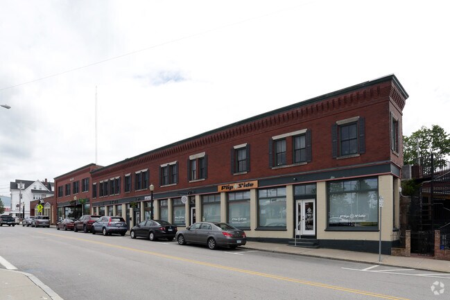
1 Railroad Ave, West Kingston, RI 02892


NEARBY LISTINGS FOR SALE OR LEASE
Property Detail
1 Railroad Ave
SKIN-001003-000000-000015
Washington
Taxexempt
Rhode Island
AE
15
44009C0185J
59.04 AC
0
Washington County
2025
Providence
051306
Providence-Warwick, RI-MA
2,850 SF
DEMOGRAPHICS near 1 Railroad Ave
1 Mile
3 Mile
5 Mile
2024 Total Population
9,227
22,811
37,598
2029 Population
8,970
22,479
37,620
Pop Growth 2024-2029
(2.79%)
(1.46%)
+ 0.06%
Average Age
42
44
46
2024 Total Households
4,208
10,044
16,423
HH Growth 2024-2029
(3.07%)
(1.71%)
+ 0.05%
Median Household Inc
$63,529
$77,926
$87,525
Avg Household Size
2.10
2.20
2.20
2024 Avg HH Vehicles
2.00
2.00
2.00
Median Home Value
$317,319
$357,077
$381,488
Median Year Built
1953
1968
1969
Nearby Places
Map Layers
Map Styles
 Street
 Aerial
- Restaurants
- Banks
- Shops
- Fitness
- Groceries
PUBLIC TRANSPORTATION
COMMUTER RAIL
Kingston Amtrak Station (Northeast Regional - Amtrak)
DRIVE
WALK
Distance
Kingston Amtrak Station (Northeast Regional - Amtrak)
3 min
19 min
1.0 mi
Wickford Junction (Providence/Stoughton Line - MBTA)
DRIVE
WALK
Distance
Wickford Junction (Providence/Stoughton Line - MBTA)
16 min
9.1 mi
AIRPORT
Rhode Island Tf Green International
DRIVE
WALK
Distance
Rhode Island Tf Green International
38 min
22.4 mi
Freight Ports
Port of Davisville, RI
DRIVE
WALK
Distance
Port of Davisville, RI
30 min
15.4 mi
Nearby Properties
Address
Land Use
TOTAL SIZE
Lot Size
Zoning
Address
Land Use
TOTAL SIZE
Lot Size
Zoning
8.03 AC
GI
Address
Land Use
TOTAL SIZE
Lot Size
Zoning
16.50 AC
GI
Address
Land Use
TOTAL SIZE
Lot Size
Zoning
50.78 AC
GI
Address
Land Use
TOTAL SIZE
Lot Size
Zoning
25.32 AC
GI
Address
Land Use
TOTAL SIZE
Lot Size
Zoning
74,782 SF
6.16 AC
MU
Address
Land Use
TOTAL SIZE
Lot Size
Zoning
340.80 AC
GI
Address
Land Use
TOTAL SIZE
Lot Size
Zoning
6.22 AC
RM
Address
Land Use
TOTAL SIZE
Lot Size
Zoning
4.81 AC
GI
Address
Land Use
TOTAL SIZE
Lot Size
Zoning
6.09 AC
GI
Address
Land Use
TOTAL SIZE
Lot Size
Zoning
4.45 AC
GI
Address
Land Use
TOTAL SIZE
Lot Size
Zoning
57,663 SF
1.45 AC
GI
Address
Land Use
TOTAL SIZE
Lot Size
Zoning
10.03 AC
GI
Address
Land Use
TOTAL SIZE
Lot Size
Zoning
86,735 SF
25 AC
RM
Address
Land Use
TOTAL SIZE
Lot Size
Zoning
4.40 AC
CN
Address
Land Use
TOTAL SIZE
Lot Size
Zoning
115.90 AC
OS
Address
Land Use
TOTAL SIZE
Lot Size
Zoning
282,537 SF
20.22 AC
IND1
Address
Land Use
TOTAL SIZE
Lot Size
Zoning
10.52 AC
GI
Address
Land Use
TOTAL SIZE
Lot Size
Zoning
33,614 SF
4.69 AC
R80
Address
Land Use
TOTAL SIZE
Lot Size
Zoning
7.45 AC
RM
Address
Land Use
TOTAL SIZE
Lot Size
Zoning
24,089 SF
5 AC
R40
Address
Land Use
TOTAL SIZE
Lot Size
Zoning
178.20 AC
OS
Address
Land Use
TOTAL SIZE
Lot Size
Zoning
26,766 SF
11.52 AC
B
Address
Land Use
TOTAL SIZE
Lot Size
Zoning
5 AC
R40
Address
Land Use
TOTAL SIZE
Lot Size
Zoning
88,416 SF
11.70 AC
IND1
Address
Land Use
TOTAL SIZE
Lot Size
Zoning
123 AC
GI
Address
Land Use
TOTAL SIZE
Lot Size
Zoning
57,570 SF
6.94 AC
B
Address
Land Use
TOTAL SIZE
Lot Size
Zoning
5,040 SF
5.02 AC
RU-4
Address
Land Use
TOTAL SIZE
Lot Size
Zoning
27,703 SF
12.78 AC
GI
Address
Land Use
TOTAL SIZE
Lot Size
Zoning
86.55 AC
GI
Address
Land Use
TOTAL SIZE
Lot Size
Zoning
3.13 AC
RA
The World's #1 Commercial Real Estate Marketplace
Connect with us
© 2026 CoStar Group
The information above has been obtained from sources believed reliable. While we do not doubt its accuracy we have not verified it and make no guarantee, warranty or representation about it. It is your responsibility to independently confirm its accuracy and completeness. Any projections, opinions, assumptions, or estimates used are for example only and do not represent the current or future performance of the property. The value of this transaction to you depends on tax and other factors which should be evaluated by your tax, financial, and legal advisors. You and your advisors should conduct a careful, independent investigation of the property to determine to your satisfaction the suitability of the property for your needs.