Property Record
1 Re Michel Dr, Glen Burnie, MD 21060


NEARBY LISTINGS FOR SALE OR LEASE
Property Detail
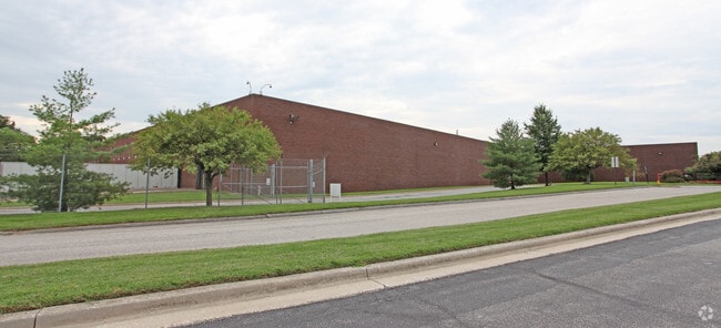
1 Re Michel Dr
Baltimore-Columbia-Towson, MD
Baymeadow
05-032-90050740
LT 22 OR 17.4196 ACS BAYMEADOW
Warehouse
Anne Arundel
AE
Maryland
24003C0062F
22
2024
17.41 AC
2025
Route 2 Corridor
751102
Baltimore
371,145 SF
DEMOGRAPHICS near 1 Re Michel Dr
1 Mile
3 Mile
5 Mile
2024 Total Population
2,548
68,689
191,154
2029 Population
2,602
70,132
193,900
Pop Growth 2024-2029
+ 2.12%
+ 2.10%
+ 1.44%
Average Age
43
39
38
2024 Total Households
955
25,477
71,494
HH Growth 2024-2029
+ 2.09%
+ 2.11%
+ 1.49%
Median Household Inc
$71,733
$83,983
$80,454
Avg Household Size
2.60
2.60
2.60
2024 Avg HH Vehicles
2.00
2.00
2.00
Median Home Value
$313,095
$298,199
$309,022
Median Year Built
1969
1968
1971
Nearby Places
Map Layers
Map Styles
 Street
 Aerial
- Restaurants
- Banks
- Shops
- Fitness
- Groceries
PUBLIC TRANSPORTATION
COMMUTER RAIL
Bwi Airport (Penn Line - Maryland Area Regional Commuter Trains (The MARC))
DRIVE
WALK
Distance
Bwi Airport (Penn Line - Maryland Area Regional Commuter Trains (The MARC))
19 min
7.8 mi
Halethorpe Marc Nb (PENN - WASHINGTON - Maryland Transit Administration)
DRIVE
WALK
Distance
Halethorpe Marc Nb (PENN - WASHINGTON - Maryland Transit Administration)
19 min
9.4 mi
AIRPORT
Baltimore/Washington International Thurgood Marshall
DRIVE
WALK
Distance
Baltimore/Washington International Thurgood Marshall
18 min
7.4 mi
Freight Ports
Port of Baltimore
DRIVE
WALK
Distance
Port of Baltimore
20 min
8.2 mi
Nearby Properties
Address
Land Use
TOTAL SIZE
Lot Size
Zoning
Address
Land Use
TOTAL SIZE
Lot Size
Zoning
1,186,080 SF
456.52 AC
W3
Address
Land Use
TOTAL SIZE
Lot Size
Zoning
467.03 AC
W2
Address
Land Use
TOTAL SIZE
Lot Size
Zoning
383,697 SF
68.35 AC
R5
Address
Land Use
TOTAL SIZE
Lot Size
Zoning
289,829 SF
24.56 AC
C3
Address
Land Use
TOTAL SIZE
Lot Size
Zoning
512,900 SF
51.15 AC
W1
Address
Land Use
TOTAL SIZE
Lot Size
Zoning
19.20 AC
R15
Address
Land Use
TOTAL SIZE
Lot Size
Zoning
252,911 SF
8.32 AC
R10
Address
Land Use
TOTAL SIZE
Lot Size
Zoning
12.90 AC
R15
Address
Land Use
TOTAL SIZE
Lot Size
Zoning
233,408 SF
24.73 AC
C3
Address
Land Use
TOTAL SIZE
Lot Size
Zoning
263,024 SF
6.87 AC
C3
Address
Land Use
TOTAL SIZE
Lot Size
Zoning
111.20 AC
W3
Address
Land Use
TOTAL SIZE
Lot Size
Zoning
16.26 AC
R15
Address
Land Use
TOTAL SIZE
Lot Size
Zoning
340,000 SF
35 AC
W1
Address
Land Use
TOTAL SIZE
Lot Size
Zoning
239,476 SF
19.02 AC
MI
Address
Land Use
TOTAL SIZE
Lot Size
Zoning
12 AC
C3
Address
Land Use
TOTAL SIZE
Lot Size
Zoning
291,600 SF
14.52 AC
W2
Address
Land Use
TOTAL SIZE
Lot Size
Zoning
304,404 SF
16.74 AC
W3
Address
Land Use
TOTAL SIZE
Lot Size
Zoning
119,220 SF
6.99 AC
W1
Address
Land Use
TOTAL SIZE
Lot Size
Zoning
345,088 SF
28.26 AC
W2
Address
Land Use
TOTAL SIZE
Lot Size
Zoning
351,620 SF
15.68 AC
W2
Address
Land Use
TOTAL SIZE
Lot Size
Zoning
10.92 AC
R15
Address
Land Use
TOTAL SIZE
Lot Size
Zoning
227,704 SF
23.52 AC
C4
Address
Land Use
TOTAL SIZE
Lot Size
Zoning
8.78 AC
R15
Address
Land Use
TOTAL SIZE
Lot Size
Zoning
28,188 SF
6.51 AC
C3
Address
Land Use
TOTAL SIZE
Lot Size
Zoning
209,044 SF
17.28 AC
C3
Address
Land Use
TOTAL SIZE
Lot Size
Zoning
674,828 SF
167.04 AC
W3
Address
Land Use
TOTAL SIZE
Lot Size
Zoning
344,254 SF
20.82 AC
W3
Address
Land Use
TOTAL SIZE
Lot Size
Zoning
155,608 SF
18.68 AC
C3
Address
Land Use
TOTAL SIZE
Lot Size
Zoning
482,600 SF
26.50 AC
I-2
Address
Land Use
TOTAL SIZE
Lot Size
Zoning
377,524 SF
31.04 AC
C3
The World's #1 Commercial Real Estate Marketplace
Connect with us
© 2026 CoStar Group
The information above has been obtained from sources believed reliable. While we do not doubt its accuracy we have not verified it and make no guarantee, warranty or representation about it. It is your responsibility to independently confirm its accuracy and completeness. Any projections, opinions, assumptions, or estimates used are for example only and do not represent the current or future performance of the property. The value of this transaction to you depends on tax and other factors which should be evaluated by your tax, financial, and legal advisors. You and your advisors should conduct a careful, independent investigation of the property to determine to your satisfaction the suitability of the property for your needs.