Property Record
1 Reynolds Dr, Beloit, WI 53511
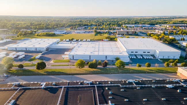

Property Detail
1 Reynolds Dr
Janesville-Beloit, WI
BEGINNING AT THE NW CORNER OF L 1, (NOW VACATED), BELOIT INDUSTRIAL PARK I-90, TH NE 900 FT, TH SE 35 FT, TH NE 600 FT, TH SE
229-70100
ROCK
Commercialnec
Wisconsin
B and X Area of moderate flood hazard, usually the area between the limits of the 100-year and 500-year floods.
24.76 AC
2025
Rock County
2025
Milwaukee/Madison
002602
NEARBY LISTINGS FOR SALE OR LEASE
DEMOGRAPHICS near 1 Reynolds Dr
1 mile
3 mile
5 mile
2025 Total Population
2,107
27,856
59,742
2030 Population
2,158
28,186
60,379
Pop Growth 2025-2030
+ 2.42%
+ 1.18%
+ 1.07%
Average Age
42
39
40
2025 Total Households
903
10,794
23,275
HH Growth 2025-2030
+ 2.44%
+ 1.25%
+ 1.08%
Median Household Inc
$83,670
$65,545
$67,862
Avg Household Size
2.30
2.40
2.40
2025 Avg HH Vehicles
2.00
2.00
2.00
Median Home Value
$284,828
$209,053
$186,119
Median Year Built
1979
1965
1965
Nearby Places
Map Layers
Map Styles
 Street
 Aerial
Layers
 Traffic
 Biking
Places
Listings with unknown addresses are not visible on the map
- Restaurants
- Banks
- Shops
- Fitness
- Groceries
PUBLIC TRANSPORTATION
AIRPORT
Chicago/Rockford International
Drive
Walk
Distance
Chicago/Rockford International
44 min
32.8 mi
Freight Ports
Port Milwaukee
Drive
Walk
Distance
Port Milwaukee
85 min
72.0 mi
SALE & LEASE HISTORY
LISTING DATE
SALE/LEASE

Sep 26, 2017
For Lease
Sep 25, 2016
For Lease
Sep 23, 2016
For Sale
Sep 12, 2017
For Lease
Sep 10, 2019
For Lease
May 14, 2018
For Lease
Nearby Properties
Address
Land Use
TOTAL SIZE
Lot Size
Zoning
Address
Land Use
TOTAL SIZE
Lot Size
Zoning
700,000 SF
80.08 AC
Address
Land Use
TOTAL SIZE
Lot Size
Zoning
264,000 SF
34 AC
Address
Land Use
TOTAL SIZE
Lot Size
Zoning
37.49 AC
CHI
Address
Land Use
TOTAL SIZE
Lot Size
Zoning
8.01 AC
Address
Land Use
TOTAL SIZE
Lot Size
Zoning
39.83 AC
Address
Land Use
TOTAL SIZE
Lot Size
Zoning
36,860 SF
11.26 AC
Address
Land Use
TOTAL SIZE
Lot Size
Zoning
202,676 SF
19.31 AC
Address
Land Use
TOTAL SIZE
Lot Size
Zoning
61,820 SF
5.63 AC
Address
Land Use
TOTAL SIZE
Lot Size
Zoning
103,761 SF
21.59 AC
Address
Land Use
TOTAL SIZE
Lot Size
Zoning
55.03 AC
Address
Land Use
TOTAL SIZE
Lot Size
Zoning
7.71 AC
Address
Land Use
TOTAL SIZE
Lot Size
Zoning
400,014 SF
43.71 AC
Address
Land Use
TOTAL SIZE
Lot Size
Zoning
32.08 AC
Address
Land Use
TOTAL SIZE
Lot Size
Zoning
3.39 AC
Address
Land Use
TOTAL SIZE
Lot Size
Zoning
3.47 AC
Address
Land Use
TOTAL SIZE
Lot Size
Zoning
141,745 SF
12.20 AC
Address
Land Use
TOTAL SIZE
Lot Size
Zoning
100,000 SF
14.54 AC
Address
Land Use
TOTAL SIZE
Lot Size
Zoning
233,850 SF
30.40 AC
Address
Land Use
TOTAL SIZE
Lot Size
Zoning
3.65 AC
Address
Land Use
TOTAL SIZE
Lot Size
Zoning
20.83 AC
Address
Land Use
TOTAL SIZE
Lot Size
Zoning
13.21 AC
Address
Land Use
TOTAL SIZE
Lot Size
Zoning
2,728 SF
10 AC
Address
Land Use
TOTAL SIZE
Lot Size
Zoning
231,166 SF
19.25 AC
Address
Land Use
TOTAL SIZE
Lot Size
Zoning
361,947 SF
23.26 AC
Address
Land Use
TOTAL SIZE
Lot Size
Zoning
24.15 AC
Address
Land Use
TOTAL SIZE
Lot Size
Zoning
193,013 SF
22.93 AC
Address
Land Use
TOTAL SIZE
Lot Size
Zoning
38,012 SF
2.74 AC
Address
Land Use
TOTAL SIZE
Lot Size
Zoning
40,800 SF
81.29 AC
Address
Land Use
TOTAL SIZE
Lot Size
Zoning
22.90 AC
The World's #1 Commercial Real Estate Marketplace
Connect with us
© 2026 CoStar Group
The information above has been obtained from sources believed reliable. While we do not doubt its accuracy we have not verified it and make no guarantee, warranty or representation about it. It is your responsibility to independently confirm its accuracy and completeness. Any projections, opinions, assumptions, or estimates used are for example only and do not represent the current or future performance of the property. The value of this transaction to you depends on tax and other factors which should be evaluated by your tax, financial, and legal advisors. You and your advisors should conduct a careful, independent investigation of the property to determine to your satisfaction the suitability of the property for your needs.