Property Record
1 River Rd, Schenectady, NY 12345
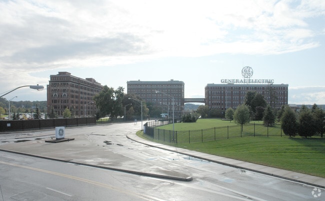

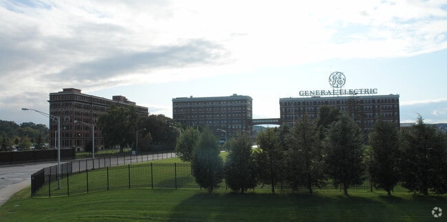
Property Detail
1 River Rd
049-029-0001-001-000-0000
Schenectady
Manufacturinglight
New York
06 - INDUS
1.000
AE The base floodplain where base flood elevations are provided. AE Zones are now used on new format FIRMs instead of A1-A30 Zones.
315.80 AC
0
Greater Schenectady
2025
Albany/Schenectady/Troy
033500
Albany-Schenectady-Troy, NY
194,403 SF
NEARBY LISTINGS FOR SALE OR LEASE
DEMOGRAPHICS near 1 River Rd
1 mile
3 mile
5 mile
2025 Total Population
8,505
95,399
145,781
2030 Population
8,791
96,817
148,070
Pop Growth 2025-2030
+ 3.36%
+ 1.49%
+ 1.57%
Average Age
40
39
40
2025 Total Households
3,871
38,990
59,670
HH Growth 2025-2030
+ 3.41%
+ 1.67%
+ 1.70%
Median Household Inc
$50,170
$60,619
$72,938
Avg Household Size
2.00
2.30
2.30
2025 Avg HH Vehicles
1.00
1.00
2.00
Median Home Value
$164,621
$194,460
$237,638
Median Year Built
1947
1948
1954
Nearby Places
Map Layers
Map Styles
 Street
 Aerial
Layers
 Traffic
 Biking
Places
Listings with unknown addresses are not visible on the map
- Restaurants
- Banks
- Shops
- Fitness
- Groceries
PUBLIC TRANSPORTATION
AIRPORT
Albany International
Drive
Walk
Distance
Albany International
16 min
7.8 mi
Freight Ports
Albany, NY Port
Drive
Walk
Distance
Albany, NY Port
34 min
21.4 mi
Nearby Properties
Address
Land Use
TOTAL SIZE
Lot Size
Zoning
Address
Land Use
TOTAL SIZE
Lot Size
Zoning
174.70 AC
Address
Land Use
TOTAL SIZE
Lot Size
Zoning
338.40 AC
Address
Land Use
TOTAL SIZE
Lot Size
Zoning
583,211 SF
9.95 AC
03 - MULTI
Address
Land Use
TOTAL SIZE
Lot Size
Zoning
155,023 SF
18.81 AC
06 - INDUS
Address
Land Use
TOTAL SIZE
Lot Size
Zoning
6,733 SF
100 AC
03 - MULTI
Address
Land Use
TOTAL SIZE
Lot Size
Zoning
600 SF
28.40 AC
06 - INDUS
Address
Land Use
TOTAL SIZE
Lot Size
Zoning
184,878 SF
15.58 AC
03 - MULTI
Address
Land Use
TOTAL SIZE
Lot Size
Zoning
246,000 SF
9.85 AC
Address
Land Use
TOTAL SIZE
Lot Size
Zoning
123,030 SF
7.21 AC
03 - MULTI
Address
Land Use
TOTAL SIZE
Lot Size
Zoning
249,801 SF
54.35 AC
R1
Address
Land Use
TOTAL SIZE
Lot Size
Zoning
306,803 SF
3.20 AC
Address
Land Use
TOTAL SIZE
Lot Size
Zoning
234,485 SF
42.50 AC
02 - SINGL
Address
Land Use
TOTAL SIZE
Lot Size
Zoning
32,385 SF
5.02 AC
Address
Land Use
TOTAL SIZE
Lot Size
Zoning
21,912 SF
26.44 AC
07 - MIXED
Address
Land Use
TOTAL SIZE
Lot Size
Zoning
19,080 SF
601.14 AC
CON
Address
Land Use
TOTAL SIZE
Lot Size
Zoning
12,528 SF
20.66 AC
R2
Address
Land Use
TOTAL SIZE
Lot Size
Zoning
60,274 SF
12.95 AC
OT
Address
Land Use
TOTAL SIZE
Lot Size
Zoning
23,923 SF
109.83 AC
CON
Address
Land Use
TOTAL SIZE
Lot Size
Zoning
194.77 AC
Address
Land Use
TOTAL SIZE
Lot Size
Zoning
117,849 SF
5.76 AC
05 - COMME
Address
Land Use
TOTAL SIZE
Lot Size
Zoning
67,526 SF
9.40 AC
R1
Address
Land Use
TOTAL SIZE
Lot Size
Zoning
32,626 SF
81.39 AC
IR
Address
Land Use
TOTAL SIZE
Lot Size
Zoning
34,807 SF
15.91 AC
R2
Address
Land Use
TOTAL SIZE
Lot Size
Zoning
117,074 SF
25.30 AC
CN
Address
Land Use
TOTAL SIZE
Lot Size
Zoning
93,846 SF
3 AC
R2
Address
Land Use
TOTAL SIZE
Lot Size
Zoning
70,487 SF
2.51 AC
Address
Land Use
TOTAL SIZE
Lot Size
Zoning
8,662 SF
4.97 AC
Address
Land Use
TOTAL SIZE
Lot Size
Zoning
45,896 SF
10.20 AC
03 - MULTI
Address
Land Use
TOTAL SIZE
Lot Size
Zoning
303 SF
29.20 AC
CN
The World's #1 Commercial Real Estate Marketplace
Connect with us
© 2026 CoStar Group
The information above has been obtained from sources believed reliable. While we do not doubt its accuracy we have not verified it and make no guarantee, warranty or representation about it. It is your responsibility to independently confirm its accuracy and completeness. Any projections, opinions, assumptions, or estimates used are for example only and do not represent the current or future performance of the property. The value of this transaction to you depends on tax and other factors which should be evaluated by your tax, financial, and legal advisors. You and your advisors should conduct a careful, independent investigation of the property to determine to your satisfaction the suitability of the property for your needs.