Property Record
1 Riverside Ave, Jacksonville, FL 32202


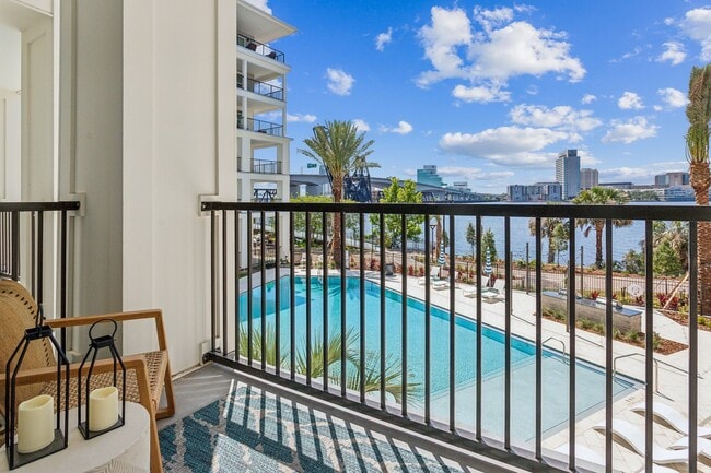
Property Detail
1 Riverside Ave
Jacksonville, FL
AJ-723 56-2S-26E 4.24 BROOKLYN PT LOTS B,C,D,UNNUMBERED STRIP 40FT WIDE SW OF BLK D, CLSD ALLEY. PT UNSURVEYED PORTION RECD O/R 20145-1082
088967-0500
DUVAL
Multifamilydwelling
Florida
CCBD
b,c
2025
4.24 AC
2026
Brooklyn
017102
Jacksonville (Florida)
216,810 SF
NEARBY LISTINGS FOR SALE OR LEASE
DEMOGRAPHICS near 1 Riverside Ave
1 mile
3 mile
5 mile
2025 Total Population
9,973
96,676
219,546
2030 Population
10,765
104,381
235,085
Pop Growth 2025-2030
+ 7.94%
+ 7.97%
+ 7.08%
Average Age
44
39
39
2025 Total Households
4,847
42,262
92,141
HH Growth 2025-2030
+ 9.61%
+ 8.46%
+ 7.47%
Median Household Inc
$47,320
$43,874
$48,166
Avg Household Size
1.50
2.10
2.20
2025 Avg HH Vehicles
1.00
1.00
1.00
Median Home Value
$409,756
$277,319
$247,255
Median Year Built
1990
1960
1960
Nearby Places
Map Layers
Map Styles
 Street
 Aerial
Layers
 Traffic
 Biking
Places
Listings with unknown addresses are not visible on the map
- Restaurants
- Banks
- Shops
- Fitness
- Groceries
PUBLIC TRANSPORTATION
TRANSIT/SUBWAY
Jefferson Street (Skyway - Jacksonville Transit Authority Skyway (The Skyway))
Drive
Walk
Distance
Jefferson Street (Skyway - Jacksonville Transit Authority Skyway (The Skyway))
4 min
9 min
0.5 mi
Central (Skyway - Jacksonville Transit Authority Skyway (The Skyway))
Drive
Walk
Distance
Central (Skyway - Jacksonville Transit Authority Skyway (The Skyway))
4 min
13 min
0.7 mi
Convention Center (Skyway - Jacksonville Transit Authority Skyway (The Skyway))
Drive
Walk
Distance
Convention Center (Skyway - Jacksonville Transit Authority Skyway (The Skyway))
5 min
15 min
0.8 mi
San Marco (Skyway - Jacksonville Transit Authority Skyway (The Skyway))
Drive
Walk
Distance
San Marco (Skyway - Jacksonville Transit Authority Skyway (The Skyway))
6 min
17 min
0.9 mi
Hemming Plaza (Skyway - Jacksonville Transit Authority Skyway (The Skyway))
Drive
Walk
Distance
Hemming Plaza (Skyway - Jacksonville Transit Authority Skyway (The Skyway))
5 min
19 min
1.0 mi
COMMUTER RAIL
Jacksonville (Silver Meteor - Amtrak, Silver Star - Amtrak)
Drive
Walk
Distance
Jacksonville (Silver Meteor - Amtrak, Silver Star - Amtrak)
15 min
8.9 mi
AIRPORT
Jacksonville International
Drive
Walk
Distance
Jacksonville International
27 min
17.4 mi
Freight Ports
Jacksonville Port
Drive
Walk
Distance
Jacksonville Port
13 min
6.1 mi
SALE & LEASE HISTORY
LISTING DATE
SALE/LEASE

Mar 30, 2022
For Lease
Nearby Properties
Address
Land Use
TOTAL SIZE
Lot Size
Zoning
Address
Land Use
TOTAL SIZE
Lot Size
Zoning
1,086,885 SF
16.34 AC
CCBD
Address
Land Use
TOTAL SIZE
Lot Size
Zoning
543,383 SF
7.87 AC
CCBD
Address
Land Use
TOTAL SIZE
Lot Size
Zoning
1,150,143 SF
43.90 AC
CCBD
Address
Land Use
TOTAL SIZE
Lot Size
Zoning
629,459 SF
10.33 AC
PUD
Address
Land Use
TOTAL SIZE
Lot Size
Zoning
705,940 SF
25.12 AC
PBF-1
Address
Land Use
TOTAL SIZE
Lot Size
Zoning
442,972 SF
5.33 AC
PUD
Address
Land Use
TOTAL SIZE
Lot Size
Zoning
165,408 SF
2.45 AC
CCBD
Address
Land Use
TOTAL SIZE
Lot Size
Zoning
407,122 SF
4.50 AC
CCBD
Address
Land Use
TOTAL SIZE
Lot Size
Zoning
521,850 SF
10.06 AC
CCBD
Address
Land Use
TOTAL SIZE
Lot Size
Zoning
831,560 SF
1.16 AC
PUD
Address
Land Use
TOTAL SIZE
Lot Size
Zoning
187,278 SF
1.71 AC
CCBD
Address
Land Use
TOTAL SIZE
Lot Size
Zoning
257,667 SF
3.91 AC
CCBD
Address
Land Use
TOTAL SIZE
Lot Size
Zoning
127,732 SF
1.44 AC
CCBD
Address
Land Use
TOTAL SIZE
Lot Size
Zoning
224,600 SF
3.41 AC
PUD
Address
Land Use
TOTAL SIZE
Lot Size
Zoning
313,472 SF
35.44 AC
CCBD
Address
Land Use
TOTAL SIZE
Lot Size
Zoning
355,967 SF
8.98 AC
PUD
Address
Land Use
TOTAL SIZE
Lot Size
Zoning
700,443 SF
8 AC
CCBD
Address
Land Use
TOTAL SIZE
Lot Size
Zoning
264,277 SF
2.07 AC
CCBD
Address
Land Use
TOTAL SIZE
Lot Size
Zoning
503,858 SF
1.32 AC
CCBD
Address
Land Use
TOTAL SIZE
Lot Size
Zoning
369,638 SF
6.30 AC
CCBD
Address
Land Use
TOTAL SIZE
Lot Size
Zoning
448,709 SF
2.97 AC
CCBD
Address
Land Use
TOTAL SIZE
Lot Size
Zoning
326,485 SF
1.56 AC
CCBD
Address
Land Use
TOTAL SIZE
Lot Size
Zoning
453,728 SF
8.20 AC
CCBD
Address
Land Use
TOTAL SIZE
Lot Size
Zoning
194,877 SF
11.64 AC
CCBD
Address
Land Use
TOTAL SIZE
Lot Size
Zoning
299,055 SF
18.93 AC
CCBD
Address
Land Use
TOTAL SIZE
Lot Size
Zoning
336,623 SF
2.06 AC
CCBD
Address
Land Use
TOTAL SIZE
Lot Size
Zoning
290,975 SF
4.49 AC
PUD
Address
Land Use
TOTAL SIZE
Lot Size
Zoning
253,858 SF
4.93 AC
PUD
Address
Land Use
TOTAL SIZE
Lot Size
Zoning
212,152 SF
8.17 AC
CCBD
Address
Land Use
TOTAL SIZE
Lot Size
Zoning
146,636 SF
2.88 AC
CCBD
The World's #1 Commercial Real Estate Marketplace
Connect with us
© 2026 CoStar Group
The information above has been obtained from sources believed reliable. While we do not doubt its accuracy we have not verified it and make no guarantee, warranty or representation about it. It is your responsibility to independently confirm its accuracy and completeness. Any projections, opinions, assumptions, or estimates used are for example only and do not represent the current or future performance of the property. The value of this transaction to you depends on tax and other factors which should be evaluated by your tax, financial, and legal advisors. You and your advisors should conduct a careful, independent investigation of the property to determine to your satisfaction the suitability of the property for your needs.