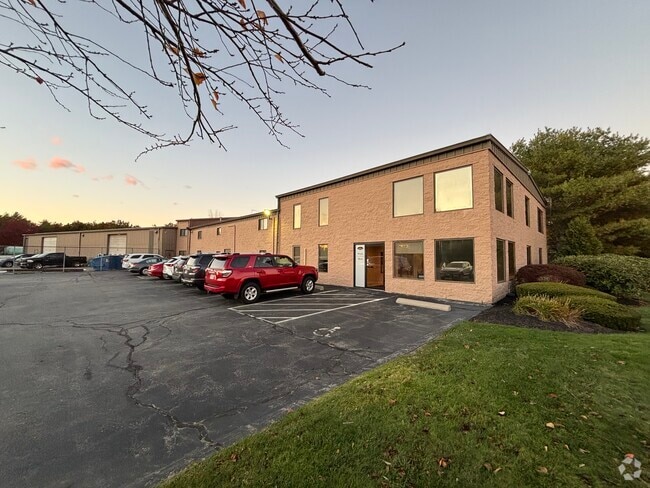
Property Record
1 Roberts Rd, Plymouth, MA 02360

NEARBY LISTINGS FOR SALE OR LEASE
Property Detail
1 Roberts Rd
PLYM-000108-000000-000022-000010
Plymouth
Warehouse
Plymouth
X
Massachusetts
25023C0361K
22-10
2025
2.12 AC
2025
Route 3 South
530400
Boston
3,090 SF
Boston-Cambridge-Newton, MA-NH
DEMOGRAPHICS near 1 Roberts Rd
1 Mile
3 Mile
5 Mile
2024 Total Population
1,642
15,792
42,105
2029 Population
1,644
15,868
42,356
Pop Growth 2024-2029
+ 0.12%
+ 0.48%
+ 0.60%
Average Age
48
44
43
2024 Total Households
694
6,058
16,592
HH Growth 2024-2029
+ 0.14%
+ 0.38%
+ 0.53%
Median Household Inc
$81,250
$110,253
$91,590
Avg Household Size
2.40
2.50
2.40
2024 Avg HH Vehicles
2.00
2.00
2.00
Median Home Value
$349,310
$415,279
$431,319
Median Year Built
1980
1978
1975
Nearby Places
Map Layers
Map Styles
 Street
 Aerial
- Restaurants
- Banks
- Shops
- Fitness
- Groceries
PUBLIC TRANSPORTATION
COMMUTER RAIL
Kingston/Route 3 (Kingston/Plymouth Line - Massachusetts Bay Transportation Authority Commuter Rail (Purple Line))
DRIVE
WALK
Distance
Kingston/Route 3 (Kingston/Plymouth Line - Massachusetts Bay Transportation Authority Commuter Rail (Purple Line))
16 min
8.0 mi
Freight Ports
Port of New Bedford Harbor
DRIVE
WALK
Distance
Port of New Bedford Harbor
41 min
28.3 mi
Nearby Properties
Address
Land Use
TOTAL SIZE
Lot Size
Zoning
Address
Land Use
TOTAL SIZE
Lot Size
Zoning
14.60 AC
MC
Address
Land Use
TOTAL SIZE
Lot Size
Zoning
27.31 AC
MC
Address
Land Use
TOTAL SIZE
Lot Size
Zoning
69.81 AC
Address
Land Use
TOTAL SIZE
Lot Size
Zoning
29.91 AC
RA
Address
Land Use
TOTAL SIZE
Lot Size
Zoning
123,423 SF
22.20 AC
GB
Address
Land Use
TOTAL SIZE
Lot Size
Zoning
214,442 SF
21.50 AC
MC
Address
Land Use
TOTAL SIZE
Lot Size
Zoning
122,558 SF
17.44 AC
GC
Address
Land Use
TOTAL SIZE
Lot Size
Zoning
9.41 AC
MC
Address
Land Use
TOTAL SIZE
Lot Size
Zoning
16.30 AC
GC
Address
Land Use
TOTAL SIZE
Lot Size
Zoning
0.24 AC
R25
Address
Land Use
TOTAL SIZE
Lot Size
Zoning
110,760 SF
2.09 AC
MC
Address
Land Use
TOTAL SIZE
Lot Size
Zoning
30,105 SF
6.45 AC
MC
Address
Land Use
TOTAL SIZE
Lot Size
Zoning
59,377 SF
2.95 AC
MC
Address
Land Use
TOTAL SIZE
Lot Size
Zoning
57,224 SF
19.36 AC
RR
Address
Land Use
TOTAL SIZE
Lot Size
Zoning
58,356 SF
32.04 AC
R25
Address
Land Use
TOTAL SIZE
Lot Size
Zoning
33.98 AC
RA
Address
Land Use
TOTAL SIZE
Lot Size
Zoning
52,447 SF
19.89 AC
Address
Land Use
TOTAL SIZE
Lot Size
Zoning
290.45 AC
AP
Address
Land Use
TOTAL SIZE
Lot Size
Zoning
5.43 AC
R25
Address
Land Use
TOTAL SIZE
Lot Size
Zoning
39,525 SF
3.84 AC
Address
Land Use
TOTAL SIZE
Lot Size
Zoning
3.55 AC
MC
Address
Land Use
TOTAL SIZE
Lot Size
Zoning
16.32 AC
V
Address
Land Use
TOTAL SIZE
Lot Size
Zoning
6.81 AC
GC
Address
Land Use
TOTAL SIZE
Lot Size
Zoning
6.26 AC
V
Address
Land Use
TOTAL SIZE
Lot Size
Zoning
24,580 SF
2.07 AC
LI
Address
Land Use
TOTAL SIZE
Lot Size
Zoning
21,791 SF
5.05 AC
MC
Address
Land Use
TOTAL SIZE
Lot Size
Zoning
23,126 SF
14.94 AC
V
Address
Land Use
TOTAL SIZE
Lot Size
Zoning
72,404 SF
3.10 AC
MC
Address
Land Use
TOTAL SIZE
Lot Size
Zoning
16,744 SF
24.62 AC
Address
Land Use
TOTAL SIZE
Lot Size
Zoning
5.64 AC
MC
The World's #1 Commercial Real Estate Marketplace
Connect with us
© 2026 CoStar Group
The information above has been obtained from sources believed reliable. While we do not doubt its accuracy we have not verified it and make no guarantee, warranty or representation about it. It is your responsibility to independently confirm its accuracy and completeness. Any projections, opinions, assumptions, or estimates used are for example only and do not represent the current or future performance of the property. The value of this transaction to you depends on tax and other factors which should be evaluated by your tax, financial, and legal advisors. You and your advisors should conduct a careful, independent investigation of the property to determine to your satisfaction the suitability of the property for your needs.