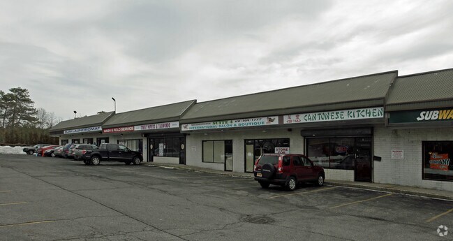
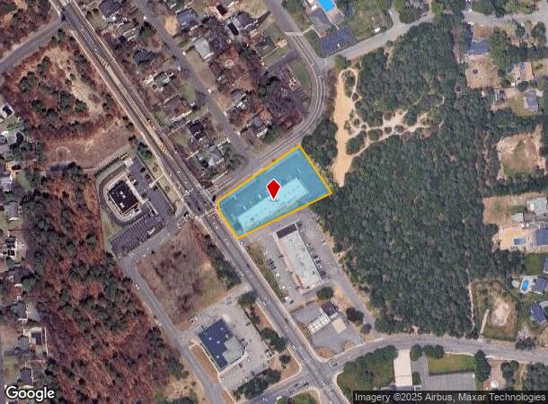
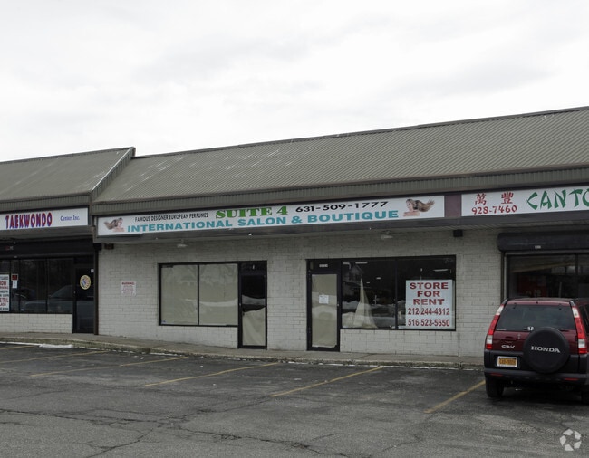
Property Record
1 Route 112 Ln, Coram, NY 11727

NEARBY LISTINGS FOR SALE OR LEASE
Property Detail
1 Route 112 Ln
Nassau County-Suffolk County, NY
Coram
0200-339-00-02-00-028-005
N GLENMERE LA T105 E BROOKHAVEN TOW
Commercialnec
Suffolk
X
New York
36103C0395H
28
2024
1.20 AC
2024
Central Suffolk
158325
Long Island (New York)
DEMOGRAPHICS near 1 Route 112 Ln
1 Mile
3 Mile
5 Mile
2024 Total Population
10,953
87,037
191,264
2029 Population
10,741
85,703
188,538
Pop Growth 2024-2029
(1.94%)
(1.53%)
(1.43%)
Average Age
42
41
41
2024 Total Households
4,031
30,323
66,257
HH Growth 2024-2029
(2.26%)
(1.76%)
(1.64%)
Median Household Inc
$90,988
$99,402
$111,152
Avg Household Size
2.60
2.70
2.80
2024 Avg HH Vehicles
2.00
2.00
2.00
Median Home Value
$400,912
$407,707
$435,578
Median Year Built
1976
1976
1975
Nearby Places
- Restaurants
- Banks
- Shops
- Fitness
- Groceries
PUBLIC TRANSPORTATION
COMMUTER RAIL
Port Jefferson Station (Port Jefferson Branch - Long Island Rail Road)
DRIVE
WALK
Distance
Port Jefferson Station (Port Jefferson Branch - Long Island Rail Road)
7 min
3.8 mi
Medford Station (Greenport Branch - Long Island Rail Road)
DRIVE
WALK
Distance
Medford Station (Greenport Branch - Long Island Rail Road)
11 min
5.7 mi
AIRPORT
Long Island MacArthur
DRIVE
WALK
Distance
Long Island MacArthur
23 min
14.2 mi
Tweed/New Haven
DRIVE
WALK
Distance
Tweed/New Haven
123 min
44.9 mi
Freight Ports
Port of New Haven
DRIVE
WALK
Distance
Port of New Haven
117 min
42.0 mi
Nearby Properties
Address
Land Use
TOTAL SIZE
Lot Size
Zoning
Address
Land Use
TOTAL SIZE
Lot Size
Zoning
6,522 SF
0.32 AC
VILLA
Address
Land Use
TOTAL SIZE
Lot Size
Zoning
21,554 SF
1.03 AC
HC
Address
Land Use
TOTAL SIZE
Lot Size
Zoning
3,879 SF
0.57 AC
R1
Address
Land Use
TOTAL SIZE
Lot Size
Zoning
1.22 AC
CR80
Address
Land Use
TOTAL SIZE
Lot Size
Zoning
5,530 SF
0.44 AC
R1
Address
Land Use
TOTAL SIZE
Lot Size
Zoning
0.92 AC
CR80
Address
Land Use
TOTAL SIZE
Lot Size
Zoning
3.52 AC
CR80
Address
Land Use
TOTAL SIZE
Lot Size
Zoning
Address
Land Use
TOTAL SIZE
Lot Size
Zoning
31.33 AC
Address
Land Use
TOTAL SIZE
Lot Size
Zoning
21.04 AC
Address
Land Use
TOTAL SIZE
Lot Size
Zoning
Address
Land Use
TOTAL SIZE
Lot Size
Zoning
Address
Land Use
TOTAL SIZE
Lot Size
Zoning
47.20 AC
Address
Land Use
TOTAL SIZE
Lot Size
Zoning
Address
Land Use
TOTAL SIZE
Lot Size
Zoning
34.53 AC
Address
Land Use
TOTAL SIZE
Lot Size
Zoning
27.75 AC
Address
Land Use
TOTAL SIZE
Lot Size
Zoning
Address
Land Use
TOTAL SIZE
Lot Size
Zoning
18.50 AC
Address
Land Use
TOTAL SIZE
Lot Size
Zoning
Address
Land Use
TOTAL SIZE
Lot Size
Zoning
22.45 AC
Address
Land Use
TOTAL SIZE
Lot Size
Zoning
Address
Land Use
TOTAL SIZE
Lot Size
Zoning
Address
Land Use
TOTAL SIZE
Lot Size
Zoning
23.35 AC
Address
Land Use
TOTAL SIZE
Lot Size
Zoning
Address
Land Use
TOTAL SIZE
Lot Size
Zoning
Address
Land Use
TOTAL SIZE
Lot Size
Zoning
23.85 AC
Address
Land Use
TOTAL SIZE
Lot Size
Zoning
Address
Land Use
TOTAL SIZE
Lot Size
Zoning
16.50 AC
Address
Land Use
TOTAL SIZE
Lot Size
Zoning
Address
Land Use
TOTAL SIZE
Lot Size
Zoning
The World's #1 Commercial Real Estate Marketplace
Connect with us
© 2025 CoStar Group
The information above has been obtained from sources believed reliable. While we do not doubt its accuracy we have not verified it and make no guarantee, warranty or representation about it. It is your responsibility to independently confirm its accuracy and completeness. Any projections, opinions, assumptions, or estimates used are for example only and do not represent the current or future performance of the property. The value of this transaction to you depends on tax and other factors which should be evaluated by your tax, financial, and legal advisors. You and your advisors should conduct a careful, independent investigation of the property to determine to your satisfaction the suitability of the property for your needs.