Property Record
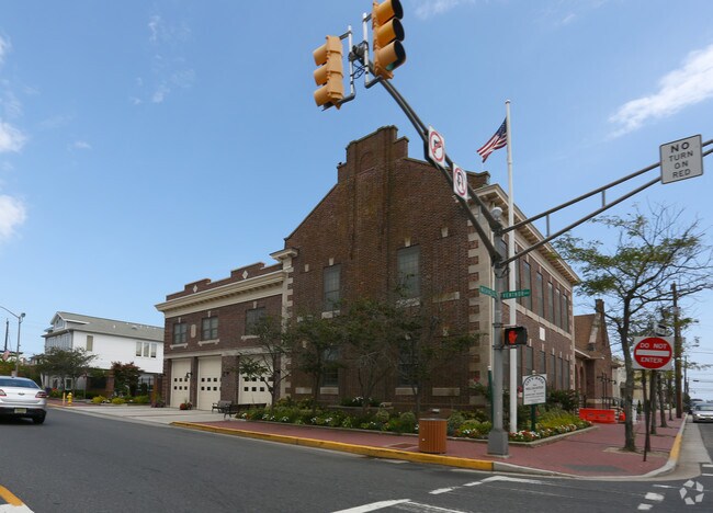
1 S Washington Ave, Margate City, NJ 08402


NEARBY LISTINGS FOR SALE OR LEASE
Property Detail
1 S Washington Ave
Atlantic City-Hammonton, NJ
FACILITY NAME: MUNICIPAL BLDG.
16-00126-0000-00090
Atlantic
Governmentalpublicusegeneral
New Jersey
AE
90
34001C0434F
0.65 AC
0
Atlantic City/Hammonton
2025
Philadelphia
013102
DEMOGRAPHICS near 1 S Washington Ave
1 Mile
3 Mile
5 Mile
2024 Total Population
10,442
28,028
89,830
2029 Population
11,664
30,307
92,066
Pop Growth 2024-2029
+ 11.70%
+ 8.13%
+ 2.49%
Average Age
53
50
44
2024 Total Households
5,350
13,335
37,034
HH Growth 2024-2029
+ 11.74%
+ 8.14%
+ 2.84%
Median Household Inc
$96,787
$86,436
$69,147
Avg Household Size
1.90
2.00
2.30
2024 Avg HH Vehicles
2.00
2.00
2.00
Median Home Value
$540,661
$396,225
$299,423
Median Year Built
1968
1965
1963
Nearby Places
Map Layers
Map Styles
 Street
 Aerial
- Restaurants
- Banks
- Shops
- Fitness
- Groceries
PUBLIC TRANSPORTATION
COMMUTER RAIL
Atlantic City (Atlantic City Line - NJ Transit Commuter Rail (NJ Transit))
DRIVE
WALK
Distance
Atlantic City (Atlantic City Line - NJ Transit Commuter Rail (NJ Transit))
14 min
5.9 mi
Absecon (Atlantic City Line - NJ Transit Commuter Rail (NJ Transit))
DRIVE
WALK
Distance
Absecon (Atlantic City Line - NJ Transit Commuter Rail (NJ Transit))
16 min
9.5 mi
AIRPORT
Atlantic City International
DRIVE
WALK
Distance
Atlantic City International
40 min
14.8 mi
Freight Ports
Broadway Terminal - Pier 5
DRIVE
WALK
Distance
Broadway Terminal - Pier 5
73 min
56.0 mi
Nearby Properties
Address
Land Use
TOTAL SIZE
Lot Size
Zoning
Address
Land Use
TOTAL SIZE
Lot Size
Zoning
20.25 AC
06
Address
Land Use
TOTAL SIZE
Lot Size
Zoning
4,024 SF
2.93 AC
B
Address
Land Use
TOTAL SIZE
Lot Size
Zoning
1.84 AC
10
Address
Land Use
TOTAL SIZE
Lot Size
Zoning
2.63 AC
I
Address
Land Use
TOTAL SIZE
Lot Size
Zoning
0.68 AC
P
Address
Land Use
TOTAL SIZE
Lot Size
Zoning
22.98 AC
Address
Land Use
TOTAL SIZE
Lot Size
Zoning
49,698 SF
15.33 AC
D-C
Address
Land Use
TOTAL SIZE
Lot Size
Zoning
4.54 AC
I
Address
Land Use
TOTAL SIZE
Lot Size
Zoning
4,268 SF
0.45 AC
03
Address
Land Use
TOTAL SIZE
Lot Size
Zoning
12.49 AC
I
Address
Land Use
TOTAL SIZE
Lot Size
Zoning
0.75 AC
CBD
Address
Land Use
TOTAL SIZE
Lot Size
Zoning
7,588 SF
2.93 AC
03
Address
Land Use
TOTAL SIZE
Lot Size
Zoning
0.46 AC
P
Address
Land Use
TOTAL SIZE
Lot Size
Zoning
1.55 AC
I
Address
Land Use
TOTAL SIZE
Lot Size
Zoning
1.84 AC
I
Address
Land Use
TOTAL SIZE
Lot Size
Zoning
0.42 AC
P
Address
Land Use
TOTAL SIZE
Lot Size
Zoning
Address
Land Use
TOTAL SIZE
Lot Size
Zoning
32,016 SF
4.41 AC
10
Address
Land Use
TOTAL SIZE
Lot Size
Zoning
0.52 AC
P
Address
Land Use
TOTAL SIZE
Lot Size
Zoning
6.57 AC
E-D
Address
Land Use
TOTAL SIZE
Lot Size
Zoning
4.49 AC
B
Address
Land Use
TOTAL SIZE
Lot Size
Zoning
0.93 AC
S-60
Address
Land Use
TOTAL SIZE
Lot Size
Zoning
Address
Land Use
TOTAL SIZE
Lot Size
Zoning
1.11 AC
C-1
Address
Land Use
TOTAL SIZE
Lot Size
Zoning
0.93 AC
P
Address
Land Use
TOTAL SIZE
Lot Size
Zoning
527 SF
2.93 AC
01
Address
Land Use
TOTAL SIZE
Lot Size
Zoning
1.24 AC
TF
Address
Land Use
TOTAL SIZE
Lot Size
Zoning
1.25 AC
GO
Address
Land Use
TOTAL SIZE
Lot Size
Zoning
0.13 AC
RSF1
Address
Land Use
TOTAL SIZE
Lot Size
Zoning
0.34 AC
S40
The World's #1 Commercial Real Estate Marketplace
Connect with us
© 2025 CoStar Group
The information above has been obtained from sources believed reliable. While we do not doubt its accuracy we have not verified it and make no guarantee, warranty or representation about it. It is your responsibility to independently confirm its accuracy and completeness. Any projections, opinions, assumptions, or estimates used are for example only and do not represent the current or future performance of the property. The value of this transaction to you depends on tax and other factors which should be evaluated by your tax, financial, and legal advisors. You and your advisors should conduct a careful, independent investigation of the property to determine to your satisfaction the suitability of the property for your needs.