Property Record
1 Salisbury Pt, Nyack, NY 10960


NEARBY LISTINGS FOR SALE OR LEASE
Property Detail
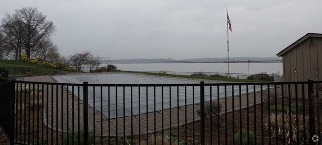
1 Salisbury Pt
392407-066-078-0001-027-000-0000
7/125/1241/11
Apartment
Rockland
AE
New York
36087C0183G
27.0
2023
5.60 AC
2024
Rockland County
013200
Northern New Jersey
124,782 SF
New York-Jersey City-White Plains, NY-NJ
DEMOGRAPHICS near 1 Salisbury Pt
1 Mile
3 Mile
5 Mile
2024 Total Population
4,710
35,769
115,579
2029 Population
4,637
35,616
114,598
Pop Growth 2024-2029
(1.55%)
(0.43%)
(0.85%)
Average Age
44
42
43
2024 Total Households
2,132
13,956
42,476
HH Growth 2024-2029
(1.55%)
(0.54%)
(0.99%)
Median Household Inc
$115,685
$100,544
$124,425
Avg Household Size
2.10
2.40
2.60
2024 Avg HH Vehicles
2.00
2.00
2.00
Median Home Value
$707,326
$627,881
$637,523
Median Year Built
1953
1963
1963
Nearby Places
Map Layers
Map Styles
 Street
 Aerial
- Restaurants
- Banks
- Shops
- Fitness
- Groceries
PUBLIC TRANSPORTATION
COMMUTER RAIL
Tarrytown Station (Hudson Line - Metro-North Commuter Railroad Company (Metro-North))
DRIVE
WALK
Distance
Tarrytown Station (Hudson Line - Metro-North Commuter Railroad Company (Metro-North))
13 min
7.2 mi
Philipse Manor Station (Hudson Line - Metro-North Commuter Railroad Company (Metro-North))
DRIVE
WALK
Distance
Philipse Manor Station (Hudson Line - Metro-North Commuter Railroad Company (Metro-North))
16 min
8.6 mi
AIRPORT
Westchester County
DRIVE
WALK
Distance
Westchester County
28 min
18.9 mi
LaGuardia
DRIVE
WALK
Distance
LaGuardia
48 min
31.7 mi
Newark Liberty International
DRIVE
WALK
Distance
Newark Liberty International
46 min
32.9 mi
Freight Ports
NY - Red Hook Container Terminal
DRIVE
WALK
Distance
NY - Red Hook Container Terminal
60 min
35.2 mi
Nearby Properties
Address
Land Use
TOTAL SIZE
Lot Size
Zoning
Address
Land Use
TOTAL SIZE
Lot Size
Zoning
415,374 SF
8.43 AC
H
Address
Land Use
TOTAL SIZE
Lot Size
Zoning
4,540,462 SF
30.89 AC
Address
Land Use
TOTAL SIZE
Lot Size
Zoning
220,594 SF
22.30 AC
R-40
Address
Land Use
TOTAL SIZE
Lot Size
Zoning
237,408 SF
14.97 AC
R-40
Address
Land Use
TOTAL SIZE
Lot Size
Zoning
197,764 SF
7.46 AC
Address
Land Use
TOTAL SIZE
Lot Size
Zoning
231,978 SF
48.30 AC
R-40
Address
Land Use
TOTAL SIZE
Lot Size
Zoning
191,148 SF
32.26 AC
R-40
Address
Land Use
TOTAL SIZE
Lot Size
Zoning
2.93 AC
Address
Land Use
TOTAL SIZE
Lot Size
Zoning
114,520 SF
6.71 AC
R4
Address
Land Use
TOTAL SIZE
Lot Size
Zoning
25.52 AC
Address
Land Use
TOTAL SIZE
Lot Size
Zoning
2.66 AC
Address
Land Use
TOTAL SIZE
Lot Size
Zoning
47,432 SF
9.81 AC
RG
Address
Land Use
TOTAL SIZE
Lot Size
Zoning
1.98 AC
Address
Land Use
TOTAL SIZE
Lot Size
Zoning
108,264 SF
14.90 AC
R-18
Address
Land Use
TOTAL SIZE
Lot Size
Zoning
0.89 AC
Address
Land Use
TOTAL SIZE
Lot Size
Zoning
31.50 AC
R-15
Address
Land Use
TOTAL SIZE
Lot Size
Zoning
302.70 AC
R-40
Address
Land Use
TOTAL SIZE
Lot Size
Zoning
1.79 AC
Address
Land Use
TOTAL SIZE
Lot Size
Zoning
66,920 SF
17.70 AC
LO
Address
Land Use
TOTAL SIZE
Lot Size
Zoning
1.10 AC
R-3
Address
Land Use
TOTAL SIZE
Lot Size
Zoning
56,436 SF
7.06 AC
R-40
Address
Land Use
TOTAL SIZE
Lot Size
Zoning
20.81 AC
Address
Land Use
TOTAL SIZE
Lot Size
Zoning
2,465 SF
2.03 AC
Address
Land Use
TOTAL SIZE
Lot Size
Zoning
17.75 AC
Address
Land Use
TOTAL SIZE
Lot Size
Zoning
8.54 AC
Address
Land Use
TOTAL SIZE
Lot Size
Zoning
984 SF
3.10 AC
LI
Address
Land Use
TOTAL SIZE
Lot Size
Zoning
81,972 SF
5.36 AC
R-40
Address
Land Use
TOTAL SIZE
Lot Size
Zoning
441.47 AC
R-40
Address
Land Use
TOTAL SIZE
Lot Size
Zoning
112,628 SF
11.80 AC
LO
The World's #1 Commercial Real Estate Marketplace
Connect with us
© 2026 CoStar Group
The information above has been obtained from sources believed reliable. While we do not doubt its accuracy we have not verified it and make no guarantee, warranty or representation about it. It is your responsibility to independently confirm its accuracy and completeness. Any projections, opinions, assumptions, or estimates used are for example only and do not represent the current or future performance of the property. The value of this transaction to you depends on tax and other factors which should be evaluated by your tax, financial, and legal advisors. You and your advisors should conduct a careful, independent investigation of the property to determine to your satisfaction the suitability of the property for your needs.