Property Record
1 Spring Dr, Port Orange, FL 32129
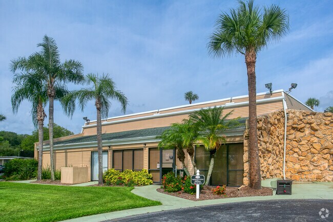

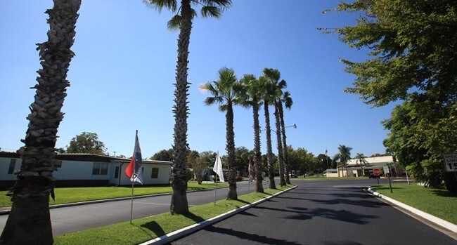
Property Detail
1 Spring Dr
6337-01-09-0040
5-16-33 LOT 4 BLK 9 DUNLAWTON EXC E 200 FT & EXC NEW R/W FOR MADELINE AVE IN S 15.81 FT OF E 153.25 FT & INC 6 & 7 SUB LOTS 1 2 & 4 & S 1/2 GOV LOT 3 DB M PG 187 PER OR 5195 PG 1719
Parkinglot
VOLUSIA
16RMH
Florida
C and X Area of minimal flood hazard, usually depicted on FIRMs as above the 500-year flood level.
4
2025
9.30 AC
2026
Outer Port Orange
082414
Deltona/Daytona Beach
9,952 SF
Deltona-Daytona Beach-Ormond Beach, FL
NEARBY LISTINGS FOR SALE OR LEASE
-
-
View all Port Orange listings for sale on LoopNet.com
DEMOGRAPHICS near 1 Spring Dr
1 mile
3 mile
5 mile
2025 Total Population
9,707
78,008
128,884
2030 Population
10,402
83,574
138,635
Pop Growth 2025-2030
+ 7.16%
+ 7.14%
+ 7.57%
Average Age
48
46
45
2025 Total Households
4,613
35,425
57,632
HH Growth 2025-2030
+ 7.18%
+ 7.28%
+ 7.73%
Median Household Inc
$58,233
$58,643
$58,917
Avg Household Size
2.00
2.10
2.10
2025 Avg HH Vehicles
2.00
2.00
2.00
Median Home Value
$235,431
$283,112
$322,175
Median Year Built
1982
1983
1983
Nearby Places
Map Layers
Map Styles
 Street
 Aerial
Layers
 Traffic
 Biking
Places
Listings with unknown addresses are not visible on the map
- Restaurants
- Banks
- Shops
- Fitness
- Groceries
PUBLIC TRANSPORTATION
AIRPORT
Daytona Beach International
Drive
Walk
Distance
Daytona Beach International
11 min
5.7 mi
Orlando Sanford International
Drive
Walk
Distance
Orlando Sanford International
56 min
38.9 mi
Freight Ports
Port Canaveral
Drive
Walk
Distance
Port Canaveral
80 min
67.5 mi
Nearby Properties
Address
Land Use
TOTAL SIZE
Lot Size
Zoning
Address
Land Use
TOTAL SIZE
Lot Size
Zoning
490,775 SF
34.26 AC
01MH1
Address
Land Use
TOTAL SIZE
Lot Size
Zoning
396,385 SF
10 AC
01A2
Address
Land Use
TOTAL SIZE
Lot Size
Zoning
448,867 SF
5.54 AC
Address
Land Use
TOTAL SIZE
Lot Size
Zoning
13,965 SF
0.70 AC
MH1
Address
Land Use
TOTAL SIZE
Lot Size
Zoning
416,320 SF
0.13 AC
Address
Land Use
TOTAL SIZE
Lot Size
Zoning
408,078 SF
50.07 AC
Address
Land Use
TOTAL SIZE
Lot Size
Zoning
354,546 SF
24.71 AC
Address
Land Use
TOTAL SIZE
Lot Size
Zoning
226,459 SF
0.57 AC
Address
Land Use
TOTAL SIZE
Lot Size
Zoning
325,744 SF
12.23 AC
Address
Land Use
TOTAL SIZE
Lot Size
Zoning
330,883 SF
19.59 AC
Address
Land Use
TOTAL SIZE
Lot Size
Zoning
300,516 SF
70 AC
A2
Address
Land Use
TOTAL SIZE
Lot Size
Zoning
379,591 SF
21.62 AC
MH1
Address
Land Use
TOTAL SIZE
Lot Size
Zoning
10,360 SF
1.56 AC
Address
Land Use
TOTAL SIZE
Lot Size
Zoning
306,467 SF
20.76 AC
Address
Land Use
TOTAL SIZE
Lot Size
Zoning
5,774 SF
0.94 AC
B4
Address
Land Use
TOTAL SIZE
Lot Size
Zoning
12,871 SF
0.20 AC
R4
Address
Land Use
TOTAL SIZE
Lot Size
Zoning
150,197 SF
16.07 AC
Address
Land Use
TOTAL SIZE
Lot Size
Zoning
94,338 SF
7.39 AC
Address
Land Use
TOTAL SIZE
Lot Size
Zoning
60,449 SF
7.14 AC
16PCD
Address
Land Use
TOTAL SIZE
Lot Size
Zoning
412,064 SF
60 AC
Address
Land Use
TOTAL SIZE
Lot Size
Zoning
184,242 SF
14.43 AC
Address
Land Use
TOTAL SIZE
Lot Size
Zoning
324,364 SF
11.59 AC
02RPUD
Address
Land Use
TOTAL SIZE
Lot Size
Zoning
146,580 SF
2.80 AC
02R3
Address
Land Use
TOTAL SIZE
Lot Size
Zoning
9,061 SF
0.23 AC
16RMH
Address
Land Use
TOTAL SIZE
Lot Size
Zoning
201,947 SF
0.23 AC
Address
Land Use
TOTAL SIZE
Lot Size
Zoning
185,278 SF
15.85 AC
Address
Land Use
TOTAL SIZE
Lot Size
Zoning
156,994 SF
47.82 AC
16A
Address
Land Use
TOTAL SIZE
Lot Size
Zoning
8,355 SF
1 AC
MH1
Address
Land Use
TOTAL SIZE
Lot Size
Zoning
269,160 SF
72.17 AC
16A
The World's #1 Commercial Real Estate Marketplace
Connect with us
© 2026 CoStar Group
The information above has been obtained from sources believed reliable. While we do not doubt its accuracy we have not verified it and make no guarantee, warranty or representation about it. It is your responsibility to independently confirm its accuracy and completeness. Any projections, opinions, assumptions, or estimates used are for example only and do not represent the current or future performance of the property. The value of this transaction to you depends on tax and other factors which should be evaluated by your tax, financial, and legal advisors. You and your advisors should conduct a careful, independent investigation of the property to determine to your satisfaction the suitability of the property for your needs.