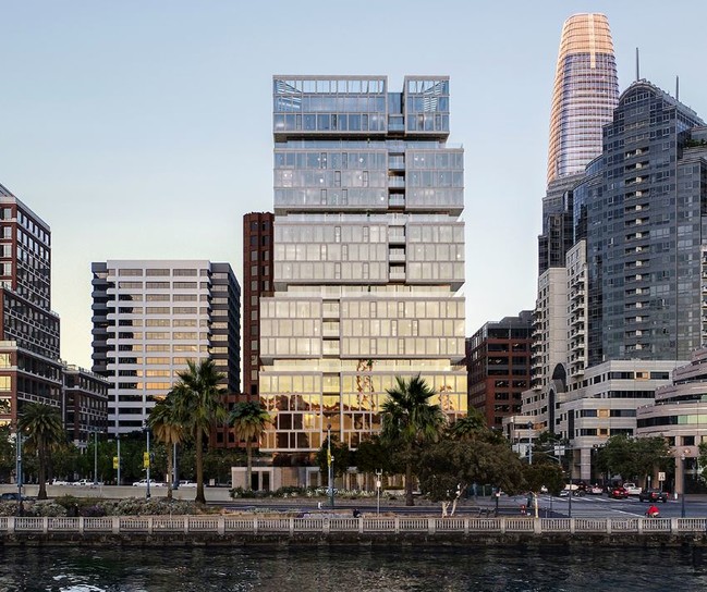
Property Record
1 Steuart Ln, San Francisco, CA 94105

Current Lease Availabilities
Property Detail
1 Steuart Ln
San Francisco-San Mateo-Redwood City, CA
SAN FRANCISCO
3741-069
California
Residentialacreage
114
2024
0.47 AC
2025
Rincon
010500
San Francisco
1,101 SF
NEARBY LISTINGS FOR SALE OR LEASE
DEMOGRAPHICS near 1 Steuart Ln
1 mile
3 mile
5 mile
2024 Total Population
44,559
355,988
601,567
2029 Population
45,653
364,452
612,602
Pop Growth 2024-2029
+ 2.46%
+ 2.38%
+ 1.83%
Average Age
44
42
42
2024 Total Households
24,633
176,043
273,063
HH Growth 2024-2029
+ 2.53%
+ 2.28%
+ 1.86%
Median Household Inc
$127,178
$122,329
$132,814
Avg Household Size
1.80
1.90
2.00
2024 Avg HH Vehicles
1.00
1.00
1.00
Median Home Value
$1,073,604
$1,087,249
$1,096,141
Median Year Built
1994
1958
1950
Nearby Places
Map Layers
Map Styles
 Street
 Aerial
Transit
 Traffic
 Biking
Places
Listings with unknown addresses are not visible on the map
- Restaurants
- Banks
- Shops
- Fitness
- Groceries
PUBLIC TRANSPORTATION
TRANSIT/SUBWAY
The Embarcadero & Folsom St (INGLESIDE - San Francisco Municipal Transportation Agency, JUDAH - San Francisco Municipal Transportation Agency, OCEAN VIEW - San Francisco Municipal Transportation Agency, TARAVAL - San Francisco Municipal Transportation Agency)
Drive
Walk
Distance
The Embarcadero & Folsom St (INGLESIDE - San Francisco Municipal Transportation Agency, JUDAH - San Francisco Municipal Transportation Agency, OCEAN VIEW - San Francisco Municipal Transportation Agency, TARAVAL - San Francisco Municipal Transportation Agency)
0 min
3 min
0.2 mi
Don Chee Way/Steuart St (MARKET & WHARVES - San Francisco Municipal Transportation Agency, MARKET & WHARVES BUS - San Francisco Municipal Transportation Agency)
Drive
Walk
Distance
Don Chee Way/Steuart St (MARKET & WHARVES - San Francisco Municipal Transportation Agency, MARKET & WHARVES BUS - San Francisco Municipal Transportation Agency)
2 min
4 min
0.2 mi
Main St & Mission St (MARKET & WHARVES - San Francisco Municipal Transportation Agency)
Drive
Walk
Distance
Main St & Mission St (MARKET & WHARVES - San Francisco Municipal Transportation Agency)
1 min
4 min
0.2 mi
Market And Drumm (F Market - San Francisco Municipal Railway (MUNI Metro))
Drive
Walk
Distance
Market And Drumm (F Market - San Francisco Municipal Railway (MUNI Metro))
1 min
6 min
0.3 mi
Ferry Terminal (F Market - San Francisco Municipal Railway (MUNI Metro))
Drive
Walk
Distance
Ferry Terminal (F Market - San Francisco Municipal Railway (MUNI Metro))
1 min
6 min
0.3 mi
COMMUTER RAIL
San Francisco Caltrain Station Southbound (Express - Caltrain (Caltrain), Limited - Caltrain (Caltrain), Local Weekday - Caltrain (Caltrain), Local Weekend - Caltrain (Caltrain))
Drive
Walk
Distance
San Francisco Caltrain Station Southbound (Express - Caltrain (Caltrain), Limited - Caltrain (Caltrain), Local Weekday - Caltrain (Caltrain), Local Weekend - Caltrain (Caltrain))
4 min
1.4 mi
Bayshore Caltrain Station Southbound (Local Weekday - Caltrain (Caltrain), Local Weekend - Caltrain (Caltrain))
Drive
Walk
Distance
Bayshore Caltrain Station Southbound (Local Weekday - Caltrain (Caltrain), Local Weekend - Caltrain (Caltrain))
12 min
6.6 mi
AIRPORT
San Francisco International
Drive
Walk
Distance
San Francisco International
23 min
14.4 mi
Metro Oakland International
Drive
Walk
Distance
Metro Oakland International
29 min
18.9 mi
Freight Ports
Port of San Francisco
Drive
Walk
Distance
Port of San Francisco
1 min
0.5 mi
Nearby Properties
Address
Land Use
TOTAL SIZE
Lot Size
Zoning
Address
Land Use
TOTAL SIZE
Lot Size
Zoning
1,015,000 SF
2.43 AC
RC4
Address
Land Use
TOTAL SIZE
Lot Size
Zoning
764,661 SF
0.67 AC
C3OSD
Address
Land Use
TOTAL SIZE
Lot Size
Zoning
750,370 SF
3.25 AC
MBR3
Address
Land Use
TOTAL SIZE
Lot Size
Zoning
1,471,929 SF
1.93 AC
C3O
Address
Land Use
TOTAL SIZE
Lot Size
Zoning
1,300,000 SF
1.74 AC
C3O
Address
Land Use
TOTAL SIZE
Lot Size
Zoning
1,420,430 SF
1.16 AC
C3OSD
Address
Land Use
TOTAL SIZE
Lot Size
Zoning
1,534,312 SF
2.60 AC
C3O
Address
Land Use
TOTAL SIZE
Lot Size
Zoning
914,037 SF
1.36 AC
C3O
Address
Land Use
TOTAL SIZE
Lot Size
Zoning
717,234 SF
3.47 AC
UMU
Address
Land Use
TOTAL SIZE
Lot Size
Zoning
605,459 SF
0.63 AC
C3O
Address
Land Use
TOTAL SIZE
Lot Size
Zoning
475,791 SF
0.55 AC
C3OSD
Address
Land Use
TOTAL SIZE
Lot Size
Zoning
690,442 SF
0.79 AC
C3O
Address
Land Use
TOTAL SIZE
Lot Size
Zoning
10.92 AC
Address
Land Use
TOTAL SIZE
Lot Size
Zoning
750,491 SF
0.51 AC
C3O
Address
Land Use
TOTAL SIZE
Lot Size
Zoning
432,000 SF
0.35 AC
C3OSD
Address
Land Use
TOTAL SIZE
Lot Size
Zoning
266,143 SF
4 AC
C-3-R
Address
Land Use
TOTAL SIZE
Lot Size
Zoning
885,581 SF
5.20 AC
M2
Address
Land Use
TOTAL SIZE
Lot Size
Zoning
512,395 SF
1.24 AC
C3O
Address
Land Use
TOTAL SIZE
Lot Size
Zoning
508,714 SF
1.29 AC
C3R
Address
Land Use
TOTAL SIZE
Lot Size
Zoning
1,084,662 SF
1.67 AC
C3O
Address
Land Use
TOTAL SIZE
Lot Size
Zoning
505,120 SF
0.41 AC
C3O
Address
Land Use
TOTAL SIZE
Lot Size
Zoning
694,334 SF
1.01 AC
C3O
Address
Land Use
TOTAL SIZE
Lot Size
Zoning
696,431 SF
0.97 AC
C3G
Address
Land Use
TOTAL SIZE
Lot Size
Zoning
139,070 SF
0.64 AC
C3O
Address
Land Use
TOTAL SIZE
Lot Size
Zoning
1.52 AC
C3G
Address
Land Use
TOTAL SIZE
Lot Size
Zoning
1,424,230 SF
2.60 AC
C3G
Address
Land Use
TOTAL SIZE
Lot Size
Zoning
614,740 SF
1.74 AC
C3OSD
Address
Land Use
TOTAL SIZE
Lot Size
Zoning
615,957 SF
0.63 AC
C3O
Address
Land Use
TOTAL SIZE
Lot Size
Zoning
492,980 SF
0.43 AC
C3O
Address
Land Use
TOTAL SIZE
Lot Size
Zoning
385,000 SF
0.81 AC
C3O
The World's #1 Commercial Real Estate Marketplace
Connect with us
© 2026 CoStar Group
The information above has been obtained from sources believed reliable. While we do not doubt its accuracy we have not verified it and make no guarantee, warranty or representation about it. It is your responsibility to independently confirm its accuracy and completeness. Any projections, opinions, assumptions, or estimates used are for example only and do not represent the current or future performance of the property. The value of this transaction to you depends on tax and other factors which should be evaluated by your tax, financial, and legal advisors. You and your advisors should conduct a careful, independent investigation of the property to determine to your satisfaction the suitability of the property for your needs.