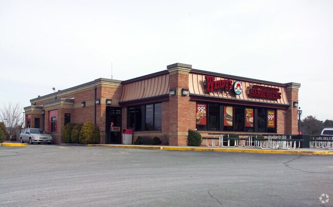
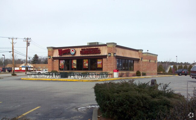
Property Record
1 Stilson Rd, Wyoming, RI 02898

Property Detail
1 Stilson Rd
RICH-000005B-000062-000001
WASHINGTON
Commercialbuilding
Rhode Island
B and X Area of moderate flood hazard, usually the area between the limits of the 100-year and 500-year floods.
1
2025
1.08 AC
2025
Washington County
050600
Providence
2,612 SF
Providence-Warwick, RI-MA
NEARBY LISTINGS FOR SALE OR LEASE
DEMOGRAPHICS near 1 Stilson Rd
1 mile
3 mile
5 mile
2025 Total Population
841
5,002
11,684
2030 Population
822
4,825
11,317
Pop Growth 2025-2030
(2.26%)
(3.54%)
(3.14%)
Average Age
43
43
43
2025 Total Households
319
1,893
4,471
HH Growth 2025-2030
(2.82%)
(4.01%)
(3.60%)
Median Household Inc
$116,368
$108,942
$110,271
Avg Household Size
2.60
2.60
2.60
2025 Avg HH Vehicles
2.00
2.00
2.00
Median Home Value
$387,142
$423,357
$438,319
Median Year Built
1981
1981
1981
Nearby Places
Map Layers
Map Styles
 Street
 Aerial
Layers
 Traffic
 Biking
Places
Listings with unknown addresses are not visible on the map
- Restaurants
- Banks
- Shops
- Fitness
- Groceries
PUBLIC TRANSPORTATION
COMMUTER RAIL
Kingston Amtrak Station (Northeast Regional - Amtrak)
Drive
Walk
Distance
Kingston Amtrak Station (Northeast Regional - Amtrak)
18 min
8.3 mi
AIRPORT
Rhode Island Tf Green International
Drive
Walk
Distance
Rhode Island Tf Green International
35 min
25.2 mi
Freight Ports
Port of Davisville, RI
Drive
Walk
Distance
Port of Davisville, RI
37 min
25.4 mi
SALE & LEASE HISTORY
LISTING DATE
SALE/LEASE

Jul 29, 2020
For Lease
Nearby Properties
Address
Land Use
TOTAL SIZE
Lot Size
Zoning
Address
Land Use
TOTAL SIZE
Lot Size
Zoning
4.65 AC
RFR8
Address
Land Use
TOTAL SIZE
Lot Size
Zoning
40,020 SF
10.17 AC
Address
Land Use
TOTAL SIZE
Lot Size
Zoning
61,929 SF
9.35 AC
Address
Land Use
TOTAL SIZE
Lot Size
Zoning
30,944 SF
Address
Land Use
TOTAL SIZE
Lot Size
Zoning
48.30 AC
Address
Land Use
TOTAL SIZE
Lot Size
Zoning
850.10 AC
Address
Land Use
TOTAL SIZE
Lot Size
Zoning
96.91 AC
Address
Land Use
TOTAL SIZE
Lot Size
Zoning
4.78 AC
R-1
Address
Land Use
TOTAL SIZE
Lot Size
Zoning
2,852 SF
887.75 AC
Address
Land Use
TOTAL SIZE
Lot Size
Zoning
Address
Land Use
TOTAL SIZE
Lot Size
Zoning
1,735 SF
469.70 AC
Address
Land Use
TOTAL SIZE
Lot Size
Zoning
150.99 AC
MFG
Address
Land Use
TOTAL SIZE
Lot Size
Zoning
208.60 AC
Address
Land Use
TOTAL SIZE
Lot Size
Zoning
17,854 SF
2.25 AC
Address
Land Use
TOTAL SIZE
Lot Size
Zoning
423.80 AC
Address
Land Use
TOTAL SIZE
Lot Size
Zoning
21,809 SF
39.90 AC
RS
Address
Land Use
TOTAL SIZE
Lot Size
Zoning
13,144 SF
1.96 AC
Address
Land Use
TOTAL SIZE
Lot Size
Zoning
Address
Land Use
TOTAL SIZE
Lot Size
Zoning
12,100 SF
2.21 AC
Address
Land Use
TOTAL SIZE
Lot Size
Zoning
10,189 SF
1.65 AC
R-1
Address
Land Use
TOTAL SIZE
Lot Size
Zoning
93.85 AC
Address
Land Use
TOTAL SIZE
Lot Size
Zoning
6,943 SF
0.96 AC
Address
Land Use
TOTAL SIZE
Lot Size
Zoning
4.80 AC
Address
Land Use
TOTAL SIZE
Lot Size
Zoning
40,400 SF
11.59 AC
Address
Land Use
TOTAL SIZE
Lot Size
Zoning
51,736 SF
4.13 AC
Address
Land Use
TOTAL SIZE
Lot Size
Zoning
198.82 AC
Address
Land Use
TOTAL SIZE
Lot Size
Zoning
6,308 SF
1.13 AC
Address
Land Use
TOTAL SIZE
Lot Size
Zoning
45.40 AC
Address
Land Use
TOTAL SIZE
Lot Size
Zoning
11,312 SF
1.23 AC
Address
Land Use
TOTAL SIZE
Lot Size
Zoning
10,348 SF
39.80 AC
The World's #1 Commercial Real Estate Marketplace
Connect with us
© 2026 CoStar Group
The information above has been obtained from sources believed reliable. While we do not doubt its accuracy we have not verified it and make no guarantee, warranty or representation about it. It is your responsibility to independently confirm its accuracy and completeness. Any projections, opinions, assumptions, or estimates used are for example only and do not represent the current or future performance of the property. The value of this transaction to you depends on tax and other factors which should be evaluated by your tax, financial, and legal advisors. You and your advisors should conduct a careful, independent investigation of the property to determine to your satisfaction the suitability of the property for your needs.