Property Record
1 Thorndal Cir, Darien, CT 06820

NEARBY LISTINGS FOR SALE OR LEASE
Property Detail
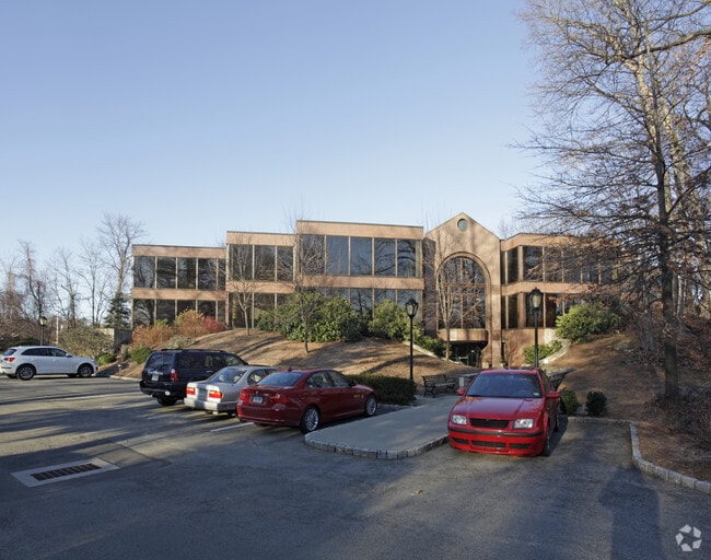
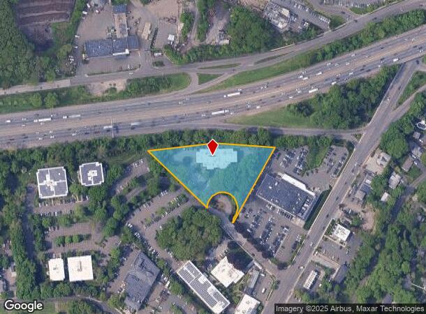
1 Thorndal Cir
Officebuilding
Fairfield
X
Connecticut
09001C0528G
1.96 AC
2025
Darien
2025
Westchester/So Connecticut
030400
Bridgeport-Stamford-Norwalk, CT
36,990 SF
DARI-000039-000000-000018
DEMOGRAPHICS near 1 Thorndal Cir
1 Mile
3 Mile
5 Mile
2024 Total Population
6,816
80,778
217,883
2029 Population
6,860
80,752
218,763
Pop Growth 2024-2029
+ 0.65%
(0.03%)
+ 0.40%
Average Age
39
39
39
2024 Total Households
2,266
29,472
84,540
HH Growth 2024-2029
+ 0.62%
(0.04%)
+ 0.58%
Median Household Inc
$235,439
$113,299
$100,366
Avg Household Size
3.00
2.70
2.50
2024 Avg HH Vehicles
2.00
2.00
2.00
Median Home Value
$1,056,396
$675,069
$619,412
Median Year Built
1953
1961
1969
Nearby Places
Map Layers
Map Styles
 Street
 Aerial
- Restaurants
- Banks
- Shops
- Fitness
- Groceries
PUBLIC TRANSPORTATION
COMMUTER RAIL
Darien Station (New Haven Line - Metro-North Commuter Railroad Company (Metro-North))
DRIVE
WALK
Distance
Darien Station (New Haven Line - Metro-North Commuter Railroad Company (Metro-North))
2 min
15 min
0.8 mi
Noroton Heights Station (New Haven Line - Metro-North Commuter Railroad Company (Metro-North))
DRIVE
WALK
Distance
Noroton Heights Station (New Haven Line - Metro-North Commuter Railroad Company (Metro-North))
4 min
1.5 mi
AIRPORT
Westchester County
DRIVE
WALK
Distance
Westchester County
28 min
16.6 mi
LaGuardia
DRIVE
WALK
Distance
LaGuardia
55 min
35.8 mi
Freight Ports
Port of New Haven
DRIVE
WALK
Distance
Port of New Haven
55 min
37.7 mi
SALE & LEASE HISTORY
LISTING DATE
SALE/LEASE

Sep 24, 2016
For Lease
Mar 16, 2021
For Lease
Nearby Properties
Address
Land Use
TOTAL SIZE
Lot Size
Zoning
Address
Land Use
TOTAL SIZE
Lot Size
Zoning
8.91 AC
DC
Address
Land Use
TOTAL SIZE
Lot Size
Zoning
336,000 SF
40 AC
MU
Address
Land Use
TOTAL SIZE
Lot Size
Zoning
9.62 AC
MZN
Address
Land Use
TOTAL SIZE
Lot Size
Zoning
79.29 AC
P
Address
Land Use
TOTAL SIZE
Lot Size
Zoning
32.68 AC
MD
Address
Land Use
TOTAL SIZE
Lot Size
Zoning
32.06 AC
DMR
Address
Land Use
TOTAL SIZE
Lot Size
Zoning
42.18 AC
P
Address
Land Use
TOTAL SIZE
Lot Size
Zoning
39,031 SF
451.38 AC
ADD
Address
Land Use
TOTAL SIZE
Lot Size
Zoning
124,373 SF
13.87 AC
A2
Address
Land Use
TOTAL SIZE
Lot Size
Zoning
13.56 AC
R75
Address
Land Use
TOTAL SIZE
Lot Size
Zoning
3.59 AC
RH
Address
Land Use
TOTAL SIZE
Lot Size
Zoning
17 AC
A2
Address
Land Use
TOTAL SIZE
Lot Size
Zoning
107,227 SF
12.89 AC
MD
Address
Land Use
TOTAL SIZE
Lot Size
Zoning
45.90 AC
R-1
Address
Land Use
TOTAL SIZE
Lot Size
Zoning
130,394 SF
28.72 AC
B
Address
Land Use
TOTAL SIZE
Lot Size
Zoning
171,335 SF
25.94 AC
MU
Address
Land Use
TOTAL SIZE
Lot Size
Zoning
58,269 SF
9.86 AC
MU
Address
Land Use
TOTAL SIZE
Lot Size
Zoning
9.76 AC
B1
Address
Land Use
TOTAL SIZE
Lot Size
Zoning
10.84 AC
R75
Address
Land Use
TOTAL SIZE
Lot Size
Zoning
132,185 SF
3.99 AC
DO
Address
Land Use
TOTAL SIZE
Lot Size
Zoning
7.84 AC
BD
Address
Land Use
TOTAL SIZE
Lot Size
Zoning
141,174 SF
10.75 AC
B2
Address
Land Use
TOTAL SIZE
Lot Size
Zoning
40.41 AC
P
Address
Land Use
TOTAL SIZE
Lot Size
Zoning
12.71 AC
B2
Address
Land Use
TOTAL SIZE
Lot Size
Zoning
9.60 AC
MU
Address
Land Use
TOTAL SIZE
Lot Size
Zoning
9.75 AC
B2
Address
Land Use
TOTAL SIZE
Lot Size
Zoning
96,563 SF
9.49 AC
DC
Address
Land Use
TOTAL SIZE
Lot Size
Zoning
110,309 SF
1.15 AC
MXD
Address
Land Use
TOTAL SIZE
Lot Size
Zoning
84,515 SF
16.31 AC
MU
Address
Land Use
TOTAL SIZE
Lot Size
Zoning
72,796 SF
8.30 AC
MU
The World's #1 Commercial Real Estate Marketplace
Connect with us
© 2025 CoStar Group
The information above has been obtained from sources believed reliable. While we do not doubt its accuracy we have not verified it and make no guarantee, warranty or representation about it. It is your responsibility to independently confirm its accuracy and completeness. Any projections, opinions, assumptions, or estimates used are for example only and do not represent the current or future performance of the property. The value of this transaction to you depends on tax and other factors which should be evaluated by your tax, financial, and legal advisors. You and your advisors should conduct a careful, independent investigation of the property to determine to your satisfaction the suitability of the property for your needs.