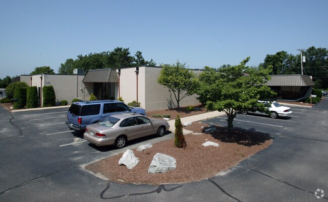
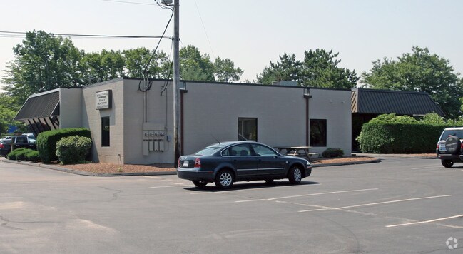
Property Record
1 Thurber Blvd, Smithfield, RI 02917

Property Detail
1 Thurber Blvd
SMIT-000046-000000-000087G
Providence
Commercialbuilding
Rhode Island
PC
87-g
B and X Area of moderate flood hazard, usually the area between the limits of the 100-year and 500-year floods.
1.87 AC
2025
Smithfield
2025
Providence
012601
Providence-Warwick, RI-MA
8,368 SF
NEARBY LISTINGS FOR SALE OR LEASE
DEMOGRAPHICS near 1 Thurber Blvd
1 mile
3 mile
5 mile
2025 Total Population
1,049
19,496
78,943
2030 Population
1,093
20,363
82,349
Pop Growth 2025-2030
+ 4.19%
+ 4.45%
+ 4.31%
Average Age
42
42
44
2025 Total Households
354
6,718
31,922
HH Growth 2025-2030
+ 4.80%
+ 4.91%
+ 4.41%
Median Household Inc
$118,749
$106,342
$99,652
Avg Household Size
2.40
2.40
2.30
2025 Avg HH Vehicles
2.00
2.00
2.00
Median Home Value
$457,142
$463,274
$429,604
Median Year Built
1980
1978
1974
Nearby Places
Map Layers
Map Styles
 Street
 Aerial
Layers
 Traffic
 Biking
Places
Listings with unknown addresses are not visible on the map
- Restaurants
- Banks
- Shops
- Fitness
- Groceries
PUBLIC TRANSPORTATION
COMMUTER RAIL
Pawtucket/Central Falls (Foxboro Event Service - MBTA, Providence/Stoughton Line - MBTA)
Drive
Walk
Distance
Pawtucket/Central Falls (Foxboro Event Service - MBTA, Providence/Stoughton Line - MBTA)
13 min
8.4 mi
Providence (Providence/Stoughton Line - Massachusetts Bay Transportation Authority Commuter Rail (Purple Line))
Drive
Walk
Distance
Providence (Providence/Stoughton Line - Massachusetts Bay Transportation Authority Commuter Rail (Purple Line))
14 min
9.1 mi
AIRPORT
Rhode Island Tf Green International
Drive
Walk
Distance
Rhode Island Tf Green International
26 min
17.7 mi
Freight Ports
Port of Davisville, RI
Drive
Walk
Distance
Port of Davisville, RI
38 min
26.9 mi
Nearby Properties
Address
Land Use
TOTAL SIZE
Lot Size
Zoning
Address
Land Use
TOTAL SIZE
Lot Size
Zoning
79.96 AC
PC
Address
Land Use
TOTAL SIZE
Lot Size
Zoning
89.07 AC
PD
Address
Land Use
TOTAL SIZE
Lot Size
Zoning
53.18 AC
C
Address
Land Use
TOTAL SIZE
Lot Size
Zoning
29.60 AC
PC
Address
Land Use
TOTAL SIZE
Lot Size
Zoning
32.17 AC
PC
Address
Land Use
TOTAL SIZE
Lot Size
Zoning
140,678 SF
37.04 AC
RA40
Address
Land Use
TOTAL SIZE
Lot Size
Zoning
55.86 AC
BL05
Address
Land Use
TOTAL SIZE
Lot Size
Zoning
315.90 AC
I
Address
Land Use
TOTAL SIZE
Lot Size
Zoning
166,368 SF
10.74 AC
R20
Address
Land Use
TOTAL SIZE
Lot Size
Zoning
115,802 SF
10.30 AC
PC
Address
Land Use
TOTAL SIZE
Lot Size
Zoning
Address
Land Use
TOTAL SIZE
Lot Size
Zoning
Address
Land Use
TOTAL SIZE
Lot Size
Zoning
285,678 SF
25 AC
ML05
Address
Land Use
TOTAL SIZE
Lot Size
Zoning
56,451 SF
5 AC
C
Address
Land Use
TOTAL SIZE
Lot Size
Zoning
22,868 SF
12.22 AC
R20
Address
Land Use
TOTAL SIZE
Lot Size
Zoning
124,397 SF
13.66 AC
C
Address
Land Use
TOTAL SIZE
Lot Size
Zoning
72.72 AC
PD
Address
Land Use
TOTAL SIZE
Lot Size
Zoning
109,549 SF
19.27 AC
PC
Address
Land Use
TOTAL SIZE
Lot Size
Zoning
89,788 SF
11.25 AC
R20
Address
Land Use
TOTAL SIZE
Lot Size
Zoning
123,800 SF
8.31 AC
Address
Land Use
TOTAL SIZE
Lot Size
Zoning
72,531 SF
11.70 AC
R20
Address
Land Use
TOTAL SIZE
Lot Size
Zoning
9.73 AC
RG7
Address
Land Use
TOTAL SIZE
Lot Size
Zoning
79,634 SF
8.79 AC
BL05
Address
Land Use
TOTAL SIZE
Lot Size
Zoning
20 AC
R20M
Address
Land Use
TOTAL SIZE
Lot Size
Zoning
64,156 SF
3 AC
PD
Address
Land Use
TOTAL SIZE
Lot Size
Zoning
54,645 SF
13.40 AC
RMED
Address
Land Use
TOTAL SIZE
Lot Size
Zoning
140,616 SF
16.20 AC
I
Address
Land Use
TOTAL SIZE
Lot Size
Zoning
215,575 SF
46.10 AC
I
Address
Land Use
TOTAL SIZE
Lot Size
Zoning
162,087 SF
15.40 AC
PC
Address
Land Use
TOTAL SIZE
Lot Size
Zoning
85,130 SF
4.40 AC
R20
The World's #1 Commercial Real Estate Marketplace
Connect with us
© 2026 CoStar Group
The information above has been obtained from sources believed reliable. While we do not doubt its accuracy we have not verified it and make no guarantee, warranty or representation about it. It is your responsibility to independently confirm its accuracy and completeness. Any projections, opinions, assumptions, or estimates used are for example only and do not represent the current or future performance of the property. The value of this transaction to you depends on tax and other factors which should be evaluated by your tax, financial, and legal advisors. You and your advisors should conduct a careful, independent investigation of the property to determine to your satisfaction the suitability of the property for your needs.