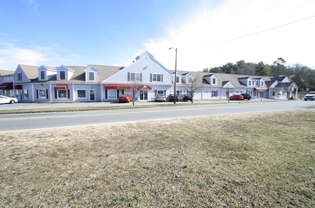
Property Record
1 Trowbridge Rd, Buzzards Bay, MA 02532

Property Detail
1 Trowbridge Rd
BOUR-000243-000000-000022
BARNSTABLE
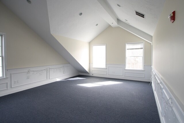
Medicalbuilding
Massachusetts
B and X Area of moderate flood hazard, usually the area between the limits of the 100-year and 500-year floods.
1.90 AC
2025
Cape Cod
2025
Other Market Areas
013900
Barnstable Town, MA
39,989 SF
NEARBY LISTINGS FOR SALE OR LEASE
-
-
View all Buzzards Bay listings for lease on LoopNet.com
DEMOGRAPHICS near 1 Trowbridge Rd
1 mile
3 mile
5 mile
2025 Total Population
3,312
14,361
32,733
2030 Population
3,218
14,236
32,661
Pop Growth 2025-2030
(2.84%)
(0.87%)
(0.22%)
Average Age
42
46
46
2025 Total Households
1,189
5,988
13,622
HH Growth 2025-2030
(3.28%)
(1.05%)
(0.53%)
Median Household Inc
$93,939
$90,494
$96,580
Avg Household Size
2.00
2.10
2.20
2025 Avg HH Vehicles
2.00
2.00
2.00
Median Home Value
$585,697
$521,053
$497,017
Median Year Built
1974
1970
1972
Nearby Places
Map Layers
Map Styles
 Street
 Aerial
Transit
 Traffic
 Biking
Places
Listings with unknown addresses are not visible on the map
- Restaurants
- Banks
- Shops
- Fitness
- Groceries
PUBLIC TRANSPORTATION
COMMUTER RAIL
Bourne (CapeFLYER - Cape Cod Regional Transit Authority)
Drive
Walk
Distance
Bourne (CapeFLYER - Cape Cod Regional Transit Authority)
2 min
17 min
0.9 mi
Buzzards Bay (CapeFLYER - Cape Cod Regional Transit Authority)
Drive
Walk
Distance
Buzzards Bay (CapeFLYER - Cape Cod Regional Transit Authority)
8 min
4.1 mi
AIRPORT
Martha's Vineyard
Drive
Walk
Distance
Martha's Vineyard
88 min
31.1 mi
Freight Ports
Port of New Bedford Harbor
Drive
Walk
Distance
Port of New Bedford Harbor
38 min
28.4 mi
SALE & LEASE HISTORY
LISTING DATE
SALE/LEASE

Sep 25, 2016
For Lease
Sep 20, 2022
For Sale
Oct 13, 2017
For Lease
Jun 29, 2023
For Lease
Jun 27, 2023
For Lease
Jan 03, 2023
For Lease
Aug 04, 2023
For Lease
Nearby Properties
Address
Land Use
TOTAL SIZE
Lot Size
Zoning
Address
Land Use
TOTAL SIZE
Lot Size
Zoning
18.82 AC
R40
Address
Land Use
TOTAL SIZE
Lot Size
Zoning
75.70 AC
R40
Address
Land Use
TOTAL SIZE
Lot Size
Zoning
1,758 SF
269.51 AC
R40
Address
Land Use
TOTAL SIZE
Lot Size
Zoning
106,987 SF
3.95 AC
Address
Land Use
TOTAL SIZE
Lot Size
Zoning
46 AC
R40
Address
Land Use
TOTAL SIZE
Lot Size
Zoning
68,120 SF
119.50 AC
B-2
Address
Land Use
TOTAL SIZE
Lot Size
Zoning
15,716 SF
7.85 AC
R40
Address
Land Use
TOTAL SIZE
Lot Size
Zoning
11,930 SF
4.81 AC
Address
Land Use
TOTAL SIZE
Lot Size
Zoning
35,732 SF
289.94 AC
R40
Address
Land Use
TOTAL SIZE
Lot Size
Zoning
73,483 SF
16.18 AC
Address
Land Use
TOTAL SIZE
Lot Size
Zoning
67,216 SF
2.70 AC
DTD
Address
Land Use
TOTAL SIZE
Lot Size
Zoning
74.05 AC
B-3
Address
Land Use
TOTAL SIZE
Lot Size
Zoning
68.53 AC
R40
Address
Land Use
TOTAL SIZE
Lot Size
Zoning
125,493 SF
5.59 AC
DTD
Address
Land Use
TOTAL SIZE
Lot Size
Zoning
208 SF
125.13 AC
SDD
Address
Land Use
TOTAL SIZE
Lot Size
Zoning
27,958 SF
5.85 AC
R40
Address
Land Use
TOTAL SIZE
Lot Size
Zoning
57,942 SF
7.20 AC
Address
Land Use
TOTAL SIZE
Lot Size
Zoning
4,214 SF
13.85 AC
Address
Land Use
TOTAL SIZE
Lot Size
Zoning
45.85 AC
Address
Land Use
TOTAL SIZE
Lot Size
Zoning
26,053 SF
1.26 AC
Address
Land Use
TOTAL SIZE
Lot Size
Zoning
2.82 AC
Address
Land Use
TOTAL SIZE
Lot Size
Zoning
17.47 AC
Address
Land Use
TOTAL SIZE
Lot Size
Zoning
1,452 SF
6.70 AC
Address
Land Use
TOTAL SIZE
Lot Size
Zoning
4,959 SF
2.30 AC
Address
Land Use
TOTAL SIZE
Lot Size
Zoning
30,195 SF
0.82 AC
Address
Land Use
TOTAL SIZE
Lot Size
Zoning
Address
Land Use
TOTAL SIZE
Lot Size
Zoning
24,100 SF
3.03 AC
Address
Land Use
TOTAL SIZE
Lot Size
Zoning
2,024 SF
10.57 AC
R40
Address
Land Use
TOTAL SIZE
Lot Size
Zoning
Address
Land Use
TOTAL SIZE
Lot Size
Zoning
10.02 AC
R40
The World's #1 Commercial Real Estate Marketplace
Connect with us
© 2026 CoStar Group
The information above has been obtained from sources believed reliable. While we do not doubt its accuracy we have not verified it and make no guarantee, warranty or representation about it. It is your responsibility to independently confirm its accuracy and completeness. Any projections, opinions, assumptions, or estimates used are for example only and do not represent the current or future performance of the property. The value of this transaction to you depends on tax and other factors which should be evaluated by your tax, financial, and legal advisors. You and your advisors should conduct a careful, independent investigation of the property to determine to your satisfaction the suitability of the property for your needs.