Property Record
1 Tupperware Dr, North Smithfield, RI 02896
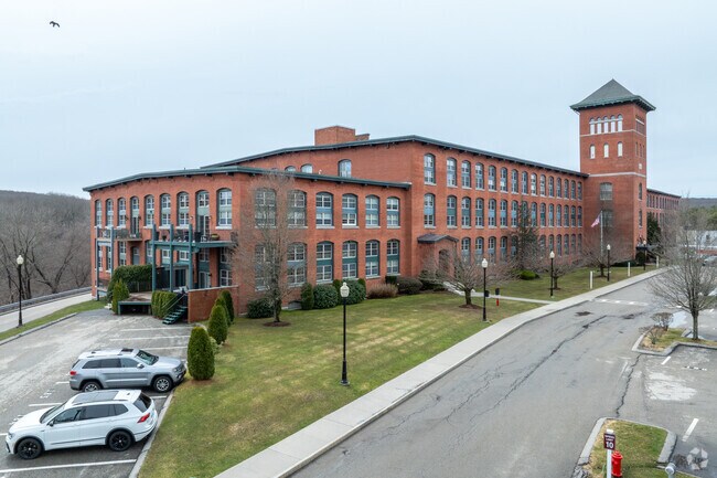


Property Detail
1 Tupperware Dr
NSMI-000003-000000-000242
Providence
Industrialgeneral
Rhode Island
M
242
B and X Area of moderate flood hazard, usually the area between the limits of the 100-year and 500-year floods.
1.96 AC
2025
Northeastern Providence County
2025
Providence
012801
Providence-Warwick, RI-MA
6,400 SF
NEARBY LISTINGS FOR SALE OR LEASE
DEMOGRAPHICS near 1 Tupperware Dr
1 mile
3 mile
5 mile
2025 Total Population
5,139
57,201
90,651
2030 Population
5,273
58,838
93,573
Pop Growth 2025-2030
+ 2.61%
+ 2.86%
+ 3.22%
Average Age
45
40
41
2025 Total Households
2,198
23,803
36,686
HH Growth 2025-2030
+ 2.73%
+ 2.91%
+ 3.25%
Median Household Inc
$88,306
$69,452
$77,669
Avg Household Size
2.20
2.30
2.40
2025 Avg HH Vehicles
2.00
2.00
2.00
Median Home Value
$450,209
$393,100
$411,274
Median Year Built
1969
1952
1961
Nearby Places
Map Layers
Map Styles
 Street
 Aerial
Layers
 Traffic
 Biking
Places
Listings with unknown addresses are not visible on the map
- Restaurants
- Banks
- Shops
- Fitness
- Groceries
PUBLIC TRANSPORTATION
AIRPORT
Rhode Island Tf Green International
Drive
Walk
Distance
Rhode Island Tf Green International
41 min
26.9 mi
Worcester Regional
Drive
Walk
Distance
Worcester Regional
45 min
31.5 mi
Freight Ports
Port of Davisville, RI
Drive
Walk
Distance
Port of Davisville, RI
55 min
38.7 mi
Nearby Properties
Address
Land Use
TOTAL SIZE
Lot Size
Zoning
Address
Land Use
TOTAL SIZE
Lot Size
Zoning
16.88 AC
I1
Address
Land Use
TOTAL SIZE
Lot Size
Zoning
210,008 SF
13.95 AC
C1
Address
Land Use
TOTAL SIZE
Lot Size
Zoning
7,580 SF
32.61 AC
R4
Address
Land Use
TOTAL SIZE
Lot Size
Zoning
31.45 AC
M
Address
Land Use
TOTAL SIZE
Lot Size
Zoning
16.49 AC
PR1
Address
Land Use
TOTAL SIZE
Lot Size
Zoning
1 AC
R4
Address
Land Use
TOTAL SIZE
Lot Size
Zoning
118,550 SF
31.97 AC
Address
Land Use
TOTAL SIZE
Lot Size
Zoning
8,930 SF
31.56 AC
R4
Address
Land Use
TOTAL SIZE
Lot Size
Zoning
150,385 SF
27.10 AC
Address
Land Use
TOTAL SIZE
Lot Size
Zoning
Address
Land Use
TOTAL SIZE
Lot Size
Zoning
46,267 SF
1.89 AC
R4
Address
Land Use
TOTAL SIZE
Lot Size
Zoning
157,856 SF
2.13 AC
C2
Address
Land Use
TOTAL SIZE
Lot Size
Zoning
34.30 AC
M
Address
Land Use
TOTAL SIZE
Lot Size
Zoning
23.36 AC
Address
Land Use
TOTAL SIZE
Lot Size
Zoning
72,880 SF
4.30 AC
BH
Address
Land Use
TOTAL SIZE
Lot Size
Zoning
115,203 SF
15.52 AC
RA
Address
Land Use
TOTAL SIZE
Lot Size
Zoning
27,720 SF
4.36 AC
I
Address
Land Use
TOTAL SIZE
Lot Size
Zoning
65,093 SF
4.65 AC
R4
Address
Land Use
TOTAL SIZE
Lot Size
Zoning
96,714 SF
2.11 AC
R4
Address
Land Use
TOTAL SIZE
Lot Size
Zoning
89,159 SF
2.33 AC
R4
Address
Land Use
TOTAL SIZE
Lot Size
Zoning
60,999 SF
6.01 AC
R3
Address
Land Use
TOTAL SIZE
Lot Size
Zoning
109,351 SF
2.35 AC
MU2
Address
Land Use
TOTAL SIZE
Lot Size
Zoning
95,337 SF
1.84 AC
R4
Address
Land Use
TOTAL SIZE
Lot Size
Zoning
45,156 SF
0.71 AC
C1
Address
Land Use
TOTAL SIZE
Lot Size
Zoning
83,040 SF
2.17 AC
R4
Address
Land Use
TOTAL SIZE
Lot Size
Zoning
65,809 SF
17.66 AC
BN
Address
Land Use
TOTAL SIZE
Lot Size
Zoning
61,008 SF
6.46 AC
BH
Address
Land Use
TOTAL SIZE
Lot Size
Zoning
43,796 SF
10.45 AC
R3
Address
Land Use
TOTAL SIZE
Lot Size
Zoning
4,440 SF
5.73 AC
R2
Address
Land Use
TOTAL SIZE
Lot Size
Zoning
91,077 SF
2.03 AC
PR1
The World's #1 Commercial Real Estate Marketplace
Connect with us
© 2026 CoStar Group
The information above has been obtained from sources believed reliable. While we do not doubt its accuracy we have not verified it and make no guarantee, warranty or representation about it. It is your responsibility to independently confirm its accuracy and completeness. Any projections, opinions, assumptions, or estimates used are for example only and do not represent the current or future performance of the property. The value of this transaction to you depends on tax and other factors which should be evaluated by your tax, financial, and legal advisors. You and your advisors should conduct a careful, independent investigation of the property to determine to your satisfaction the suitability of the property for your needs.