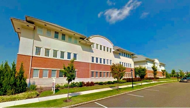
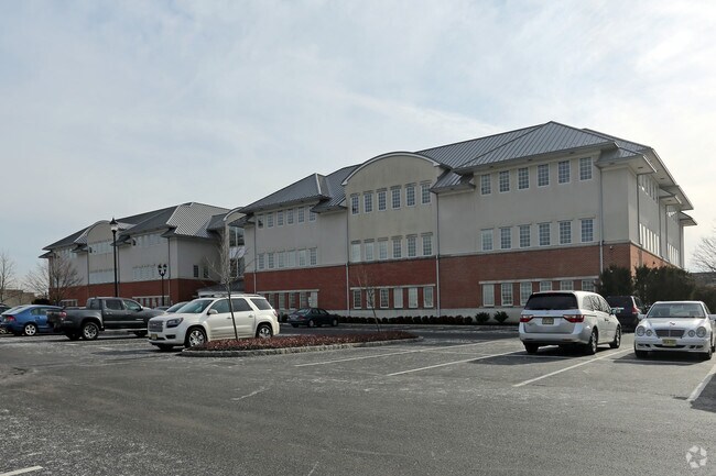
Property Record
1 Union St, Robbinsville, NJ 08691

Current Lease Availabilities
NEARBY LISTINGS FOR SALE OR LEASE
Property Detail
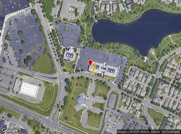
1 Union St
12-00003-49-00023-0000-C0005
Mercer
Officebuilding
New Jersey
X
23
34021C0232F
3.10 AC
2024
Trenton
2025
Northern New Jersey
004311
Trenton, NJ
DEMOGRAPHICS near 1 Union St
1 Mile
3 Mile
5 Mile
2024 Total Population
10,493
41,784
114,203
2029 Population
10,466
41,223
112,615
Pop Growth 2024-2029
(0.26%)
(1.34%)
(1.39%)
Average Age
41
44
43
2024 Total Households
4,038
16,297
43,700
HH Growth 2024-2029
(0.37%)
(1.53%)
(1.56%)
Median Household Inc
$125,496
$113,052
$106,451
Avg Household Size
2.60
2.50
2.60
2024 Avg HH Vehicles
2.00
2.00
2.00
Median Home Value
$334,756
$331,027
$322,597
Median Year Built
1988
1981
1972
Nearby Places
- Restaurants
- Banks
- Shops
- Fitness
- Groceries
PUBLIC TRANSPORTATION
COMMUTER RAIL
Hamilton (Northeast Corridor Line - NJ Transit Commuter Rail (NJ Transit))
DRIVE
WALK
Distance
Hamilton (Northeast Corridor Line - NJ Transit Commuter Rail (NJ Transit))
12 min
5.4 mi
Trenton Transit Center (Njt) (Northeast Corridor Line - NJ Transit Commuter Rail (NJ Transit), R7 - NJ Transit Commuter Rail (NJ Transit), River LINE - NJ Transit Commuter Rail (NJ Transit))
DRIVE
WALK
Distance
Trenton Transit Center (Njt) (Northeast Corridor Line - NJ Transit Commuter Rail (NJ Transit), R7 - NJ Transit Commuter Rail (NJ Transit), River LINE - NJ Transit Commuter Rail (NJ Transit))
15 min
7.2 mi
AIRPORT
Trenton Mercer
DRIVE
WALK
Distance
Trenton Mercer
24 min
16.0 mi
Freight Ports
Port of Philadelphia
DRIVE
WALK
Distance
Port of Philadelphia
51 min
37.8 mi
Nearby Properties
Address
Land Use
TOTAL SIZE
Lot Size
Zoning
Address
Land Use
TOTAL SIZE
Lot Size
Zoning
40.83 AC
E
Address
Land Use
TOTAL SIZE
Lot Size
Zoning
31.05 AC
Address
Land Use
TOTAL SIZE
Lot Size
Zoning
23.13 AC
RD
Address
Land Use
TOTAL SIZE
Lot Size
Zoning
64.43 AC
PCD
Address
Land Use
TOTAL SIZE
Lot Size
Zoning
30.94 AC
Address
Land Use
TOTAL SIZE
Lot Size
Zoning
60.26 AC
RD
Address
Land Use
TOTAL SIZE
Lot Size
Zoning
44.82 AC
RD
Address
Land Use
TOTAL SIZE
Lot Size
Zoning
2,030 SF
45.57 AC
Address
Land Use
TOTAL SIZE
Lot Size
Zoning
Address
Land Use
TOTAL SIZE
Lot Size
Zoning
18.33 AC
Address
Land Use
TOTAL SIZE
Lot Size
Zoning
17.84 AC
HC
Address
Land Use
TOTAL SIZE
Lot Size
Zoning
Address
Land Use
TOTAL SIZE
Lot Size
Zoning
23.13 AC
RR
Address
Land Use
TOTAL SIZE
Lot Size
Zoning
56.90 AC
RD
Address
Land Use
TOTAL SIZE
Lot Size
Zoning
50.05 AC
RR
Address
Land Use
TOTAL SIZE
Lot Size
Zoning
1,836 SF
33.91 AC
RD
Address
Land Use
TOTAL SIZE
Lot Size
Zoning
9.63 AC
RD
Address
Land Use
TOTAL SIZE
Lot Size
Zoning
Address
Land Use
TOTAL SIZE
Lot Size
Zoning
15.80 AC
C
Address
Land Use
TOTAL SIZE
Lot Size
Zoning
28.36 AC
E
Address
Land Use
TOTAL SIZE
Lot Size
Zoning
21.62 AC
RD
Address
Land Use
TOTAL SIZE
Lot Size
Zoning
Address
Land Use
TOTAL SIZE
Lot Size
Zoning
38.78 AC
PCD
Address
Land Use
TOTAL SIZE
Lot Size
Zoning
9.31 AC
HC
Address
Land Use
TOTAL SIZE
Lot Size
Zoning
60,564 SF
18.37 AC
RD
Address
Land Use
TOTAL SIZE
Lot Size
Zoning
77,722 SF
39.13 AC
Address
Land Use
TOTAL SIZE
Lot Size
Zoning
17.06 AC
RD
Address
Land Use
TOTAL SIZE
Lot Size
Zoning
2.89 AC
RD
Address
Land Use
TOTAL SIZE
Lot Size
Zoning
55.49 AC
RD
Address
Land Use
TOTAL SIZE
Lot Size
Zoning
27.89 AC
C
The World's #1 Commercial Real Estate Marketplace
Connect with us
© 2025 CoStar Group
The information above has been obtained from sources believed reliable. While we do not doubt its accuracy we have not verified it and make no guarantee, warranty or representation about it. It is your responsibility to independently confirm its accuracy and completeness. Any projections, opinions, assumptions, or estimates used are for example only and do not represent the current or future performance of the property. The value of this transaction to you depends on tax and other factors which should be evaluated by your tax, financial, and legal advisors. You and your advisors should conduct a careful, independent investigation of the property to determine to your satisfaction the suitability of the property for your needs.