Property Record
1 W Main St, Macedon, NY 14502
NEARBY LISTINGS FOR SALE OR LEASE
-
-
View all Macedon listings for sale on LoopNet.com
Property Detail
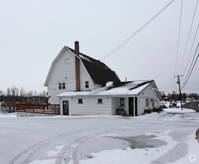
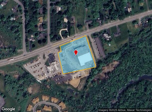
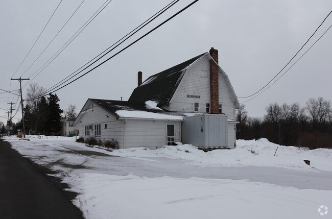
1 W Main St
Rochester, NY
GAETANO'S RESTAURANT 30111-07-528748
543000-062-111-0007-561-756-0000
Wayne
Vehiclerentalsvehiclesales
New York
2024
561.756
2024
3.14 AC
020302
Wayne County
25,541 SF
Rochester
DEMOGRAPHICS near 1 W Main St
1 Mile
3 Mile
5 Mile
2024 Total Population
2,019
6,374
25,395
2029 Population
2,011
6,338
25,157
Pop Growth 2024-2029
(0.40%)
(0.56%)
(0.94%)
Average Age
45
44
42
2024 Total Households
910
2,665
10,108
HH Growth 2024-2029
(0.44%)
(0.64%)
(0.98%)
Median Household Inc
$65,000
$73,504
$86,913
Avg Household Size
2.20
2.30
2.50
2024 Avg HH Vehicles
1.00
2.00
2.00
Median Home Value
$146,043
$164,954
$188,161
Median Year Built
1985
1978
1980
Nearby Places
Map Layers
Map Styles
 Street
 Aerial
- Restaurants
- Banks
- Shops
- Fitness
- Groceries
PUBLIC TRANSPORTATION
AIRPORT
Frederick Douglass/Greater Rochester International
DRIVE
WALK
Distance
Frederick Douglass/Greater Rochester International
33 min
20.5 mi
Freight Ports
Albany, NY Port
DRIVE
WALK
Distance
Albany, NY Port
250 min
211.3 mi
Nearby Properties
Address
Land Use
TOTAL SIZE
Lot Size
Zoning
Address
Land Use
TOTAL SIZE
Lot Size
Zoning
203,819 SF
21.83 AC
Address
Land Use
TOTAL SIZE
Lot Size
Zoning
171,069 SF
15.77 AC
05 - COMME
Address
Land Use
TOTAL SIZE
Lot Size
Zoning
11,144 SF
24.17 AC
05 - COMME
Address
Land Use
TOTAL SIZE
Lot Size
Zoning
2.73 AC
Address
Land Use
TOTAL SIZE
Lot Size
Zoning
88,818 SF
7.67 AC
Address
Land Use
TOTAL SIZE
Lot Size
Zoning
25,725 SF
4.02 AC
Address
Land Use
TOTAL SIZE
Lot Size
Zoning
0.52 AC
Address
Land Use
TOTAL SIZE
Lot Size
Zoning
16,000 SF
6.29 AC
Address
Land Use
TOTAL SIZE
Lot Size
Zoning
55,180 SF
22.91 AC
05 - COMME
Address
Land Use
TOTAL SIZE
Lot Size
Zoning
30,240 SF
2.91 AC
05 - COMME
Address
Land Use
TOTAL SIZE
Lot Size
Zoning
31,509 SF
1.87 AC
CON
Address
Land Use
TOTAL SIZE
Lot Size
Zoning
44.80 AC
Address
Land Use
TOTAL SIZE
Lot Size
Zoning
58.11 AC
Address
Land Use
TOTAL SIZE
Lot Size
Zoning
10,125 SF
2.42 AC
Address
Land Use
TOTAL SIZE
Lot Size
Zoning
110,360 SF
8.45 AC
GC
Address
Land Use
TOTAL SIZE
Lot Size
Zoning
69,078 SF
6.80 AC
05 - COMME
Address
Land Use
TOTAL SIZE
Lot Size
Zoning
3.40 AC
Address
Land Use
TOTAL SIZE
Lot Size
Zoning
42,685 SF
6 AC
06 - INDUS
Address
Land Use
TOTAL SIZE
Lot Size
Zoning
4,556 SF
1.58 AC
05 - COMME
Address
Land Use
TOTAL SIZE
Lot Size
Zoning
58,400 SF
5.34 AC
Address
Land Use
TOTAL SIZE
Lot Size
Zoning
63,806 SF
3.93 AC
06 - INDUS
Address
Land Use
TOTAL SIZE
Lot Size
Zoning
18,938 SF
58.50 AC
ORM
Address
Land Use
TOTAL SIZE
Lot Size
Zoning
24.51 AC
Address
Land Use
TOTAL SIZE
Lot Size
Zoning
41,875 SF
3.71 AC
06 - INDUS
Address
Land Use
TOTAL SIZE
Lot Size
Zoning
840 SF
15.45 AC
05 - COMME
Address
Land Use
TOTAL SIZE
Lot Size
Zoning
2,600 SF
142.18 AC
05 - COMME
Address
Land Use
TOTAL SIZE
Lot Size
Zoning
7,825 SF
2.57 AC
GC
Address
Land Use
TOTAL SIZE
Lot Size
Zoning
16,628 SF
3.13 AC
05 - COMME
Address
Land Use
TOTAL SIZE
Lot Size
Zoning
34,700 SF
6.90 AC
The World's #1 Commercial Real Estate Marketplace
Connect with us
© 2026 CoStar Group
The information above has been obtained from sources believed reliable. While we do not doubt its accuracy we have not verified it and make no guarantee, warranty or representation about it. It is your responsibility to independently confirm its accuracy and completeness. Any projections, opinions, assumptions, or estimates used are for example only and do not represent the current or future performance of the property. The value of this transaction to you depends on tax and other factors which should be evaluated by your tax, financial, and legal advisors. You and your advisors should conduct a careful, independent investigation of the property to determine to your satisfaction the suitability of the property for your needs.