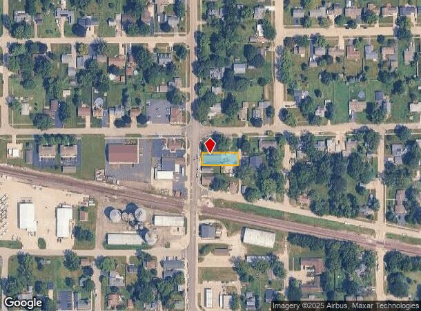
Property Record
12 S Somonauk Rd, Cortland, IL 60112
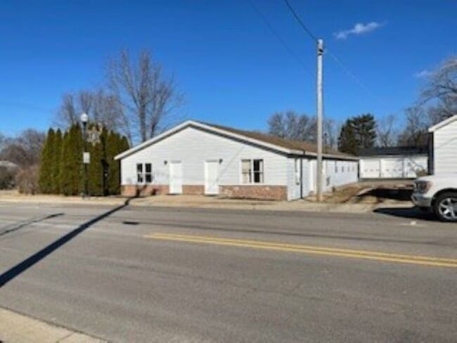
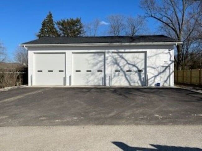
This Property Is For Sale
NEARBY LISTINGS FOR SALE OR LEASE
Property Detail
12 S Somonauk Rd
Chicago-Naperville-Elgin, IL-IN-WI
Cortland (Original Town)
09-29-201-002
DeKalb
Residentialnec
Illinois
X
0.18 AC
17037C0275E
Western East/West Corr
3,200 SF
Chicago
DEMOGRAPHICS near 12 S Somonauk Rd
1 Mile
3 Mile
5 Mile
2024 Total Population
3,386
11,329
58,583
2029 Population
3,433
11,339
58,727
Pop Growth 2024-2029
+ 1.39%
+ 0.09%
+ 0.25%
Average Age
38
38
36
2024 Total Households
1,242
4,411
22,954
HH Growth 2024-2029
+ 1.29%
(0.02%)
+ 0.25%
Median Household Inc
$87,176
$67,763
$62,463
Avg Household Size
2.70
2.50
2.30
2024 Avg HH Vehicles
2.00
2.00
2.00
Median Home Value
$214,222
$181,458
$220,312
Median Year Built
1995
1971
1977
Nearby Places
- Restaurants
- Banks
- Shops
- Fitness
- Groceries
PUBLIC TRANSPORTATION
AIRPORT
Chicago/Rockford International
DRIVE
WALK
Distance
Chicago/Rockford International
59 min
43.8 mi
Nearby Properties
Address
Land Use
TOTAL SIZE
Lot Size
Zoning
Address
Land Use
TOTAL SIZE
Lot Size
Zoning
49.71 AC
Address
Land Use
TOTAL SIZE
Lot Size
Zoning
49.73 AC
Address
Land Use
TOTAL SIZE
Lot Size
Zoning
98.56 AC
Address
Land Use
TOTAL SIZE
Lot Size
Zoning
47.87 AC
Address
Land Use
TOTAL SIZE
Lot Size
Zoning
21.61 AC
Address
Land Use
TOTAL SIZE
Lot Size
Zoning
25.70 AC
Address
Land Use
TOTAL SIZE
Lot Size
Zoning
Address
Land Use
TOTAL SIZE
Lot Size
Zoning
Address
Land Use
TOTAL SIZE
Lot Size
Zoning
29,732 SF
3.66 AC
Address
Land Use
TOTAL SIZE
Lot Size
Zoning
20.83 AC
Address
Land Use
TOTAL SIZE
Lot Size
Zoning
8.14 AC
Address
Land Use
TOTAL SIZE
Lot Size
Zoning
21.35 AC
Address
Land Use
TOTAL SIZE
Lot Size
Zoning
23.25 AC
Address
Land Use
TOTAL SIZE
Lot Size
Zoning
202,500 SF
15.65 AC
Address
Land Use
TOTAL SIZE
Lot Size
Zoning
240 SF
7.46 AC
Address
Land Use
TOTAL SIZE
Lot Size
Zoning
8.46 AC
Address
Land Use
TOTAL SIZE
Lot Size
Zoning
3.84 AC
Address
Land Use
TOTAL SIZE
Lot Size
Zoning
11.54 AC
A1
Address
Land Use
TOTAL SIZE
Lot Size
Zoning
31.11 AC
A1
Address
Land Use
TOTAL SIZE
Lot Size
Zoning
7.57 AC
Address
Land Use
TOTAL SIZE
Lot Size
Zoning
6.75 AC
Address
Land Use
TOTAL SIZE
Lot Size
Zoning
9.66 AC
Address
Land Use
TOTAL SIZE
Lot Size
Zoning
16.23 AC
Address
Land Use
TOTAL SIZE
Lot Size
Zoning
2.87 AC
Address
Land Use
TOTAL SIZE
Lot Size
Zoning
4.91 AC
Address
Land Use
TOTAL SIZE
Lot Size
Zoning
92.65 AC
Address
Land Use
TOTAL SIZE
Lot Size
Zoning
Address
Land Use
TOTAL SIZE
Lot Size
Zoning
4.08 AC
Address
Land Use
TOTAL SIZE
Lot Size
Zoning
9.12 AC
Address
Land Use
TOTAL SIZE
Lot Size
Zoning
2.08 AC
The World's #1 Commercial Real Estate Marketplace
Connect with us
© 2025 CoStar Group
The information above has been obtained from sources believed reliable. While we do not doubt its accuracy we have not verified it and make no guarantee, warranty or representation about it. It is your responsibility to independently confirm its accuracy and completeness. Any projections, opinions, assumptions, or estimates used are for example only and do not represent the current or future performance of the property. The value of this transaction to you depends on tax and other factors which should be evaluated by your tax, financial, and legal advisors. You and your advisors should conduct a careful, independent investigation of the property to determine to your satisfaction the suitability of the property for your needs.