Property Record
10 Arthur Dr, Lynn Haven, FL 32444
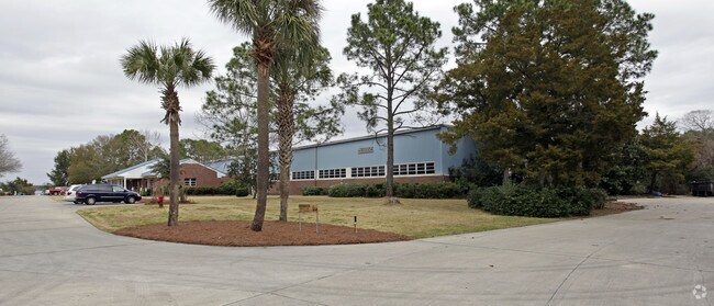


Property Detail
10 Arthur Dr
08922-010-000
6/7/8/9 3S 14W -3.3- 89C/89D COM AT SW COR OF INTERSECTION 10TH & KENTUCKY AV LH TH S 115.8 W 88.82 WLY 6124.19 FOR POB S 31.24 SWLY 550.69 W 670.18 NELY TO PT S 730.45 TO POB ORB 1337 P 1867 ORB 2634 P 627 ORB 2724 P 514
Heavyindustrial
BAY
COM
Florida
AE The base floodplain where base flood elevations are provided. AE Zones are now used on new format FIRMs instead of A1-A30 Zones.
19.60 AC
2024
Panama City
2025
Other Market Areas
001404
Panama City-Panama City Beach, FL
61,523 SF
NEARBY LISTINGS FOR SALE OR LEASE
DEMOGRAPHICS near 10 Arthur Dr
1 mile
3 mile
5 mile
2025 Total Population
675
18,547
45,592
2030 Population
718
20,103
49,794
Pop Growth 2025-2030
+ 6.37%
+ 8.39%
+ 9.22%
Average Age
42
40
40
2025 Total Households
244
7,220
17,619
HH Growth 2025-2030
+ 6.56%
+ 8.49%
+ 9.44%
Median Household Inc
$122,442
$79,526
$78,773
Avg Household Size
2.70
2.50
2.50
2025 Avg HH Vehicles
2.00
2.00
2.00
Median Home Value
$360,465
$321,953
$320,903
Median Year Built
1986
1990
1988
Nearby Places
Map Layers
Map Styles
 Street
 Aerial
Layers
 Traffic
 Biking
Places
Listings with unknown addresses are not visible on the map
- Restaurants
- Banks
- Shops
- Fitness
- Groceries
PUBLIC TRANSPORTATION
AIRPORT
Northwest Florida Beaches International
Drive
Walk
Distance
Northwest Florida Beaches International
35 min
19.4 mi
Freight Ports
Port of Panama City
Drive
Walk
Distance
Port of Panama City
21 min
8.1 mi
Nearby Properties
Address
Land Use
TOTAL SIZE
Lot Size
Zoning
Address
Land Use
TOTAL SIZE
Lot Size
Zoning
455,239 SF
11.87 AC
PC11
Address
Land Use
TOTAL SIZE
Lot Size
Zoning
279,378 SF
13.24 AC
PC07
Address
Land Use
TOTAL SIZE
Lot Size
Zoning
239,259 SF
15.86 AC
UND
Address
Land Use
TOTAL SIZE
Lot Size
Zoning
252,630 SF
10.70 AC
Address
Land Use
TOTAL SIZE
Lot Size
Zoning
281,578 SF
21.66 AC
UND
Address
Land Use
TOTAL SIZE
Lot Size
Zoning
30,349 SF
15.70 AC
PC11
Address
Land Use
TOTAL SIZE
Lot Size
Zoning
206,758 SF
25.65 AC
SB
Address
Land Use
TOTAL SIZE
Lot Size
Zoning
88,106 SF
12.22 AC
PC11
Address
Land Use
TOTAL SIZE
Lot Size
Zoning
263,140 SF
650 AC
BC13
Address
Land Use
TOTAL SIZE
Lot Size
Zoning
90,834 SF
3.04 AC
UND
Address
Land Use
TOTAL SIZE
Lot Size
Zoning
64,000 SF
9.84 AC
UND
Address
Land Use
TOTAL SIZE
Lot Size
Zoning
157,600 SF
17.68 AC
UND
Address
Land Use
TOTAL SIZE
Lot Size
Zoning
135,852 SF
34.90 AC
C5
Address
Land Use
TOTAL SIZE
Lot Size
Zoning
131,236 SF
9.17 AC
PC09
Address
Land Use
TOTAL SIZE
Lot Size
Zoning
100,582 SF
4.45 AC
Address
Land Use
TOTAL SIZE
Lot Size
Zoning
94,000 SF
19.92 AC
PC09
Address
Land Use
TOTAL SIZE
Lot Size
Zoning
139,911 SF
37.43 AC
PSP
Address
Land Use
TOTAL SIZE
Lot Size
Zoning
42,776 SF
10.40 AC
UND
Address
Land Use
TOTAL SIZE
Lot Size
Zoning
91,484 SF
9.39 AC
RB
Address
Land Use
TOTAL SIZE
Lot Size
Zoning
102,538 SF
12 AC
PC11
Address
Land Use
TOTAL SIZE
Lot Size
Zoning
123,800 SF
4 AC
RB
Address
Land Use
TOTAL SIZE
Lot Size
Zoning
135,994 SF
7.97 AC
PC05
Address
Land Use
TOTAL SIZE
Lot Size
Zoning
44,304 SF
5 AC
UND
Address
Land Use
TOTAL SIZE
Lot Size
Zoning
42,809 SF
0.77 AC
PSP
Address
Land Use
TOTAL SIZE
Lot Size
Zoning
117,108 SF
8.45 AC
UND
Address
Land Use
TOTAL SIZE
Lot Size
Zoning
18,048 SF
3.50 AC
PC11
Address
Land Use
TOTAL SIZE
Lot Size
Zoning
41,220 SF
14.40 AC
BC14
Address
Land Use
TOTAL SIZE
Lot Size
Zoning
12,000 SF
5.97 AC
PC11
Address
Land Use
TOTAL SIZE
Lot Size
Zoning
31,680 SF
5 AC
UND
Address
Land Use
TOTAL SIZE
Lot Size
Zoning
19,056 SF
3.25 AC
The World's #1 Commercial Real Estate Marketplace
Connect with us
© 2026 CoStar Group
The information above has been obtained from sources believed reliable. While we do not doubt its accuracy we have not verified it and make no guarantee, warranty or representation about it. It is your responsibility to independently confirm its accuracy and completeness. Any projections, opinions, assumptions, or estimates used are for example only and do not represent the current or future performance of the property. The value of this transaction to you depends on tax and other factors which should be evaluated by your tax, financial, and legal advisors. You and your advisors should conduct a careful, independent investigation of the property to determine to your satisfaction the suitability of the property for your needs.