Property Record
10 Birdseye Rd, Farmington, CT 06032


Property Detail
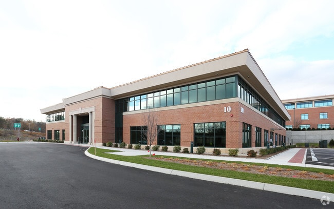
10 Birdseye Rd
Medicalbuilding
Capitol
MOC
Connecticut
B and X Area of moderate flood hazard, usually the area between the limits of the 100-year and 500-year floods.
2.46 AC
2025
Farmington
2025
Hartford
460202
Hartford-West Hartford-East Hartford, CT
36,000 SF
0093 7
NEARBY LISTINGS FOR SALE OR LEASE
DEMOGRAPHICS near 10 Birdseye Rd
1 mile
3 mile
5 mile
2025 Total Population
2,813
38,617
170,544
2030 Population
2,921
39,354
173,126
Pop Growth 2025-2030
+ 3.84%
+ 1.91%
+ 1.51%
Average Age
45
43
41
2025 Total Households
1,181
15,934
69,006
HH Growth 2025-2030
+ 3.81%
+ 1.95%
+ 1.57%
Median Household Inc
$147,477
$105,559
$88,265
Avg Household Size
2.30
2.30
2.40
2025 Avg HH Vehicles
2.00
2.00
2.00
Median Home Value
$465,675
$343,038
$322,379
Median Year Built
1980
1969
1958
Nearby Places
Map Layers
Map Styles
 Street
 Aerial
Layers
 Traffic
 Biking
Places
Listings with unknown addresses are not visible on the map
- Restaurants
- Banks
- Shops
- Fitness
- Groceries
PUBLIC TRANSPORTATION
COMMUTER RAIL
Drive
Walk
Distance
15 min
7.4 mi
Drive
Walk
Distance
15 min
7.4 mi
AIRPORT
Bradley International
Drive
Walk
Distance
Bradley International
46 min
21.0 mi
Tweed/New Haven
Drive
Walk
Distance
Tweed/New Haven
54 min
37.5 mi
SALE & LEASE HISTORY
LISTING DATE
SALE/LEASE

Sep 25, 2016
For Lease
Jun 20, 2019
For Lease
Nearby Properties
Address
Land Use
TOTAL SIZE
Lot Size
Zoning
Address
Land Use
TOTAL SIZE
Lot Size
Zoning
61.11 AC
R20
Address
Land Use
TOTAL SIZE
Lot Size
Zoning
146,740 SF
18.23 AC
TPC
Address
Land Use
TOTAL SIZE
Lot Size
Zoning
23.64 AC
S3
Address
Land Use
TOTAL SIZE
Lot Size
Zoning
20.61 AC
R-10,S
Address
Land Use
TOTAL SIZE
Lot Size
Zoning
131.09 AC
OP
Address
Land Use
TOTAL SIZE
Lot Size
Zoning
19.60 AC
S2
Address
Land Use
TOTAL SIZE
Lot Size
Zoning
191,718 SF
16 AC
R40
Address
Land Use
TOTAL SIZE
Lot Size
Zoning
23.62 AC
A3
Address
Land Use
TOTAL SIZE
Lot Size
Zoning
28 AC
CR
Address
Land Use
TOTAL SIZE
Lot Size
Zoning
0.01 AC
PR
Address
Land Use
TOTAL SIZE
Lot Size
Zoning
14.68 AC
SIF
Address
Land Use
TOTAL SIZE
Lot Size
Zoning
11.16 AC
R30
Address
Land Use
TOTAL SIZE
Lot Size
Zoning
138,582 SF
23.64 AC
BR
Address
Land Use
TOTAL SIZE
Lot Size
Zoning
162,470 SF
27.10 AC
R40
Address
Land Use
TOTAL SIZE
Lot Size
Zoning
112,304 SF
10.39 AC
S3
Address
Land Use
TOTAL SIZE
Lot Size
Zoning
16.94 AC
C1
Address
Land Use
TOTAL SIZE
Lot Size
Zoning
12 AC
R20
Address
Land Use
TOTAL SIZE
Lot Size
Zoning
215,215 SF
42 AC
R-10,R
Address
Land Use
TOTAL SIZE
Lot Size
Zoning
120,310 SF
13.43 AC
BR
Address
Land Use
TOTAL SIZE
Lot Size
Zoning
8.87 AC
BS,R-1
Address
Land Use
TOTAL SIZE
Lot Size
Zoning
13.13 AC
SDD/BG
Address
Land Use
TOTAL SIZE
Lot Size
Zoning
182,930 SF
15.70 AC
SA
Address
Land Use
TOTAL SIZE
Lot Size
Zoning
78,132 SF
11.76 AC
S2
Address
Land Use
TOTAL SIZE
Lot Size
Zoning
173,619 SF
20 AC
SA
Address
Land Use
TOTAL SIZE
Lot Size
Zoning
365.02 AC
CR
Address
Land Use
TOTAL SIZE
Lot Size
Zoning
10.10 AC
RDM
Address
Land Use
TOTAL SIZE
Lot Size
Zoning
121,775 SF
19.61 AC
PR
Address
Land Use
TOTAL SIZE
Lot Size
Zoning
1,678 AC
R-20,R
Address
Land Use
TOTAL SIZE
Lot Size
Zoning
1,500 SF
32.52 AC
A1
Address
Land Use
TOTAL SIZE
Lot Size
Zoning
8.51 AC
S2
The World's #1 Commercial Real Estate Marketplace
Connect with us
© 2026 CoStar Group
The information above has been obtained from sources believed reliable. While we do not doubt its accuracy we have not verified it and make no guarantee, warranty or representation about it. It is your responsibility to independently confirm its accuracy and completeness. Any projections, opinions, assumptions, or estimates used are for example only and do not represent the current or future performance of the property. The value of this transaction to you depends on tax and other factors which should be evaluated by your tax, financial, and legal advisors. You and your advisors should conduct a careful, independent investigation of the property to determine to your satisfaction the suitability of the property for your needs.