Property Record
10 Burnham Ave, Burnham, IL 60633
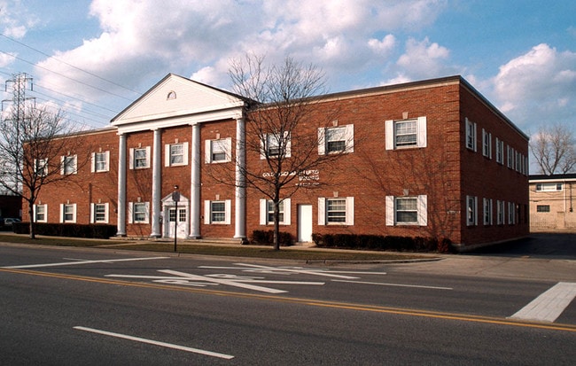
Property Detail
10 Burnham Ave
Chicago-Naperville-Elgin, IL-IN
COOK
30-08-100-016-0000
Illinois
Vacantlandnec
5-9
B and X Area of moderate flood hazard, usually the area between the limits of the 100-year and 500-year floods.
5.32 AC
0
Near North
2025
Chicago
806900
NEARBY LISTINGS FOR SALE OR LEASE
DEMOGRAPHICS near 10 Burnham Ave
1 mile
3 mile
5 mile
2025 Total Population
20,708
153,025
429,706
2030 Population
21,083
154,488
432,440
Pop Growth 2025-2030
+ 1.81%
+ 0.96%
+ 0.64%
Average Age
44
43
42
2025 Total Households
7,717
54,244
157,283
HH Growth 2025-2030
+ 1.57%
+ 0.83%
+ 0.47%
Median Household Inc
$84,294
$114,094
$105,164
Avg Household Size
2.60
2.70
2.60
2025 Avg HH Vehicles
2.00
2.00
2.00
Median Home Value
$367,150
$441,106
$458,040
Median Year Built
1960
1957
1957
Nearby Places
Map Layers
Map Styles
 Street
 Aerial
Layers
 Traffic
 Biking
Places
Listings with unknown addresses are not visible on the map
- Restaurants
- Banks
- Shops
- Fitness
- Groceries
Nearby Properties
Address
Land Use
TOTAL SIZE
Lot Size
Zoning
Address
Land Use
TOTAL SIZE
Lot Size
Zoning
399,000 SF
23.92 AC
Address
Land Use
TOTAL SIZE
Lot Size
Zoning
119,200 SF
9.87 AC
Address
Land Use
TOTAL SIZE
Lot Size
Zoning
82,736 SF
0.37 AC
Address
Land Use
TOTAL SIZE
Lot Size
Zoning
144,256 SF
2.91 AC
R3
Address
Land Use
TOTAL SIZE
Lot Size
Zoning
241,800 SF
14.30 AC
Address
Land Use
TOTAL SIZE
Lot Size
Zoning
24.56 AC
Address
Land Use
TOTAL SIZE
Lot Size
Zoning
115,612 SF
4.20 AC
Address
Land Use
TOTAL SIZE
Lot Size
Zoning
99,042 SF
255 AC
Address
Land Use
TOTAL SIZE
Lot Size
Zoning
298,373 SF
21.23 AC
Address
Land Use
TOTAL SIZE
Lot Size
Zoning
186,608 SF
18.11 AC
R3
Address
Land Use
TOTAL SIZE
Lot Size
Zoning
130,002 SF
18.27 AC
Address
Land Use
TOTAL SIZE
Lot Size
Zoning
126,900 SF
75.99 AC
Address
Land Use
TOTAL SIZE
Lot Size
Zoning
55,800 SF
7.25 AC
Address
Land Use
TOTAL SIZE
Lot Size
Zoning
118,120 SF
4.70 AC
Address
Land Use
TOTAL SIZE
Lot Size
Zoning
68,885 SF
5.93 AC
Address
Land Use
TOTAL SIZE
Lot Size
Zoning
8,400 SF
65.94 AC
PMD 6
Address
Land Use
TOTAL SIZE
Lot Size
Zoning
115,509 SF
5.95 AC
Address
Land Use
TOTAL SIZE
Lot Size
Zoning
29.25 AC
PMD 6
Address
Land Use
TOTAL SIZE
Lot Size
Zoning
129,650 SF
12.16 AC
Address
Land Use
TOTAL SIZE
Lot Size
Zoning
149,623 SF
4.93 AC
Address
Land Use
TOTAL SIZE
Lot Size
Zoning
600,448 SF
36.42 AC
Address
Land Use
TOTAL SIZE
Lot Size
Zoning
497,713 SF
31.43 AC
Address
Land Use
TOTAL SIZE
Lot Size
Zoning
102,264 SF
8.61 AC
R3
Address
Land Use
TOTAL SIZE
Lot Size
Zoning
755,859 SF
8.77 AC
Address
Land Use
TOTAL SIZE
Lot Size
Zoning
106,812 SF
8.78 AC
Address
Land Use
TOTAL SIZE
Lot Size
Zoning
148,696 SF
13.89 AC
Address
Land Use
TOTAL SIZE
Lot Size
Zoning
83,922 SF
1.35 AC
Address
Land Use
TOTAL SIZE
Lot Size
Zoning
95,774 SF
9.92 AC
R3
Address
Land Use
TOTAL SIZE
Lot Size
Zoning
119,082 SF
Address
Land Use
TOTAL SIZE
Lot Size
Zoning
344,488 SF
30.19 AC
The World's #1 Commercial Real Estate Marketplace
Connect with us
© 2026 CoStar Group
The information above has been obtained from sources believed reliable. While we do not doubt its accuracy we have not verified it and make no guarantee, warranty or representation about it. It is your responsibility to independently confirm its accuracy and completeness. Any projections, opinions, assumptions, or estimates used are for example only and do not represent the current or future performance of the property. The value of this transaction to you depends on tax and other factors which should be evaluated by your tax, financial, and legal advisors. You and your advisors should conduct a careful, independent investigation of the property to determine to your satisfaction the suitability of the property for your needs.