Property Record
10 Caine Dr, Madison, IL 62060


NEARBY LISTINGS FOR SALE OR LEASE
Property Detail
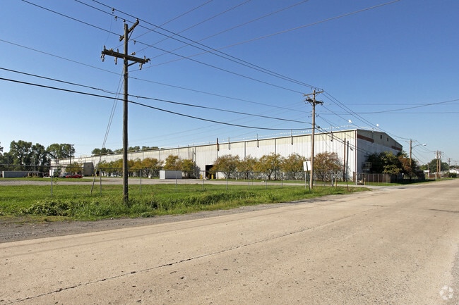
10 Caine Dr
St. Louis
Stephan Maeras Industrial Park
St. Louis, MO-IL
PORTION OUTLOT B & NE4 NW4 & PART SW4 NE4 SEC30 TWP03N RNG09W 3P & PART LOT11
17-2-20-30-06-101-014-001
Madison
Industrialgeneral
Illinois
2024
11
2024
3.53 AC
400903
Illinois
93,730 SF
DEMOGRAPHICS near 10 Caine Dr
1 Mile
3 Mile
5 Mile
2024 Total Population
4,236
26,215
88,618
2029 Population
4,325
26,409
88,393
Pop Growth 2024-2029
+ 2.10%
+ 0.74%
(0.25%)
Average Age
41
39
40
2024 Total Households
1,748
11,000
38,822
HH Growth 2024-2029
+ 2.00%
+ 0.64%
(0.44%)
Median Household Inc
$36,740
$47,693
$42,742
Avg Household Size
2.30
2.30
2.20
2024 Avg HH Vehicles
2.00
2.00
1.00
Median Home Value
$73,794
$66,473
$82,251
Median Year Built
1958
1955
1956
Nearby Places
Map Layers
Map Styles
 Street
 Aerial
- Restaurants
- Banks
- Shops
- Fitness
- Groceries
PUBLIC TRANSPORTATION
COMMUTER RAIL
Emerson Park (Lambert Airport Shiloh-Scott - St. Louis MetroLink (MetroLink), Shrewsbury-Lansdowne I-44 Emerson Park - St. Louis MetroLink (MetroLink))
DRIVE
WALK
Distance
Emerson Park (Lambert Airport Shiloh-Scott - St. Louis MetroLink (MetroLink), Shrewsbury-Lansdowne I-44 Emerson Park - St. Louis MetroLink (MetroLink))
9 min
5.2 mi
5Th And Missouri (Lambert Airport Shiloh-Scott - St. Louis MetroLink (MetroLink), Shrewsbury-Lansdowne I-44 Emerson Park - St. Louis MetroLink (MetroLink))
DRIVE
WALK
Distance
5Th And Missouri (Lambert Airport Shiloh-Scott - St. Louis MetroLink (MetroLink), Shrewsbury-Lansdowne I-44 Emerson Park - St. Louis MetroLink (MetroLink))
10 min
5.9 mi
AIRPORT
St Louis Lambert International
DRIVE
WALK
Distance
St Louis Lambert International
25 min
15.7 mi
Scott AFB/Midamerica St Louis
DRIVE
WALK
Distance
Scott AFB/Midamerica St Louis
41 min
26.4 mi
Freight Ports
Port Milwaukee
DRIVE
WALK
Distance
Port Milwaukee
416 min
366.1 mi
SALE & LEASE HISTORY
LISTING DATE
SALE/LEASE

Aug 02, 2019
For Sale
Nearby Properties
Address
Land Use
TOTAL SIZE
Lot Size
Zoning
Address
Land Use
TOTAL SIZE
Lot Size
Zoning
33.55 AC
Address
Land Use
TOTAL SIZE
Lot Size
Zoning
Address
Land Use
TOTAL SIZE
Lot Size
Zoning
1,925 SF
79.42 AC
Address
Land Use
TOTAL SIZE
Lot Size
Zoning
3.46 AC
Address
Land Use
TOTAL SIZE
Lot Size
Zoning
3.26 AC
Address
Land Use
TOTAL SIZE
Lot Size
Zoning
71,730 SF
3.23 AC
Address
Land Use
TOTAL SIZE
Lot Size
Zoning
165.04 AC
Address
Land Use
TOTAL SIZE
Lot Size
Zoning
54.74 AC
K
Address
Land Use
TOTAL SIZE
Lot Size
Zoning
102,355 SF
9.31 AC
Address
Land Use
TOTAL SIZE
Lot Size
Zoning
6,240 SF
4.50 AC
Address
Land Use
TOTAL SIZE
Lot Size
Zoning
8,510 SF
27.51 AC
Address
Land Use
TOTAL SIZE
Lot Size
Zoning
11,541 SF
11.82 AC
Address
Land Use
TOTAL SIZE
Lot Size
Zoning
5,610 SF
50.66 AC
Address
Land Use
TOTAL SIZE
Lot Size
Zoning
444 SF
9.80 AC
Address
Land Use
TOTAL SIZE
Lot Size
Zoning
47,556 SF
1.62 AC
Address
Land Use
TOTAL SIZE
Lot Size
Zoning
309,129 SF
29.47 AC
Address
Land Use
TOTAL SIZE
Lot Size
Zoning
92,130 SF
11.15 AC
Address
Land Use
TOTAL SIZE
Lot Size
Zoning
30,906 SF
1.68 AC
Address
Land Use
TOTAL SIZE
Lot Size
Zoning
Address
Land Use
TOTAL SIZE
Lot Size
Zoning
45,888 SF
14.62 AC
Address
Land Use
TOTAL SIZE
Lot Size
Zoning
22,500 SF
22.21 AC
Address
Land Use
TOTAL SIZE
Lot Size
Zoning
389.39 AC
Address
Land Use
TOTAL SIZE
Lot Size
Zoning
154,822 SF
Address
Land Use
TOTAL SIZE
Lot Size
Zoning
14,400 SF
54.33 AC
Address
Land Use
TOTAL SIZE
Lot Size
Zoning
9.15 AC
Address
Land Use
TOTAL SIZE
Lot Size
Zoning
20,000 SF
0.83 AC
Address
Land Use
TOTAL SIZE
Lot Size
Zoning
208,260 SF
10.80 AC
Address
Land Use
TOTAL SIZE
Lot Size
Zoning
16,300 SF
8 AC
Address
Land Use
TOTAL SIZE
Lot Size
Zoning
608 SF
52.09 AC
Address
Land Use
TOTAL SIZE
Lot Size
Zoning
18,744 SF
15.47 AC
The World's #1 Commercial Real Estate Marketplace
Connect with us
© 2026 CoStar Group
The information above has been obtained from sources believed reliable. While we do not doubt its accuracy we have not verified it and make no guarantee, warranty or representation about it. It is your responsibility to independently confirm its accuracy and completeness. Any projections, opinions, assumptions, or estimates used are for example only and do not represent the current or future performance of the property. The value of this transaction to you depends on tax and other factors which should be evaluated by your tax, financial, and legal advisors. You and your advisors should conduct a careful, independent investigation of the property to determine to your satisfaction the suitability of the property for your needs.