Property Record
10 Caliper Rd, Whitman, MA 02382

NEARBY LISTINGS FOR SALE OR LEASE
Property Detail
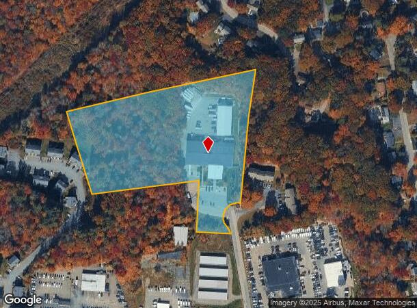
10 Caliper Rd
WHIT-000021B-000117-000053D
Plymouth
Industrialgeneral
Massachusetts
X
53d
25023C0179J
7 AC
2025
Route 3 South
2025
Boston
521101
Boston-Cambridge-Newton, MA-NH
21,500 SF
DEMOGRAPHICS near 10 Caliper Rd
1 Mile
3 Mile
5 Mile
2024 Total Population
6,732
68,242
169,490
2029 Population
6,831
67,928
168,158
Pop Growth 2024-2029
+ 1.47%
(0.46%)
(0.79%)
Average Age
41
39
40
2024 Total Households
2,259
23,429
60,113
HH Growth 2024-2029
+ 1.33%
(0.51%)
(0.86%)
Median Household Inc
$94,621
$85,170
$86,795
Avg Household Size
2.80
2.80
2.70
2024 Avg HH Vehicles
2.00
2.00
2.00
Median Home Value
$405,535
$394,946
$398,211
Median Year Built
1966
1962
1960
Nearby Places
Map Layers
Map Styles
 Street
 Aerial
- Restaurants
- Banks
- Shops
- Fitness
- Groceries
PUBLIC TRANSPORTATION
COMMUTER RAIL
Whitman (Kingston/Plymouth Line - Massachusetts Bay Transportation Authority Commuter Rail (Purple Line))
DRIVE
WALK
Distance
Whitman (Kingston/Plymouth Line - Massachusetts Bay Transportation Authority Commuter Rail (Purple Line))
6 min
2.3 mi
Brockton (Middleborough/Lakeville Line - Massachusetts Bay Transportation Authority Commuter Rail (Purple Line))
DRIVE
WALK
Distance
Brockton (Middleborough/Lakeville Line - Massachusetts Bay Transportation Authority Commuter Rail (Purple Line))
7 min
3.2 mi
AIRPORT
General Edward Lawrence Logan International
DRIVE
WALK
Distance
General Edward Lawrence Logan International
41 min
26.4 mi
Rhode Island Tf Green International
DRIVE
WALK
Distance
Rhode Island Tf Green International
76 min
45.1 mi
Freight Ports
Port of Boston
DRIVE
WALK
Distance
Port of Boston
39 min
24.2 mi
Nearby Properties
Address
Land Use
TOTAL SIZE
Lot Size
Zoning
Address
Land Use
TOTAL SIZE
Lot Size
Zoning
3,088 SF
1.42 AC
C3
Address
Land Use
TOTAL SIZE
Lot Size
Zoning
95.27 AC
R1C
Address
Land Use
TOTAL SIZE
Lot Size
Zoning
780 SF
10.81 AC
C5
Address
Land Use
TOTAL SIZE
Lot Size
Zoning
449,704 SF
3.56 AC
C2
Address
Land Use
TOTAL SIZE
Lot Size
Zoning
412,500 SF
48.94 AC
100
Address
Land Use
TOTAL SIZE
Lot Size
Zoning
733 SF
16.41 AC
R1C
Address
Land Use
TOTAL SIZE
Lot Size
Zoning
36.20 AC
Address
Land Use
TOTAL SIZE
Lot Size
Zoning
920 SF
13.48 AC
R1C
Address
Land Use
TOTAL SIZE
Lot Size
Zoning
3,088 SF
1.38 AC
C3
Address
Land Use
TOTAL SIZE
Lot Size
Zoning
3,438 SF
1.15 AC
C2
Address
Land Use
TOTAL SIZE
Lot Size
Zoning
88,957 SF
0.57 AC
R2
Address
Land Use
TOTAL SIZE
Lot Size
Zoning
35.10 AC
Address
Land Use
TOTAL SIZE
Lot Size
Zoning
2,062 SF
5.01 AC
C2
Address
Land Use
TOTAL SIZE
Lot Size
Zoning
3,812 SF
0.64 AC
C3
Address
Land Use
TOTAL SIZE
Lot Size
Zoning
1,172 SF
32.67 AC
R1C
Address
Land Use
TOTAL SIZE
Lot Size
Zoning
3,255 SF
1 AC
C3
Address
Land Use
TOTAL SIZE
Lot Size
Zoning
1,217 SF
13.79 AC
R1C
Address
Land Use
TOTAL SIZE
Lot Size
Zoning
22.54 AC
C2
Address
Land Use
TOTAL SIZE
Lot Size
Zoning
48,997 SF
5.68 AC
R3
Address
Land Use
TOTAL SIZE
Lot Size
Zoning
10.58 AC
R3
Address
Land Use
TOTAL SIZE
Lot Size
Zoning
69,184 SF
7.90 AC
100
Address
Land Use
TOTAL SIZE
Lot Size
Zoning
207,654 SF
14.17 AC
R1C
Address
Land Use
TOTAL SIZE
Lot Size
Zoning
53,538 SF
2.95 AC
C5
Address
Land Use
TOTAL SIZE
Lot Size
Zoning
2.24 AC
GB
Address
Land Use
TOTAL SIZE
Lot Size
Zoning
1,384 SF
14.23 AC
R1C
Address
Land Use
TOTAL SIZE
Lot Size
Zoning
1,138 SF
10.84 AC
R1C
Address
Land Use
TOTAL SIZE
Lot Size
Zoning
2,285 SF
2.42 AC
C2
Address
Land Use
TOTAL SIZE
Lot Size
Zoning
144,704 SF
1.82 AC
C3
Address
Land Use
TOTAL SIZE
Lot Size
Zoning
55.90 AC
Address
Land Use
TOTAL SIZE
Lot Size
Zoning
106,907 SF
26.42 AC
A1
The World's #1 Commercial Real Estate Marketplace
Connect with us
© 2025 CoStar Group
The information above has been obtained from sources believed reliable. While we do not doubt its accuracy we have not verified it and make no guarantee, warranty or representation about it. It is your responsibility to independently confirm its accuracy and completeness. Any projections, opinions, assumptions, or estimates used are for example only and do not represent the current or future performance of the property. The value of this transaction to you depends on tax and other factors which should be evaluated by your tax, financial, and legal advisors. You and your advisors should conduct a careful, independent investigation of the property to determine to your satisfaction the suitability of the property for your needs.