Property Record
10 Carroll Wood Dr, Wood River, IL 62095


NEARBY LISTINGS FOR SALE OR LEASE
-
-
View all Wood River listings for sale on LoopNet.com
Property Detail
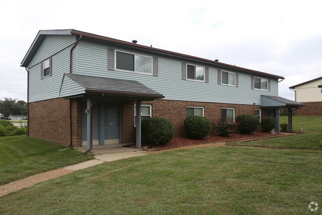
10 Carroll Wood Dr
St. Louis, MO-IL
PT SE NW
19-1-08-26-10-101-005
Madison
Gardenaptcourtapt5plusunits
Illinois
2024
8.25 AC
2024
Wood River
401000
St. Louis
4,380 SF
DEMOGRAPHICS near 10 Carroll Wood Dr
1 Mile
3 Mile
5 Mile
2024 Total Population
5,771
25,056
49,183
2029 Population
5,674
24,797
48,757
Pop Growth 2024-2029
(1.68%)
(1.03%)
(0.87%)
Average Age
40
41
41
2024 Total Households
2,475
10,758
20,952
HH Growth 2024-2029
(1.74%)
(1.10%)
(0.92%)
Median Household Inc
$60,704
$58,469
$58,700
Avg Household Size
2.30
2.30
2.30
2024 Avg HH Vehicles
2.00
2.00
2.00
Median Home Value
$104,124
$104,223
$110,905
Median Year Built
1952
1956
1958
Nearby Places
Map Layers
Map Styles
 Street
 Aerial
- Restaurants
- Banks
- Shops
- Fitness
- Groceries
PUBLIC TRANSPORTATION
COMMUTER RAIL
Alton Amtrak Station (Lincoln Service - Amtrak, Lincoln Service Missouri River Runner - Amtrak, Texas Eagle - Amtrak)
DRIVE
WALK
Distance
Alton Amtrak Station (Lincoln Service - Amtrak, Lincoln Service Missouri River Runner - Amtrak, Texas Eagle - Amtrak)
14 min
8.3 mi
AIRPORT
St Louis Lambert International
DRIVE
WALK
Distance
St Louis Lambert International
33 min
23.6 mi
Scott AFB/Midamerica St Louis
DRIVE
WALK
Distance
Scott AFB/Midamerica St Louis
53 min
36.6 mi
Freight Ports
Port Milwaukee
DRIVE
WALK
Distance
Port Milwaukee
408 min
355.4 mi
Nearby Properties
Address
Land Use
TOTAL SIZE
Lot Size
Zoning
Address
Land Use
TOTAL SIZE
Lot Size
Zoning
610.24 AC
Address
Land Use
TOTAL SIZE
Lot Size
Zoning
19.26 AC
Address
Land Use
TOTAL SIZE
Lot Size
Zoning
73.24 AC
Address
Land Use
TOTAL SIZE
Lot Size
Zoning
476.79 AC
Address
Land Use
TOTAL SIZE
Lot Size
Zoning
50.23 AC
Address
Land Use
TOTAL SIZE
Lot Size
Zoning
59.04 AC
Address
Land Use
TOTAL SIZE
Lot Size
Zoning
Address
Land Use
TOTAL SIZE
Lot Size
Zoning
199.57 AC
Address
Land Use
TOTAL SIZE
Lot Size
Zoning
215,635 SF
23.08 AC
Address
Land Use
TOTAL SIZE
Lot Size
Zoning
Address
Land Use
TOTAL SIZE
Lot Size
Zoning
58,990 SF
11.77 AC
Address
Land Use
TOTAL SIZE
Lot Size
Zoning
4,000 SF
23.25 AC
Address
Land Use
TOTAL SIZE
Lot Size
Zoning
242.45 AC
Address
Land Use
TOTAL SIZE
Lot Size
Zoning
147,365 SF
1.91 AC
Address
Land Use
TOTAL SIZE
Lot Size
Zoning
37,533 SF
7.80 AC
Address
Land Use
TOTAL SIZE
Lot Size
Zoning
6,240 SF
12.32 AC
Address
Land Use
TOTAL SIZE
Lot Size
Zoning
66,140 SF
9.79 AC
Address
Land Use
TOTAL SIZE
Lot Size
Zoning
58,900 SF
2.05 AC
Address
Land Use
TOTAL SIZE
Lot Size
Zoning
46,642 SF
10.50 AC
Address
Land Use
TOTAL SIZE
Lot Size
Zoning
75,312 SF
4.35 AC
Address
Land Use
TOTAL SIZE
Lot Size
Zoning
4,800 SF
39.15 AC
Address
Land Use
TOTAL SIZE
Lot Size
Zoning
20,000 SF
10.81 AC
Address
Land Use
TOTAL SIZE
Lot Size
Zoning
576 SF
16.80 AC
Address
Land Use
TOTAL SIZE
Lot Size
Zoning
22,902 SF
408.34 AC
Address
Land Use
TOTAL SIZE
Lot Size
Zoning
1,800 SF
31.54 AC
Address
Land Use
TOTAL SIZE
Lot Size
Zoning
55,020 SF
2.85 AC
Address
Land Use
TOTAL SIZE
Lot Size
Zoning
10,236 SF
5 AC
Address
Land Use
TOTAL SIZE
Lot Size
Zoning
38,517 SF
4.10 AC
Address
Land Use
TOTAL SIZE
Lot Size
Zoning
16,349 SF
3 AC
Address
Land Use
TOTAL SIZE
Lot Size
Zoning
2,700 SF
11.77 AC
The World's #1 Commercial Real Estate Marketplace
Connect with us
© 2026 CoStar Group
The information above has been obtained from sources believed reliable. While we do not doubt its accuracy we have not verified it and make no guarantee, warranty or representation about it. It is your responsibility to independently confirm its accuracy and completeness. Any projections, opinions, assumptions, or estimates used are for example only and do not represent the current or future performance of the property. The value of this transaction to you depends on tax and other factors which should be evaluated by your tax, financial, and legal advisors. You and your advisors should conduct a careful, independent investigation of the property to determine to your satisfaction the suitability of the property for your needs.