Property Record
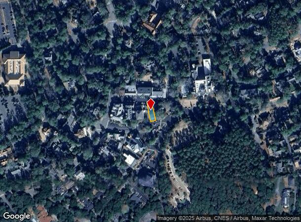
10 Chinquapin Rd, Pinehurst, NC 28374
NEARBY LISTINGS FOR SALE OR LEASE
-
-
View all Pinehurst listings for lease on LoopNet.com
Property Detail
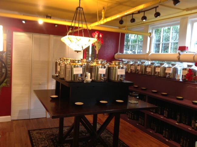
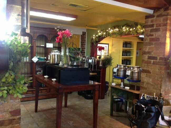
10 Chinquapin Rd
8552-12-96-8441
SCOTFIELD PART LOT 802
Financialbuilding
Moore
X
North Carolina
3710854200J
802
2024
0.09 AC
2024
North Carolina Southeast Area
950601
Other Market Areas
15,753 SF
Pinehurst-Southern Pines, NC
DEMOGRAPHICS near 10 Chinquapin Rd
1 mile
3 mile
5 mile
2024 Total Population
3,379
25,387
47,204
2029 Population
3,940
29,410
54,616
Pop Growth 2024-2029
+ 16.60%
+ 15.85%
+ 15.70%
Average Age
50
49
46
2024 Total Households
1,535
11,425
21,394
HH Growth 2024-2029
+ 17.00%
+ 16.18%
+ 15.99%
Median Household Inc
$113,675
$91,254
$72,354
Avg Household Size
2.10
2.20
2.20
2024 Avg HH Vehicles
2.00
2.00
2.00
Median Home Value
$446,468
$401,997
$363,893
Median Year Built
1990
1995
1995
Nearby Places
Map Layers
Map Styles
 Street
 Aerial
Transit
 Traffic
 Biking
Places
Listings with unknown addresses are not visible on the map
- Restaurants
- Banks
- Shops
- Fitness
- Groceries
PUBLIC TRANSPORTATION
COMMUTER RAIL
Drive
Walk
Distance
12 min
6.0 mi
AIRPORT
Fayetteville Regional/Grannis Field
Drive
Walk
Distance
Fayetteville Regional/Grannis Field
71 min
45.2 mi
SALE & LEASE HISTORY
LISTING DATE
SALE/LEASE

Jan 28, 2019
For Lease
Nearby Properties
Address
Land Use
TOTAL SIZE
Lot Size
Zoning
Address
Land Use
TOTAL SIZE
Lot Size
Zoning
3,953 SF
86.18 AC
MULTI
Address
Land Use
TOTAL SIZE
Lot Size
Zoning
29,476 SF
22.76 AC
H
Address
Land Use
TOTAL SIZE
Lot Size
Zoning
20,091 SF
12 AC
PPC
Address
Land Use
TOTAL SIZE
Lot Size
Zoning
16.26 AC
PD
Address
Land Use
TOTAL SIZE
Lot Size
Zoning
7,161 SF
0.87 AC
RD
Address
Land Use
TOTAL SIZE
Lot Size
Zoning
132,600 SF
86.18 AC
Address
Land Use
TOTAL SIZE
Lot Size
Zoning
17,091 SF
12.65 AC
R10
Address
Land Use
TOTAL SIZE
Lot Size
Zoning
21,138 SF
473.33 AC
RD
Address
Land Use
TOTAL SIZE
Lot Size
Zoning
51,552 SF
33.02 AC
GBCD
Address
Land Use
TOTAL SIZE
Lot Size
Zoning
4,992 SF
14.75 AC
PD
Address
Land Use
TOTAL SIZE
Lot Size
Zoning
11.80 AC
Address
Land Use
TOTAL SIZE
Lot Size
Zoning
190.53 AC
Address
Land Use
TOTAL SIZE
Lot Size
Zoning
155.66 AC
RD
Address
Land Use
TOTAL SIZE
Lot Size
Zoning
7.45 AC
Address
Land Use
TOTAL SIZE
Lot Size
Zoning
26,856 SF
1.52 AC
R10
Address
Land Use
TOTAL SIZE
Lot Size
Zoning
9,417 SF
4.19 AC
OP
Address
Land Use
TOTAL SIZE
Lot Size
Zoning
15,422 SF
35.21 AC
R20
Address
Land Use
TOTAL SIZE
Lot Size
Zoning
4,000 SF
238.22 AC
PDD
Address
Land Use
TOTAL SIZE
Lot Size
Zoning
24,802 SF
3.92 AC
OS
Address
Land Use
TOTAL SIZE
Lot Size
Zoning
33,960 SF
18 AC
NC
Address
Land Use
TOTAL SIZE
Lot Size
Zoning
25,651 SF
4.34 AC
CM
Address
Land Use
TOTAL SIZE
Lot Size
Zoning
57,109 SF
4.08 AC
GBSD
Address
Land Use
TOTAL SIZE
Lot Size
Zoning
15,100 SF
11.47 AC
NC
Address
Land Use
TOTAL SIZE
Lot Size
Zoning
20,709 SF
3.60 AC
H
Address
Land Use
TOTAL SIZE
Lot Size
Zoning
33,886 SF
9.68 AC
R10
Address
Land Use
TOTAL SIZE
Lot Size
Zoning
0.87 AC
Address
Land Use
TOTAL SIZE
Lot Size
Zoning
0.87 AC
Address
Land Use
TOTAL SIZE
Lot Size
Zoning
47,273 SF
11.25 AC
NC
Address
Land Use
TOTAL SIZE
Lot Size
Zoning
7.43 AC
Address
Land Use
TOTAL SIZE
Lot Size
Zoning
10,435 SF
11.26 AC
R20
The World's #1 Commercial Real Estate Marketplace
Connect with us
© 2026 CoStar Group
The information above has been obtained from sources believed reliable. While we do not doubt its accuracy we have not verified it and make no guarantee, warranty or representation about it. It is your responsibility to independently confirm its accuracy and completeness. Any projections, opinions, assumptions, or estimates used are for example only and do not represent the current or future performance of the property. The value of this transaction to you depends on tax and other factors which should be evaluated by your tax, financial, and legal advisors. You and your advisors should conduct a careful, independent investigation of the property to determine to your satisfaction the suitability of the property for your needs.