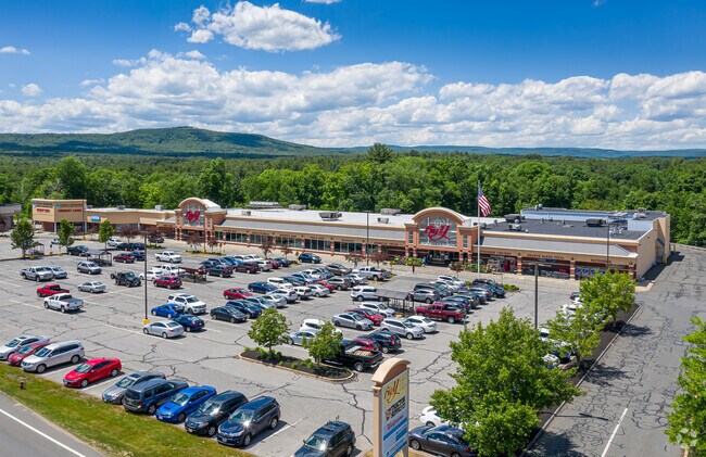
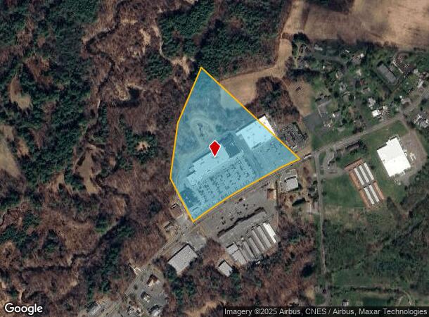
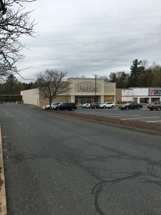
Property Record
10 College Hwy, Southampton, MA 01073
NEARBY LISTINGS FOR SALE OR LEASE
-
-
View all Southampton listings for lease on LoopNet.com
Property Detail
10 College Hwy
Springfield, MA
Hampshire
SHAM-000014-000002
Massachusetts
Commercialnec
14.80 AC
2025
Hampshire County
2025
Hartford
822500
DEMOGRAPHICS near 10 College Hwy
1 Mile
3 Mile
5 Mile
2024 Total Population
2,040
18,229
41,995
2029 Population
1,596
14,381
35,776
Pop Growth 2024-2029
(21.76%)
(21.11%)
(14.81%)
Average Age
45
45
44
2024 Total Households
874
8,214
18,178
HH Growth 2024-2029
(22.08%)
(21.49%)
(15.52%)
Median Household Inc
$89,320
$71,951
$72,241
Avg Household Size
2.30
2.20
2.20
2024 Avg HH Vehicles
2.00
2.00
2.00
Median Home Value
$368,975
$335,793
$329,501
Median Year Built
1979
1969
1964
Nearby Places
Map Layers
Map Styles
 Street
 Aerial
- Restaurants
- Banks
- Shops
- Fitness
- Groceries
PUBLIC TRANSPORTATION
AIRPORT
Bradley International
DRIVE
WALK
Distance
Bradley International
54 min
27.9 mi
SALE & LEASE HISTORY
LISTING DATE
SALE/LEASE

Apr 22, 2019
For Lease
Nearby Properties
Address
Land Use
TOTAL SIZE
Lot Size
Zoning
Address
Land Use
TOTAL SIZE
Lot Size
Zoning
42,416 SF
17.58 AC
R10
Address
Land Use
TOTAL SIZE
Lot Size
Zoning
126,515 SF
183.24 AC
R40
Address
Land Use
TOTAL SIZE
Lot Size
Zoning
5,272 SF
16.12 AC
R10
Address
Land Use
TOTAL SIZE
Lot Size
Zoning
4,114 SF
125.44 AC
R35
Address
Land Use
TOTAL SIZE
Lot Size
Zoning
115,407 SF
7.53 AC
R10
Address
Land Use
TOTAL SIZE
Lot Size
Zoning
48,626 SF
4.25 AC
DB
Address
Land Use
TOTAL SIZE
Lot Size
Zoning
16,720 SF
5.74 AC
HB
Address
Land Use
TOTAL SIZE
Lot Size
Zoning
67,783 SF
16.51 AC
Address
Land Use
TOTAL SIZE
Lot Size
Zoning
211,382 SF
17.15 AC
I
Address
Land Use
TOTAL SIZE
Lot Size
Zoning
6.90 AC
Address
Land Use
TOTAL SIZE
Lot Size
Zoning
29,946 SF
6.36 AC
HB
Address
Land Use
TOTAL SIZE
Lot Size
Zoning
480,770 SF
6.98 AC
MI
Address
Land Use
TOTAL SIZE
Lot Size
Zoning
3,792 SF
7.27 AC
R15
Address
Land Use
TOTAL SIZE
Lot Size
Zoning
90,748 SF
MI
Address
Land Use
TOTAL SIZE
Lot Size
Zoning
43,286 SF
0.71 AC
R5
Address
Land Use
TOTAL SIZE
Lot Size
Zoning
106,823 SF
5.31 AC
MI
Address
Land Use
TOTAL SIZE
Lot Size
Zoning
15,674 SF
3.77 AC
R10
Address
Land Use
TOTAL SIZE
Lot Size
Zoning
33,275 SF
0.71 AC
DB
Address
Land Use
TOTAL SIZE
Lot Size
Zoning
29,142 SF
2.78 AC
R15
Address
Land Use
TOTAL SIZE
Lot Size
Zoning
98,189 SF
1.65 AC
MI
Address
Land Use
TOTAL SIZE
Lot Size
Zoning
30,517 SF
0.73 AC
DB
Address
Land Use
TOTAL SIZE
Lot Size
Zoning
4.06 AC
Address
Land Use
TOTAL SIZE
Lot Size
Zoning
11,400 SF
6.93 AC
R15
Address
Land Use
TOTAL SIZE
Lot Size
Zoning
20,610 SF
10.01 AC
HB
Address
Land Use
TOTAL SIZE
Lot Size
Zoning
27,096 SF
1.40 AC
R10
Address
Land Use
TOTAL SIZE
Lot Size
Zoning
101,406 SF
4.34 AC
MI
Address
Land Use
TOTAL SIZE
Lot Size
Zoning
25,840 SF
1.31 AC
DB
Address
Land Use
TOTAL SIZE
Lot Size
Zoning
3,504 SF
2.46 AC
R10
Address
Land Use
TOTAL SIZE
Lot Size
Zoning
8,700 SF
2.03 AC
R10
The World's #1 Commercial Real Estate Marketplace
Connect with us
© 2026 CoStar Group
The information above has been obtained from sources believed reliable. While we do not doubt its accuracy we have not verified it and make no guarantee, warranty or representation about it. It is your responsibility to independently confirm its accuracy and completeness. Any projections, opinions, assumptions, or estimates used are for example only and do not represent the current or future performance of the property. The value of this transaction to you depends on tax and other factors which should be evaluated by your tax, financial, and legal advisors. You and your advisors should conduct a careful, independent investigation of the property to determine to your satisfaction the suitability of the property for your needs.