Property Record
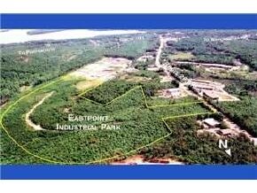
10 E Eastpoint Dr, Hooksett, NH 03106

Property Detail
10 E Eastpoint Dr
HOOK-000049-000000-000004
MERRIMACK
Industrialacreage
New Hampshire
IND
74.91 AC
A Areas with a 1% annual chance of flooding and a 26% chance of flooding over the life of a 30-year mortgage.
Manchester/New Hampshire South Area
2024
Other Market Areas
2024
Concord, NH
044200
NEARBY LISTINGS FOR SALE OR LEASE
DEMOGRAPHICS near 10 E Eastpoint Dr
1 mile
3 mile
5 mile
2025 Total Population
1,105
28,549
110,646
2030 Population
1,128
28,901
111,458
Pop Growth 2025-2030
+ 2.08%
+ 1.23%
+ 0.73%
Average Age
42
42
40
2025 Total Households
405
11,328
46,425
HH Growth 2025-2030
+ 1.98%
+ 1.24%
+ 0.82%
Median Household Inc
$136,666
$111,564
$86,603
Avg Household Size
2.70
2.40
2.20
2025 Avg HH Vehicles
3.00
2.00
2.00
Median Home Value
$492,934
$411,178
$388,361
Median Year Built
1986
1980
1968
Nearby Places
Map Layers
Map Styles
 Street
 Aerial
Transit
 Traffic
 Biking
Places
Listings with unknown addresses are not visible on the map
- Restaurants
- Banks
- Shops
- Fitness
- Groceries
PUBLIC TRANSPORTATION
AIRPORT
Manchester Boston Regional
Drive
Walk
Distance
Manchester Boston Regional
20 min
9.9 mi
Portsmouth International at Pease
Drive
Walk
Distance
Portsmouth International at Pease
57 min
38.7 mi
Freight Ports
Port of Boston
Drive
Walk
Distance
Port of Boston
82 min
54.0 mi
Nearby Properties
Address
Land Use
TOTAL SIZE
Lot Size
Zoning
Address
Land Use
TOTAL SIZE
Lot Size
Zoning
6,830 SF
17.24 AC
Address
Land Use
TOTAL SIZE
Lot Size
Zoning
135,686 SF
30.23 AC
Address
Land Use
TOTAL SIZE
Lot Size
Zoning
36,070 SF
141.66 AC
MUD4
Address
Land Use
TOTAL SIZE
Lot Size
Zoning
24,064 SF
19.44 AC
Address
Land Use
TOTAL SIZE
Lot Size
Zoning
51.32 AC
MUD4
Address
Land Use
TOTAL SIZE
Lot Size
Zoning
211,525 SF
93.01 AC
Address
Land Use
TOTAL SIZE
Lot Size
Zoning
2,218 SF
17.11 AC
Address
Land Use
TOTAL SIZE
Lot Size
Zoning
109,034 SF
14.30 AC
RESID
Address
Land Use
TOTAL SIZE
Lot Size
Zoning
38,506 SF
9.88 AC
Address
Land Use
TOTAL SIZE
Lot Size
Zoning
1,998 SF
72.09 AC
MDR
Address
Land Use
TOTAL SIZE
Lot Size
Zoning
92,492 SF
85 AC
Address
Land Use
TOTAL SIZE
Lot Size
Zoning
131,003 SF
49.31 AC
Address
Land Use
TOTAL SIZE
Lot Size
Zoning
28,888 SF
5.50 AC
Address
Land Use
TOTAL SIZE
Lot Size
Zoning
16,000 SF
20.69 AC
Address
Land Use
TOTAL SIZE
Lot Size
Zoning
5,150 SF
13.50 AC
Address
Land Use
TOTAL SIZE
Lot Size
Zoning
56,033 SF
4.91 AC
Address
Land Use
TOTAL SIZE
Lot Size
Zoning
40,718 SF
3.42 AC
Address
Land Use
TOTAL SIZE
Lot Size
Zoning
3,608 SF
133.83 AC
Address
Land Use
TOTAL SIZE
Lot Size
Zoning
1,976 SF
40.02 AC
Address
Land Use
TOTAL SIZE
Lot Size
Zoning
35,478 SF
4.50 AC
Address
Land Use
TOTAL SIZE
Lot Size
Zoning
56,769 SF
20.09 AC
Address
Land Use
TOTAL SIZE
Lot Size
Zoning
57,964 SF
13.85 AC
PZ
Address
Land Use
TOTAL SIZE
Lot Size
Zoning
144,966 SF
13.26 AC
PZ
Address
Land Use
TOTAL SIZE
Lot Size
Zoning
1,704 SF
76.35 AC
Address
Land Use
TOTAL SIZE
Lot Size
Zoning
43,494 SF
9.60 AC
Address
Land Use
TOTAL SIZE
Lot Size
Zoning
75,202 SF
3.59 AC
Address
Land Use
TOTAL SIZE
Lot Size
Zoning
41,807 SF
4.88 AC
Address
Land Use
TOTAL SIZE
Lot Size
Zoning
29,370 SF
5.31 AC
RESID
Address
Land Use
TOTAL SIZE
Lot Size
Zoning
80,550 SF
6.79 AC
COM
Address
Land Use
TOTAL SIZE
Lot Size
Zoning
23,034 SF
21.15 AC
The World's #1 Commercial Real Estate Marketplace
Connect with us
© 2026 CoStar Group
The information above has been obtained from sources believed reliable. While we do not doubt its accuracy we have not verified it and make no guarantee, warranty or representation about it. It is your responsibility to independently confirm its accuracy and completeness. Any projections, opinions, assumptions, or estimates used are for example only and do not represent the current or future performance of the property. The value of this transaction to you depends on tax and other factors which should be evaluated by your tax, financial, and legal advisors. You and your advisors should conduct a careful, independent investigation of the property to determine to your satisfaction the suitability of the property for your needs.