Property Record
10 E Highway N, Wentzville, MO 63385

NEARBY LISTINGS FOR SALE OR LEASE
-
-
View all Wentzville listings for sale on LoopNet.com
Property Detail
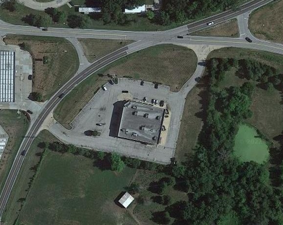
10 E Highway N
St. Louis, MO-IL
Hanebery Sub
4-0030-4289-05-0002.0000000
HANEBERY SUB PT LOT 5 & PT SW 1/4
Commercialnec
St. Charles
X
Missouri
29183C0215G
5
2024
2.50 AC
2025
Outer St Charles Cnty
312206
St. Louis
14,736 SF
DEMOGRAPHICS near 10 E Highway N
1 Mile
3 Mile
5 Mile
2024 Total Population
3,040
25,857
76,943
2029 Population
3,205
27,578
82,161
Pop Growth 2024-2029
+ 5.43%
+ 6.66%
+ 6.78%
Average Age
36
38
38
2024 Total Households
968
9,001
26,987
HH Growth 2024-2029
+ 5.37%
+ 6.78%
+ 6.84%
Median Household Inc
$101,763
$102,622
$106,973
Avg Household Size
3.10
2.80
2.80
2024 Avg HH Vehicles
2.00
2.00
2.00
Median Home Value
$284,491
$325,776
$323,290
Median Year Built
2005
2006
2006
Nearby Places
Map Layers
Map Styles
 Street
 Aerial
- Restaurants
- Banks
- Shops
- Fitness
- Groceries
PUBLIC TRANSPORTATION
AIRPORT
St Louis Lambert International
DRIVE
WALK
Distance
St Louis Lambert International
45 min
32.7 mi
Nearby Properties
Address
Land Use
TOTAL SIZE
Lot Size
Zoning
Address
Land Use
TOTAL SIZE
Lot Size
Zoning
26,068 SF
10.01 AC
Address
Land Use
TOTAL SIZE
Lot Size
Zoning
200,008 SF
14.30 AC
Address
Land Use
TOTAL SIZE
Lot Size
Zoning
420,000 SF
20.75 AC
Address
Land Use
TOTAL SIZE
Lot Size
Zoning
215,329 SF
19.29 AC
Address
Land Use
TOTAL SIZE
Lot Size
Zoning
137,118 SF
6.91 AC
Address
Land Use
TOTAL SIZE
Lot Size
Zoning
108.37 AC
Address
Land Use
TOTAL SIZE
Lot Size
Zoning
28.69 AC
Address
Land Use
TOTAL SIZE
Lot Size
Zoning
55,263 SF
1.65 AC
Address
Land Use
TOTAL SIZE
Lot Size
Zoning
52,222 SF
1.68 AC
Address
Land Use
TOTAL SIZE
Lot Size
Zoning
54,059 SF
2.06 AC
Address
Land Use
TOTAL SIZE
Lot Size
Zoning
30.56 AC
AA1
Address
Land Use
TOTAL SIZE
Lot Size
Zoning
63,976 SF
2.31 AC
Address
Land Use
TOTAL SIZE
Lot Size
Zoning
106,800 SF
11.57 AC
Address
Land Use
TOTAL SIZE
Lot Size
Zoning
29,603 SF
5.02 AC
Address
Land Use
TOTAL SIZE
Lot Size
Zoning
74,509 SF
7.98 AC
Address
Land Use
TOTAL SIZE
Lot Size
Zoning
97,458 SF
2.58 AC
Address
Land Use
TOTAL SIZE
Lot Size
Zoning
88,693 SF
6.54 AC
Address
Land Use
TOTAL SIZE
Lot Size
Zoning
34.96 AC
Address
Land Use
TOTAL SIZE
Lot Size
Zoning
45,041 SF
4.47 AC
Address
Land Use
TOTAL SIZE
Lot Size
Zoning
12,280 SF
16.61 AC
Address
Land Use
TOTAL SIZE
Lot Size
Zoning
680 SF
245.79 AC
Address
Land Use
TOTAL SIZE
Lot Size
Zoning
55,408 SF
5.23 AC
Address
Land Use
TOTAL SIZE
Lot Size
Zoning
26,400 SF
15.73 AC
Address
Land Use
TOTAL SIZE
Lot Size
Zoning
82,859 SF
4.98 AC
Address
Land Use
TOTAL SIZE
Lot Size
Zoning
31.28 AC
AA1
Address
Land Use
TOTAL SIZE
Lot Size
Zoning
61,404 SF
8.37 AC
Address
Land Use
TOTAL SIZE
Lot Size
Zoning
97,526 SF
9.32 AC
Address
Land Use
TOTAL SIZE
Lot Size
Zoning
4,108 SF
5.49 AC
AA1
Address
Land Use
TOTAL SIZE
Lot Size
Zoning
4,442 SF
12.69 AC
Address
Land Use
TOTAL SIZE
Lot Size
Zoning
The World's #1 Commercial Real Estate Marketplace
Connect with us
© 2026 CoStar Group
The information above has been obtained from sources believed reliable. While we do not doubt its accuracy we have not verified it and make no guarantee, warranty or representation about it. It is your responsibility to independently confirm its accuracy and completeness. Any projections, opinions, assumptions, or estimates used are for example only and do not represent the current or future performance of the property. The value of this transaction to you depends on tax and other factors which should be evaluated by your tax, financial, and legal advisors. You and your advisors should conduct a careful, independent investigation of the property to determine to your satisfaction the suitability of the property for your needs.