Property Record
10 E Mayfair Ct, Spokane, WA 99208
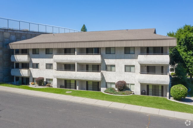
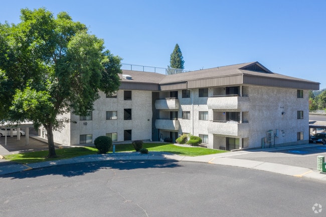
Property Detail
10 E Mayfair Ct
Spokane-Spokane Valley, WA
Pine Ridge
36203.2015
PINE RIDGE APARTMENTS L16 B1
Apartment
Spokane
X
Washington
53063C0531D
16
2025
0.41 AC
2025
Nevada Lidgerwood
011102
Spokane
26,980 SF
NEARBY LISTINGS FOR SALE OR LEASE
DEMOGRAPHICS near 10 E Mayfair Ct
1 mile
3 mile
5 mile
2024 Total Population
13,889
93,072
186,396
2029 Population
14,724
98,767
197,794
Pop Growth 2024-2029
+ 6.01%
+ 6.12%
+ 6.11%
Average Age
38
39
39
2024 Total Households
5,542
36,646
72,455
HH Growth 2024-2029
+ 6.26%
+ 6.28%
+ 6.31%
Median Household Inc
$57,168
$58,768
$60,517
Avg Household Size
2.30
2.40
2.40
2024 Avg HH Vehicles
2.00
2.00
2.00
Median Home Value
$314,286
$299,533
$301,744
Median Year Built
1978
1971
1968
Nearby Places
Map Layers
Map Styles
 Street
 Aerial
Transit
 Traffic
 Biking
Places
Listings with unknown addresses are not visible on the map
- Restaurants
- Banks
- Shops
- Fitness
- Groceries
PUBLIC TRANSPORTATION
COMMUTER RAIL
Spokane (Empire Builder - Amtrak)
Drive
Walk
Distance
Spokane (Empire Builder - Amtrak)
15 min
5.9 mi
AIRPORT
Spokane International
Drive
Walk
Distance
Spokane International
25 min
12.4 mi
Freight Ports
Port of Everett
Drive
Walk
Distance
Port of Everett
353 min
308.0 mi
Nearby Properties
Address
Land Use
TOTAL SIZE
Lot Size
Zoning
Address
Land Use
TOTAL SIZE
Lot Size
Zoning
545,909 SF
92.96 AC
LDR
Address
Land Use
TOTAL SIZE
Lot Size
Zoning
531,295 SF
17.11 AC
CC2
Address
Land Use
TOTAL SIZE
Lot Size
Zoning
386,885 SF
22.81 AC
RSF
Address
Land Use
TOTAL SIZE
Lot Size
Zoning
278,777 SF
5.47 AC
HDR
Address
Land Use
TOTAL SIZE
Lot Size
Zoning
188,040 SF
68.10 AC
UR
Address
Land Use
TOTAL SIZE
Lot Size
Zoning
456,984 SF
26.06 AC
O
Address
Land Use
TOTAL SIZE
Lot Size
Zoning
696,382 SF
37.43 AC
LI
Address
Land Use
TOTAL SIZE
Lot Size
Zoning
317,750 SF
31.10 AC
GC
Address
Land Use
TOTAL SIZE
Lot Size
Zoning
1,555,116 SF
23.12 AC
GC
Address
Land Use
TOTAL SIZE
Lot Size
Zoning
78,497 SF
9.19 AC
MU
Address
Land Use
TOTAL SIZE
Lot Size
Zoning
56,600 SF
4.98 AC
GC
Address
Land Use
TOTAL SIZE
Lot Size
Zoning
159,508 SF
18.52 AC
RSF
Address
Land Use
TOTAL SIZE
Lot Size
Zoning
158,348 SF
6.60 AC
RMF
Address
Land Use
TOTAL SIZE
Lot Size
Zoning
116,772 SF
8.56 AC
MU
Address
Land Use
TOTAL SIZE
Lot Size
Zoning
166,390 SF
19.33 AC
MU
Address
Land Use
TOTAL SIZE
Lot Size
Zoning
136,780 SF
8.75 AC
RMF
Address
Land Use
TOTAL SIZE
Lot Size
Zoning
101,372 SF
5.48 AC
RMF
Address
Land Use
TOTAL SIZE
Lot Size
Zoning
76,559 SF
7.11 AC
LDR
Address
Land Use
TOTAL SIZE
Lot Size
Zoning
131,469 SF
7.24 AC
RMF
Address
Land Use
TOTAL SIZE
Lot Size
Zoning
150,061 SF
5.01 AC
GC
Address
Land Use
TOTAL SIZE
Lot Size
Zoning
153,780 SF
10.31 AC
RMF
Address
Land Use
TOTAL SIZE
Lot Size
Zoning
67,094 SF
9.33 AC
RSF
Address
Land Use
TOTAL SIZE
Lot Size
Zoning
209,047 SF
41.68 AC
HI
Address
Land Use
TOTAL SIZE
Lot Size
Zoning
113,638 SF
34.05 AC
RSF
Address
Land Use
TOTAL SIZE
Lot Size
Zoning
183,152 SF
38.47 AC
LDR
Address
Land Use
TOTAL SIZE
Lot Size
Zoning
114,377 SF
2.51 AC
RSF
Address
Land Use
TOTAL SIZE
Lot Size
Zoning
230,295 SF
22.41 AC
GC
Address
Land Use
TOTAL SIZE
Lot Size
Zoning
35,343 SF
5.31 AC
GC
Address
Land Use
TOTAL SIZE
Lot Size
Zoning
125,588 SF
12.84 AC
RMF
Address
Land Use
TOTAL SIZE
Lot Size
Zoning
179,208 SF
13.94 AC
RMF
The World's #1 Commercial Real Estate Marketplace
Connect with us
© 2026 CoStar Group
The information above has been obtained from sources believed reliable. While we do not doubt its accuracy we have not verified it and make no guarantee, warranty or representation about it. It is your responsibility to independently confirm its accuracy and completeness. Any projections, opinions, assumptions, or estimates used are for example only and do not represent the current or future performance of the property. The value of this transaction to you depends on tax and other factors which should be evaluated by your tax, financial, and legal advisors. You and your advisors should conduct a careful, independent investigation of the property to determine to your satisfaction the suitability of the property for your needs.