Property Record
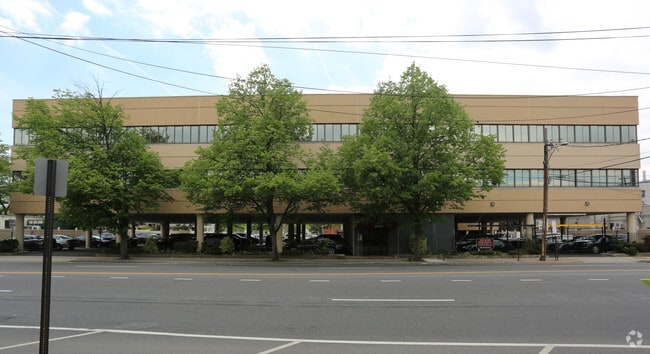
10 E Merrick Rd, Valley Stream, NY 11580


NEARBY LISTINGS FOR SALE OR LEASE
Property Detail
10 E Merrick Rd
2035-37-113-00-0007-0
7-15
Officebuilding
Nassau
X
New York
36059C0212G
7
2025
0.37 AC
2025
Southern Nassau
410500
Long Island (New York)
24,960 SF
Nassau County-Suffolk County, NY
DEMOGRAPHICS near 10 E Merrick Rd
1 mile
3 mile
5 mile
2024 Total Population
30,404
255,418
664,952
2029 Population
29,555
245,845
634,791
Pop Growth 2024-2029
(2.79%)
(3.75%)
(4.54%)
Average Age
41
41
41
2024 Total Households
9,673
81,009
208,925
HH Growth 2024-2029
(2.96%)
(3.91%)
(4.73%)
Median Household Inc
$120,130
$118,742
$105,893
Avg Household Size
3.00
3.00
3.10
2024 Avg HH Vehicles
2.00
2.00
2.00
Median Home Value
$588,853
$639,986
$651,929
Median Year Built
1948
1952
1951
Nearby Places
Map Layers
Map Styles
 Street
 Aerial
Transit
 Traffic
 Biking
Places
Listings with unknown addresses are not visible on the map
- Restaurants
- Banks
- Shops
- Fitness
- Groceries
PUBLIC TRANSPORTATION
COMMUTER RAIL
Valley Stream Station (Far Rockaway Branch - Long Island Rail Road, Long Beach Branch - Long Island Rail Road, West Hempstead Branch - Long Island Rail Road)
Drive
Walk
Distance
Valley Stream Station (Far Rockaway Branch - Long Island Rail Road, Long Beach Branch - Long Island Rail Road, West Hempstead Branch - Long Island Rail Road)
1 min
12 min
0.6 mi
Westwood Station (West Hempstead Branch - Long Island Rail Road)
Drive
Walk
Distance
Westwood Station (West Hempstead Branch - Long Island Rail Road)
3 min
20 min
1.0 mi
AIRPORT
John F Kennedy International
Drive
Walk
Distance
John F Kennedy International
13 min
7.5 mi
LaGuardia
Drive
Walk
Distance
LaGuardia
23 min
14.5 mi
Newark Liberty International
Drive
Walk
Distance
Newark Liberty International
50 min
34.2 mi
Freight Ports
NY - Red Hook Container Terminal
Drive
Walk
Distance
NY - Red Hook Container Terminal
34 min
18.9 mi
SALE & LEASE HISTORY
LISTING DATE
SALE/LEASE

Oct 22, 2021
For Lease
Mar 02, 2022
For Lease
Jun 18, 2018
For Lease
Dec 28, 2022
For Lease
Dec 08, 2020
For Lease
Dec 07, 2020
For Sale
Aug 17, 2020
For Lease
Nearby Properties
Address
Land Use
TOTAL SIZE
Lot Size
Zoning
Address
Land Use
TOTAL SIZE
Lot Size
Zoning
27.23 AC
PARK
Address
Land Use
TOTAL SIZE
Lot Size
Zoning
129,378 SF
4.86 AC
R2A
Address
Land Use
TOTAL SIZE
Lot Size
Zoning
64,618 SF
8.04 AC
Address
Land Use
TOTAL SIZE
Lot Size
Zoning
93.35 AC
PARK
Address
Land Use
TOTAL SIZE
Lot Size
Zoning
5,296 SF
37.42 AC
PARK
Address
Land Use
TOTAL SIZE
Lot Size
Zoning
213,338 SF
2.91 AC
R3X
Address
Land Use
TOTAL SIZE
Lot Size
Zoning
97,190 SF
1.75 AC
R3X
Address
Land Use
TOTAL SIZE
Lot Size
Zoning
152,362 SF
9.06 AC
R3-2
Address
Land Use
TOTAL SIZE
Lot Size
Zoning
152,362 SF
9.06 AC
R3-2
Address
Land Use
TOTAL SIZE
Lot Size
Zoning
152,362 SF
9.06 AC
R3-2
Address
Land Use
TOTAL SIZE
Lot Size
Zoning
152,362 SF
9.06 AC
R3-2
Address
Land Use
TOTAL SIZE
Lot Size
Zoning
152,362 SF
9.06 AC
R3-2
Address
Land Use
TOTAL SIZE
Lot Size
Zoning
152,362 SF
9.06 AC
R3-2
Address
Land Use
TOTAL SIZE
Lot Size
Zoning
152,362 SF
9.06 AC
R3-2
Address
Land Use
TOTAL SIZE
Lot Size
Zoning
152,362 SF
9.06 AC
R3-2
Address
Land Use
TOTAL SIZE
Lot Size
Zoning
152,362 SF
9.06 AC
R3-2
Address
Land Use
TOTAL SIZE
Lot Size
Zoning
152,362 SF
9.06 AC
R3-2
Address
Land Use
TOTAL SIZE
Lot Size
Zoning
152,362 SF
9.06 AC
R3-2
Address
Land Use
TOTAL SIZE
Lot Size
Zoning
152,362 SF
9.06 AC
R3-2
Address
Land Use
TOTAL SIZE
Lot Size
Zoning
152,362 SF
9.06 AC
R3-2
Address
Land Use
TOTAL SIZE
Lot Size
Zoning
152,362 SF
9.06 AC
R3-2
Address
Land Use
TOTAL SIZE
Lot Size
Zoning
152,362 SF
9.06 AC
R3-2
Address
Land Use
TOTAL SIZE
Lot Size
Zoning
152,362 SF
9.06 AC
R3-2
Address
Land Use
TOTAL SIZE
Lot Size
Zoning
152,362 SF
9.06 AC
R3-2
Address
Land Use
TOTAL SIZE
Lot Size
Zoning
152,362 SF
9.06 AC
R3-2
Address
Land Use
TOTAL SIZE
Lot Size
Zoning
152,362 SF
9.06 AC
R3-2
Address
Land Use
TOTAL SIZE
Lot Size
Zoning
152,362 SF
9.06 AC
R3-2
Address
Land Use
TOTAL SIZE
Lot Size
Zoning
152,362 SF
9.06 AC
R3-2
Address
Land Use
TOTAL SIZE
Lot Size
Zoning
152,362 SF
9.06 AC
R3-2
Address
Land Use
TOTAL SIZE
Lot Size
Zoning
152,362 SF
9.06 AC
R3-2
The World's #1 Commercial Real Estate Marketplace
Connect with us
© 2026 CoStar Group
The information above has been obtained from sources believed reliable. While we do not doubt its accuracy we have not verified it and make no guarantee, warranty or representation about it. It is your responsibility to independently confirm its accuracy and completeness. Any projections, opinions, assumptions, or estimates used are for example only and do not represent the current or future performance of the property. The value of this transaction to you depends on tax and other factors which should be evaluated by your tax, financial, and legal advisors. You and your advisors should conduct a careful, independent investigation of the property to determine to your satisfaction the suitability of the property for your needs.