Property Record
10 Euharlee Rd Sw, Euharlee, GA 30120
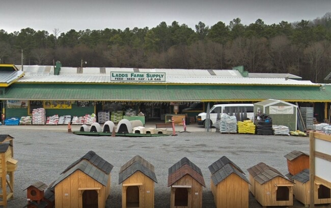
Property Detail
10 Euharlee Rd Sw
0056B-0003-016
LL634 LD4 SHAW S/D LOT
Commercialnec
Bartow
A1
Georgia
AE The base floodplain where base flood elevations are provided. AE Zones are now used on new format FIRMs instead of A1-A30 Zones.
6.31 AC
2025
Kennesaw/Acworth
2025
Atlanta
960902
Atlanta-Sandy Springs-Roswell, GA
8,000 SF
NEARBY LISTINGS FOR SALE OR LEASE
DEMOGRAPHICS near 10 Euharlee Rd Sw
1 mile
3 mile
5 mile
2025 Total Population
1,772
23,062
49,835
2030 Population
1,886
24,598
53,326
Pop Growth 2025-2030
+ 6.43%
+ 6.66%
+ 7.01%
Average Age
40
40
40
2025 Total Households
703
8,643
18,779
HH Growth 2025-2030
+ 6.54%
+ 6.64%
+ 7.05%
Median Household Inc
$90,816
$84,119
$79,978
Avg Household Size
2.40
2.60
2.50
2025 Avg HH Vehicles
2.00
2.00
2.00
Median Home Value
$394,999
$339,117
$316,174
Median Year Built
1993
1990
1992
Nearby Places
Map Layers
Map Styles
 Street
 Aerial
Layers
 Traffic
 Biking
Places
Listings with unknown addresses are not visible on the map
- Restaurants
- Banks
- Shops
- Fitness
- Groceries
Nearby Properties
Address
Land Use
TOTAL SIZE
Lot Size
Zoning
Address
Land Use
TOTAL SIZE
Lot Size
Zoning
1,200 SF
25.69 AC
IN
Address
Land Use
TOTAL SIZE
Lot Size
Zoning
226,108 SF
33.73 AC
Address
Land Use
TOTAL SIZE
Lot Size
Zoning
196,710 SF
149.63 AC
Address
Land Use
TOTAL SIZE
Lot Size
Zoning
104,757 SF
45 AC
IN
Address
Land Use
TOTAL SIZE
Lot Size
Zoning
149,158 SF
46.23 AC
IN
Address
Land Use
TOTAL SIZE
Lot Size
Zoning
Address
Land Use
TOTAL SIZE
Lot Size
Zoning
134,528 SF
4.71 AC
IN
Address
Land Use
TOTAL SIZE
Lot Size
Zoning
Address
Land Use
TOTAL SIZE
Lot Size
Zoning
1,800 SF
102.03 AC
A1
Address
Land Use
TOTAL SIZE
Lot Size
Zoning
Address
Land Use
TOTAL SIZE
Lot Size
Zoning
88,974 SF
5.42 AC
IN
Address
Land Use
TOTAL SIZE
Lot Size
Zoning
24,991 SF
25.20 AC
Address
Land Use
TOTAL SIZE
Lot Size
Zoning
29,629 SF
21.90 AC
IN
Address
Land Use
TOTAL SIZE
Lot Size
Zoning
93,358 SF
22.63 AC
A1
Address
Land Use
TOTAL SIZE
Lot Size
Zoning
57,164 SF
4.88 AC
Address
Land Use
TOTAL SIZE
Lot Size
Zoning
470,504 SF
22.66 AC
IN
Address
Land Use
TOTAL SIZE
Lot Size
Zoning
66,606 SF
6.74 AC
IN
Address
Land Use
TOTAL SIZE
Lot Size
Zoning
92,072 SF
11.77 AC
IN
Address
Land Use
TOTAL SIZE
Lot Size
Zoning
34,786 SF
12.23 AC
IN
Address
Land Use
TOTAL SIZE
Lot Size
Zoning
70,987 SF
7.45 AC
IN
Address
Land Use
TOTAL SIZE
Lot Size
Zoning
Address
Land Use
TOTAL SIZE
Lot Size
Zoning
170,445 SF
6.12 AC
IN
Address
Land Use
TOTAL SIZE
Lot Size
Zoning
128.74 AC
A1
Address
Land Use
TOTAL SIZE
Lot Size
Zoning
61,132 SF
5.39 AC
Address
Land Use
TOTAL SIZE
Lot Size
Zoning
272.81 AC
A1
Address
Land Use
TOTAL SIZE
Lot Size
Zoning
24,850 SF
4.12 AC
IN
Address
Land Use
TOTAL SIZE
Lot Size
Zoning
6,909 SF
10 AC
IN
Address
Land Use
TOTAL SIZE
Lot Size
Zoning
Address
Land Use
TOTAL SIZE
Lot Size
Zoning
211,879 SF
23.57 AC
IN
Address
Land Use
TOTAL SIZE
Lot Size
Zoning
13,784 SF
5 AC
IN
The World's #1 Commercial Real Estate Marketplace
Connect with us
© 2026 CoStar Group
The information above has been obtained from sources believed reliable. While we do not doubt its accuracy we have not verified it and make no guarantee, warranty or representation about it. It is your responsibility to independently confirm its accuracy and completeness. Any projections, opinions, assumptions, or estimates used are for example only and do not represent the current or future performance of the property. The value of this transaction to you depends on tax and other factors which should be evaluated by your tax, financial, and legal advisors. You and your advisors should conduct a careful, independent investigation of the property to determine to your satisfaction the suitability of the property for your needs.