Property Record
10 Gilmore Rd, Red Bluff, CA 96080
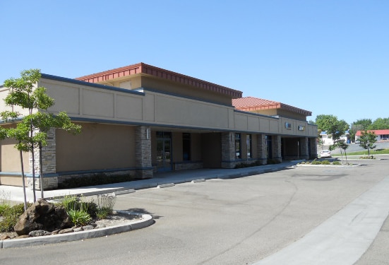


Property Detail
10 Gilmore Rd
041-193-001-000
PTN PAR A PM 84-61 BK 8 PG 47
Officebuilding
Tehama
C-2
California
AE The base floodplain where base flood elevations are provided. AE Zones are now used on new format FIRMs instead of A1-A30 Zones.
1.25 AC
2024
Redding/Chico
2025
Other Market Areas
000600
Red Bluff, CA
NEARBY LISTINGS FOR SALE OR LEASE
DEMOGRAPHICS near 10 Gilmore Rd
1 mile
3 mile
5 mile
2025 Total Population
6,990
22,955
26,060
2030 Population
7,057
23,082
26,084
Pop Growth 2025-2030
+ 0.96%
+ 0.55%
+ 0.09%
Average Age
40
40
41
2025 Total Households
2,929
9,063
10,288
HH Growth 2025-2030
+ 0.99%
+ 0.60%
+ 0.12%
Median Household Inc
$45,833
$51,769
$54,385
Avg Household Size
2.30
2.50
2.50
2025 Avg HH Vehicles
1.00
2.00
2.00
Median Home Value
$330,000
$330,455
$344,980
Median Year Built
1975
1978
1978
Nearby Places
Map Layers
Map Styles
 Street
 Aerial
Transit
 Traffic
 Biking
Places
Listings with unknown addresses are not visible on the map
- Restaurants
- Banks
- Shops
- Fitness
- Groceries
PUBLIC TRANSPORTATION
AIRPORT
Redding Regional
Drive
Walk
Distance
Redding Regional
30 min
24.3 mi
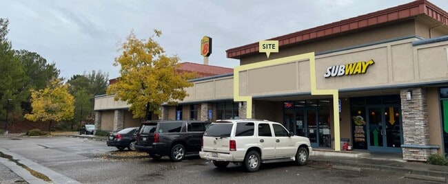
SALE & LEASE HISTORY
LISTING DATE
SALE/LEASE

Sep 18, 2025
For Lease
Nov 18, 2021
For Lease
Nearby Properties
Address
Land Use
TOTAL SIZE
Lot Size
Zoning
Address
Land Use
TOTAL SIZE
Lot Size
Zoning
13.54 AC
C-3
Address
Land Use
TOTAL SIZE
Lot Size
Zoning
189,773 SF
15.37 AC
C-3
Address
Land Use
TOTAL SIZE
Lot Size
Zoning
3,551 SF
99.98 AC
Address
Land Use
TOTAL SIZE
Lot Size
Zoning
154.56 AC
Address
Land Use
TOTAL SIZE
Lot Size
Zoning
5 AC
M2
Address
Land Use
TOTAL SIZE
Lot Size
Zoning
50,720 SF
2.45 AC
F-C
Address
Land Use
TOTAL SIZE
Lot Size
Zoning
2.82 AC
C-1
Address
Land Use
TOTAL SIZE
Lot Size
Zoning
9.13 AC
C-3
Address
Land Use
TOTAL SIZE
Lot Size
Zoning
56,307 SF
4.67 AC
C-3
Address
Land Use
TOTAL SIZE
Lot Size
Zoning
4.45 AC
R-4
Address
Land Use
TOTAL SIZE
Lot Size
Zoning
20.38 AC
C-3
Address
Land Use
TOTAL SIZE
Lot Size
Zoning
102,273 SF
12.42 AC
C-3
Address
Land Use
TOTAL SIZE
Lot Size
Zoning
4.18 AC
Address
Land Use
TOTAL SIZE
Lot Size
Zoning
5.16 AC
R-4
Address
Land Use
TOTAL SIZE
Lot Size
Zoning
43,416 SF
2.85 AC
R-4
Address
Land Use
TOTAL SIZE
Lot Size
Zoning
60,918 SF
5.92 AC
C-3
Address
Land Use
TOTAL SIZE
Lot Size
Zoning
5.04 AC
M-1
Address
Land Use
TOTAL SIZE
Lot Size
Zoning
2.21 AC
C-3
Address
Land Use
TOTAL SIZE
Lot Size
Zoning
6.31 AC
R-4
Address
Land Use
TOTAL SIZE
Lot Size
Zoning
32,502 SF
10.88 AC
F-C
Address
Land Use
TOTAL SIZE
Lot Size
Zoning
9,010 SF
1.20 AC
C-2
Address
Land Use
TOTAL SIZE
Lot Size
Zoning
7.40 AC
M-2
Address
Land Use
TOTAL SIZE
Lot Size
Zoning
4,746 SF
2.17 AC
Address
Land Use
TOTAL SIZE
Lot Size
Zoning
37,296 SF
1.02 AC
C-2
Address
Land Use
TOTAL SIZE
Lot Size
Zoning
11,750 SF
20.37 AC
R1AB435
Address
Land Use
TOTAL SIZE
Lot Size
Zoning
12,394 SF
1.48 AC
C-3
Address
Land Use
TOTAL SIZE
Lot Size
Zoning
1.58 AC
C-3
Address
Land Use
TOTAL SIZE
Lot Size
Zoning
4.49 AC
C-3
Address
Land Use
TOTAL SIZE
Lot Size
Zoning
960 SF
5.94 AC
M1
Address
Land Use
TOTAL SIZE
Lot Size
Zoning
11.42 AC
R-2
The World's #1 Commercial Real Estate Marketplace
Connect with us
© 2026 CoStar Group
The information above has been obtained from sources believed reliable. While we do not doubt its accuracy we have not verified it and make no guarantee, warranty or representation about it. It is your responsibility to independently confirm its accuracy and completeness. Any projections, opinions, assumptions, or estimates used are for example only and do not represent the current or future performance of the property. The value of this transaction to you depends on tax and other factors which should be evaluated by your tax, financial, and legal advisors. You and your advisors should conduct a careful, independent investigation of the property to determine to your satisfaction the suitability of the property for your needs.