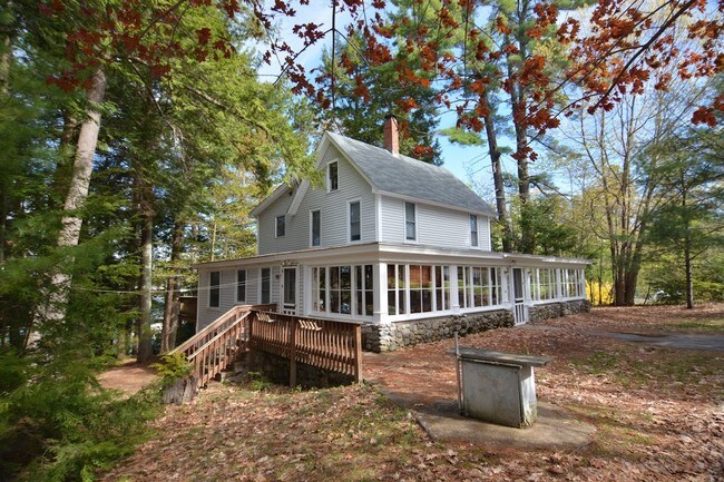
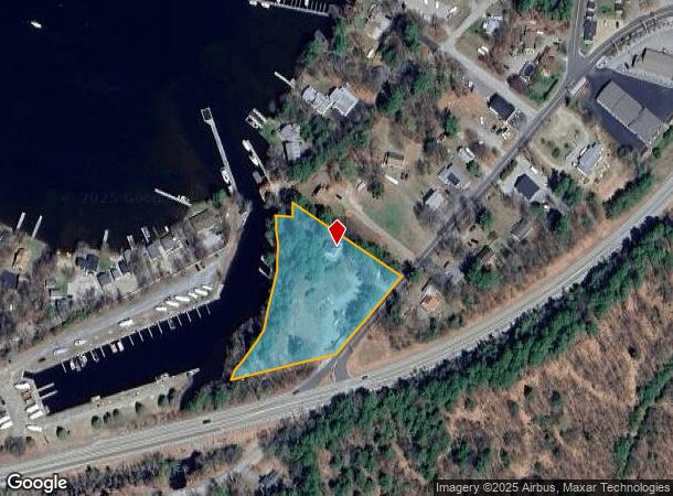
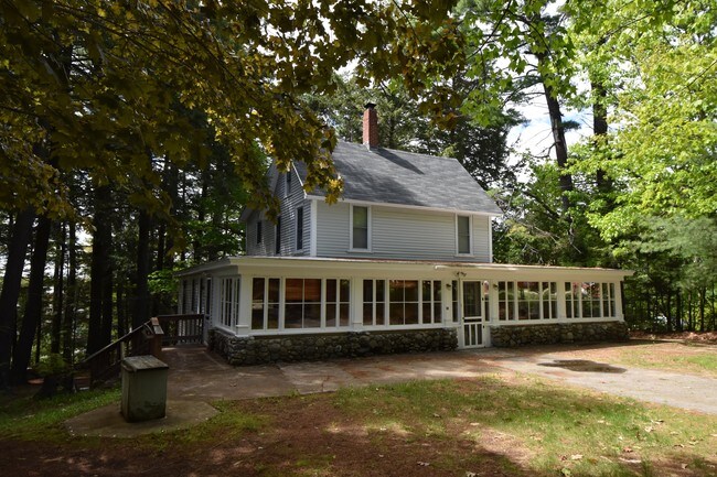
Property Record
10 Glendale Pl, Gilford, NH 03249
NEARBY LISTINGS FOR SALE OR LEASE
-
-
View all Gilford listings for sale on LoopNet.com
Property Detail
10 Glendale Pl
GIFL-000242-000142
Belknap
Multifamilydwelling
New Hampshire
2024
2.14 AC
2024
Concord/New Hampshire North Area
966401
Other Market Areas
1,648 SF
Laconia, NH
DEMOGRAPHICS near 10 Glendale Pl
1 Mile
3 Mile
5 Mile
2024 Total Population
1,142
6,879
19,224
2029 Population
1,254
7,442
20,684
Pop Growth 2024-2029
+ 9.81%
+ 8.18%
+ 7.59%
Average Age
50
49
49
2024 Total Households
540
3,147
8,754
HH Growth 2024-2029
+ 9.63%
+ 8.13%
+ 7.57%
Median Household Inc
$96,428
$102,473
$93,342
Avg Household Size
2.10
2.20
2.20
2024 Avg HH Vehicles
2.00
2.00
2.00
Median Home Value
$425,000
$376,721
$355,417
Median Year Built
1983
1983
1982
Nearby Places
Map Layers
Map Styles
 Street
 Aerial
- Restaurants
- Banks
- Shops
- Fitness
- Groceries
SALE & LEASE HISTORY
LISTING DATE
SALE/LEASE

Nov 08, 2017
For Sale
May 03, 2017
For Sale
Jun 19, 2017
For Sale
Nearby Properties
Address
Land Use
TOTAL SIZE
Lot Size
Zoning
Address
Land Use
TOTAL SIZE
Lot Size
Zoning
26 AC
SFR
Address
Land Use
TOTAL SIZE
Lot Size
Zoning
21.50 AC
C
Address
Land Use
TOTAL SIZE
Lot Size
Zoning
18.80 AC
SFR
Address
Land Use
TOTAL SIZE
Lot Size
Zoning
85 AC
SFR
Address
Land Use
TOTAL SIZE
Lot Size
Zoning
343.45 AC
I
Address
Land Use
TOTAL SIZE
Lot Size
Zoning
104,952 SF
5.10 AC
C
Address
Land Use
TOTAL SIZE
Lot Size
Zoning
31 AC
SFR
Address
Land Use
TOTAL SIZE
Lot Size
Zoning
0.62 AC
SFR
Address
Land Use
TOTAL SIZE
Lot Size
Zoning
8,318 SF
0.77 AC
SFR
Address
Land Use
TOTAL SIZE
Lot Size
Zoning
Address
Land Use
TOTAL SIZE
Lot Size
Zoning
10 AC
C
Address
Land Use
TOTAL SIZE
Lot Size
Zoning
2,860 SF
1.70 AC
SFR
Address
Land Use
TOTAL SIZE
Lot Size
Zoning
6.60 AC
SFR
Address
Land Use
TOTAL SIZE
Lot Size
Zoning
0.92 AC
RC
Address
Land Use
TOTAL SIZE
Lot Size
Zoning
968 SF
1.39 AC
SFR
Address
Land Use
TOTAL SIZE
Lot Size
Zoning
23 AC
SFR
Address
Land Use
TOTAL SIZE
Lot Size
Zoning
99.90 AC
NRR
Address
Land Use
TOTAL SIZE
Lot Size
Zoning
4,345 SF
1.10 AC
SFR
Address
Land Use
TOTAL SIZE
Lot Size
Zoning
2.50 AC
SFR
Address
Land Use
TOTAL SIZE
Lot Size
Zoning
34 AC
SFR
Address
Land Use
TOTAL SIZE
Lot Size
Zoning
4.50 AC
RC
Address
Land Use
TOTAL SIZE
Lot Size
Zoning
17 AC
RC
Address
Land Use
TOTAL SIZE
Lot Size
Zoning
5.88 AC
C
Address
Land Use
TOTAL SIZE
Lot Size
Zoning
378.13 AC
NRR
Address
Land Use
TOTAL SIZE
Lot Size
Zoning
8.22 AC
RC
Address
Land Use
TOTAL SIZE
Lot Size
Zoning
4.40 AC
SFR
Address
Land Use
TOTAL SIZE
Lot Size
Zoning
4,029 SF
0.73 AC
SFR
Address
Land Use
TOTAL SIZE
Lot Size
Zoning
7.28 AC
C
Address
Land Use
TOTAL SIZE
Lot Size
Zoning
5,875 SF
4.80 AC
LR
Address
Land Use
TOTAL SIZE
Lot Size
Zoning
1.34 AC
SFR
The World's #1 Commercial Real Estate Marketplace
Connect with us
© 2026 CoStar Group
The information above has been obtained from sources believed reliable. While we do not doubt its accuracy we have not verified it and make no guarantee, warranty or representation about it. It is your responsibility to independently confirm its accuracy and completeness. Any projections, opinions, assumptions, or estimates used are for example only and do not represent the current or future performance of the property. The value of this transaction to you depends on tax and other factors which should be evaluated by your tax, financial, and legal advisors. You and your advisors should conduct a careful, independent investigation of the property to determine to your satisfaction the suitability of the property for your needs.