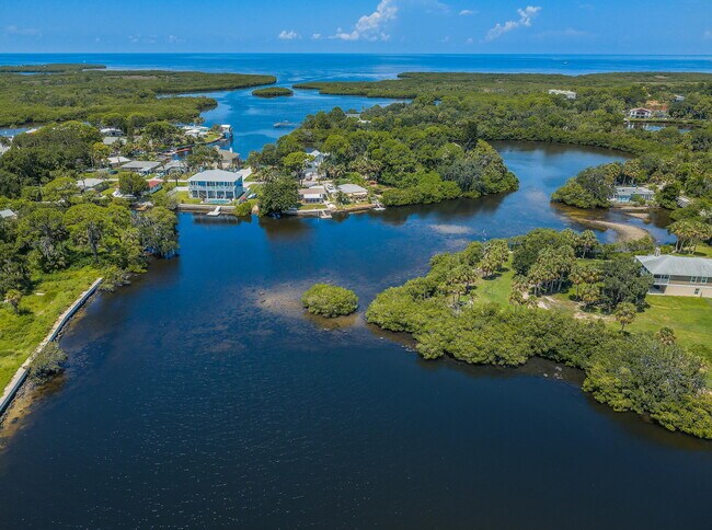
Property Record
4835 Green Key Rd, New Port Richey, FL 34652


NEARBY LISTINGS FOR SALE OR LEASE
Property Detail
4835 Green Key Rd
06-26-16-0000-00500-0000
A
Wastedisposalsewagetreatmentfacility
COM E1/4 COR OF SEC THS89DG 4445W 460 FT TH CV R RAD 100.00 FT CHD N45DG1515W 141.42 FT TH N00DG1515W 368.33 FT TH S89DG4445W 25.0 FT FOR POB TH S00DG1515E 368.33 FT TH CV L RAD 125.00FT CHD S12DG0532E 51.28 FT TH S89DG4445W 744.52 FT TH N00DG0452E 5
AE
Pasco
12101C0188G
Florida
2024
0.10 AC
2025
Pasco County
030304
Tampa/St Petersburg
1,152 SF
Tampa-St. Petersburg-Clearwater, FL
DEMOGRAPHICS near 4835 Green Key Rd
1 Mile
3 Mile
5 Mile
2024 Total Population
6,358
58,530
153,884
2029 Population
7,695
70,383
185,452
Pop Growth 2024-2029
+ 21.03%
+ 20.25%
+ 20.51%
Average Age
49
46
44
2024 Total Households
3,120
27,132
67,075
HH Growth 2024-2029
+ 21.12%
+ 20.29%
+ 20.58%
Median Household Inc
$52,478
$44,111
$44,791
Avg Household Size
2.00
2.10
2.20
2024 Avg HH Vehicles
2.00
1.00
2.00
Median Home Value
$334,158
$164,703
$158,536
Median Year Built
1980
1977
1978
Nearby Places
Map Layers
Map Styles
 Street
 Aerial
- Restaurants
- Banks
- Shops
- Fitness
- Groceries
PUBLIC TRANSPORTATION
AIRPORT
Tampa International
DRIVE
WALK
Distance
Tampa International
55 min
31.8 mi
St Pete-Clearwater International
DRIVE
WALK
Distance
St Pete-Clearwater International
55 min
31.9 mi
Freight Ports
Port of Tampa Bay
DRIVE
WALK
Distance
Port of Tampa Bay
68 min
41.7 mi
SALE & LEASE HISTORY
LISTING DATE
SALE/LEASE

Jul 23, 2022
For Sale
Nearby Properties
Address
Land Use
TOTAL SIZE
Lot Size
Zoning
Address
Land Use
TOTAL SIZE
Lot Size
Zoning
248,561 SF
14.17 AC
C
Address
Land Use
TOTAL SIZE
Lot Size
Zoning
241,429 SF
37.59 AC
C
Address
Land Use
TOTAL SIZE
Lot Size
Zoning
149,162 SF
3.10 AC
C
Address
Land Use
TOTAL SIZE
Lot Size
Zoning
163,106 SF
13.97 AC
C
Address
Land Use
TOTAL SIZE
Lot Size
Zoning
91,660 SF
16.29 AC
C
Address
Land Use
TOTAL SIZE
Lot Size
Zoning
82,047 SF
21.48 AC
MF2
Address
Land Use
TOTAL SIZE
Lot Size
Zoning
76,160 SF
6.74 AC
MPUD
Address
Land Use
TOTAL SIZE
Lot Size
Zoning
22,216 SF
7.20 AC
C2
Address
Land Use
TOTAL SIZE
Lot Size
Zoning
212,308 SF
10.91 AC
MF2
Address
Land Use
TOTAL SIZE
Lot Size
Zoning
41,156 SF
2.26 AC
C
Address
Land Use
TOTAL SIZE
Lot Size
Zoning
181,980 SF
11.12 AC
MF2
Address
Land Use
TOTAL SIZE
Lot Size
Zoning
135,857 SF
20.37 AC
C2
Address
Land Use
TOTAL SIZE
Lot Size
Zoning
77,439 SF
4.36 AC
C
Address
Land Use
TOTAL SIZE
Lot Size
Zoning
33,124 SF
4.95 AC
C2
Address
Land Use
TOTAL SIZE
Lot Size
Zoning
94,380 SF
4.57 AC
C2
Address
Land Use
TOTAL SIZE
Lot Size
Zoning
35,013 SF
1.59 AC
R3
Address
Land Use
TOTAL SIZE
Lot Size
Zoning
39,348 SF
4.95 AC
MPUD
Address
Land Use
TOTAL SIZE
Lot Size
Zoning
65,700 SF
6.05 AC
C
Address
Land Use
TOTAL SIZE
Lot Size
Zoning
51,946 SF
1.20 AC
C
Address
Land Use
TOTAL SIZE
Lot Size
Zoning
94,834 SF
2.65 AC
R2
Address
Land Use
TOTAL SIZE
Lot Size
Zoning
98,699 SF
8.97 AC
MF2
Address
Land Use
TOTAL SIZE
Lot Size
Zoning
47,047 SF
5.88 AC
O
Address
Land Use
TOTAL SIZE
Lot Size
Zoning
1.12 AC
C
Address
Land Use
TOTAL SIZE
Lot Size
Zoning
73,399 SF
22.60 AC
MF1
Address
Land Use
TOTAL SIZE
Lot Size
Zoning
21,454 SF
0.73 AC
R2
Address
Land Use
TOTAL SIZE
Lot Size
Zoning
28,560 SF
2.65 AC
MPUD
Address
Land Use
TOTAL SIZE
Lot Size
Zoning
85,752 SF
4.61 AC
MF2
Address
Land Use
TOTAL SIZE
Lot Size
Zoning
52,240 SF
4.66 AC
C3
Address
Land Use
TOTAL SIZE
Lot Size
Zoning
43,040 SF
1.95 AC
MPUD
Address
Land Use
TOTAL SIZE
Lot Size
Zoning
6,028 SF
2.56 AC
C2
The World's #1 Commercial Real Estate Marketplace
Connect with us
© 2025 CoStar Group
The information above has been obtained from sources believed reliable. While we do not doubt its accuracy we have not verified it and make no guarantee, warranty or representation about it. It is your responsibility to independently confirm its accuracy and completeness. Any projections, opinions, assumptions, or estimates used are for example only and do not represent the current or future performance of the property. The value of this transaction to you depends on tax and other factors which should be evaluated by your tax, financial, and legal advisors. You and your advisors should conduct a careful, independent investigation of the property to determine to your satisfaction the suitability of the property for your needs.