Property Record
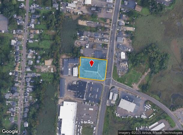
10 Hemingway Ave, East Haven, CT 06512
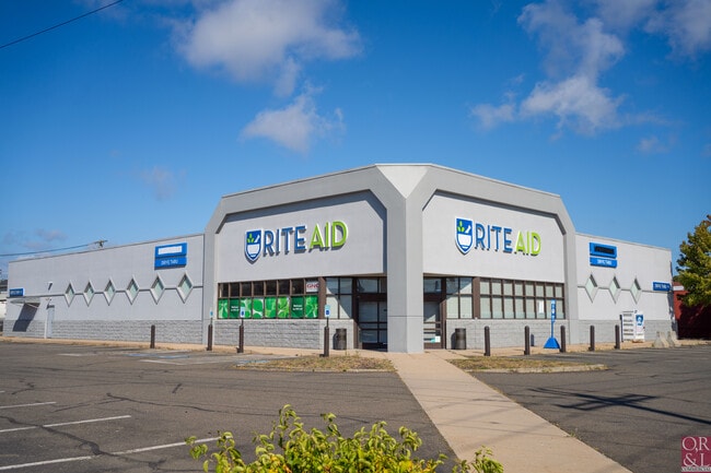
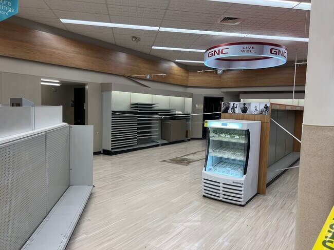
This Property Is For Sale
Current Lease Availabilities
NEARBY LISTINGS FOR SALE OR LEASE
Property Detail
10 Hemingway Ave
EHAV-000160-001715-000002
New Haven
Storebuilding
Connecticut
AE
2
09009C0463K
1.28 AC
2025
East Haven
2025
Westchester/So Connecticut
180200
New Haven-Milford, CT
11,240 SF
DEMOGRAPHICS near 10 Hemingway Ave
1 Mile
3 Mile
5 Mile
2024 Total Population
9,290
46,084
177,092
2029 Population
9,330
45,921
175,677
Pop Growth 2024-2029
+ 0.43%
(0.35%)
(0.80%)
Average Age
42
42
39
2024 Total Households
3,795
19,230
72,207
HH Growth 2024-2029
+ 0.37%
(0.32%)
(0.70%)
Median Household Inc
$74,999
$68,745
$59,884
Avg Household Size
2.40
2.30
2.20
2024 Avg HH Vehicles
2.00
2.00
1.00
Median Home Value
$243,153
$253,090
$251,477
Median Year Built
1962
1964
1959
Nearby Places
- Restaurants
- Banks
- Shops
- Fitness
- Groceries
PUBLIC TRANSPORTATION
COMMUTER RAIL
Branford (Commuter Rail - Shore Line East, Shore Line East - Shore Line East)
DRIVE
WALK
Distance
Branford (Commuter Rail - Shore Line East, Shore Line East - Shore Line East)
7 min
3.9 mi
New Haven Union Station (Hartford Line - CONN DOT)
DRIVE
WALK
Distance
New Haven Union Station (Hartford Line - CONN DOT)
8 min
4.9 mi
AIRPORT
Tweed/New Haven
DRIVE
WALK
Distance
Tweed/New Haven
4 min
1.0 mi
Freight Ports
Port of New Haven
DRIVE
WALK
Distance
Port of New Haven
7 min
3.5 mi
Nearby Properties
Address
Land Use
TOTAL SIZE
Lot Size
Zoning
Address
Land Use
TOTAL SIZE
Lot Size
Zoning
117,066 SF
71.34 AC
IH
Address
Land Use
TOTAL SIZE
Lot Size
Zoning
8,655 SF
107.61 AC
AIRPOR
Address
Land Use
TOTAL SIZE
Lot Size
Zoning
17,462 SF
86.34 AC
PARK
Address
Land Use
TOTAL SIZE
Lot Size
Zoning
85,679 SF
14.23 AC
RM1
Address
Land Use
TOTAL SIZE
Lot Size
Zoning
197.78 AC
LI-3
Address
Land Use
TOTAL SIZE
Lot Size
Zoning
407,320 SF
2.31 AC
PDD 53
Address
Land Use
TOTAL SIZE
Lot Size
Zoning
7.72 AC
RA-1
Address
Land Use
TOTAL SIZE
Lot Size
Zoning
29,872 SF
Address
Land Use
TOTAL SIZE
Lot Size
Zoning
1,932 SF
64.06 AC
PARK
Address
Land Use
TOTAL SIZE
Lot Size
Zoning
16.50 AC
Address
Land Use
TOTAL SIZE
Lot Size
Zoning
35 AC
RA-1
Address
Land Use
TOTAL SIZE
Lot Size
Zoning
96,449 SF
1.67 AC
RS2
Address
Land Use
TOTAL SIZE
Lot Size
Zoning
48,726 SF
9.46 AC
Address
Land Use
TOTAL SIZE
Lot Size
Zoning
19.26 AC
R-2
Address
Land Use
TOTAL SIZE
Lot Size
Zoning
9.34 AC
CA-1
Address
Land Use
TOTAL SIZE
Lot Size
Zoning
261,465 SF
1.62 AC
PDD 53
Address
Land Use
TOTAL SIZE
Lot Size
Zoning
105,998 SF
13.68 AC
PDD
Address
Land Use
TOTAL SIZE
Lot Size
Zoning
10,892 SF
5.05 AC
Address
Land Use
TOTAL SIZE
Lot Size
Zoning
2,816 SF
PDD 11
Address
Land Use
TOTAL SIZE
Lot Size
Zoning
5,596 SF
37.74 AC
IH/RM1
Address
Land Use
TOTAL SIZE
Lot Size
Zoning
19.50 AC
Address
Land Use
TOTAL SIZE
Lot Size
Zoning
34,341 SF
5.65 AC
Address
Land Use
TOTAL SIZE
Lot Size
Zoning
109,119 SF
CA-1
Address
Land Use
TOTAL SIZE
Lot Size
Zoning
14,508 SF
14 AC
Address
Land Use
TOTAL SIZE
Lot Size
Zoning
78,000 SF
1.13 AC
BC
Address
Land Use
TOTAL SIZE
Lot Size
Zoning
5,089 SF
25.20 AC
R18
Address
Land Use
TOTAL SIZE
Lot Size
Zoning
66,116 SF
2.05 AC
CB-1
Address
Land Use
TOTAL SIZE
Lot Size
Zoning
39,293 SF
7.70 AC
BC
Address
Land Use
TOTAL SIZE
Lot Size
Zoning
4.87 AC
Address
Land Use
TOTAL SIZE
Lot Size
Zoning
124,472 SF
16.60 AC
The World's #1 Commercial Real Estate Marketplace
Connect with us
© 2025 CoStar Group
The information above has been obtained from sources believed reliable. While we do not doubt its accuracy we have not verified it and make no guarantee, warranty or representation about it. It is your responsibility to independently confirm its accuracy and completeness. Any projections, opinions, assumptions, or estimates used are for example only and do not represent the current or future performance of the property. The value of this transaction to you depends on tax and other factors which should be evaluated by your tax, financial, and legal advisors. You and your advisors should conduct a careful, independent investigation of the property to determine to your satisfaction the suitability of the property for your needs.